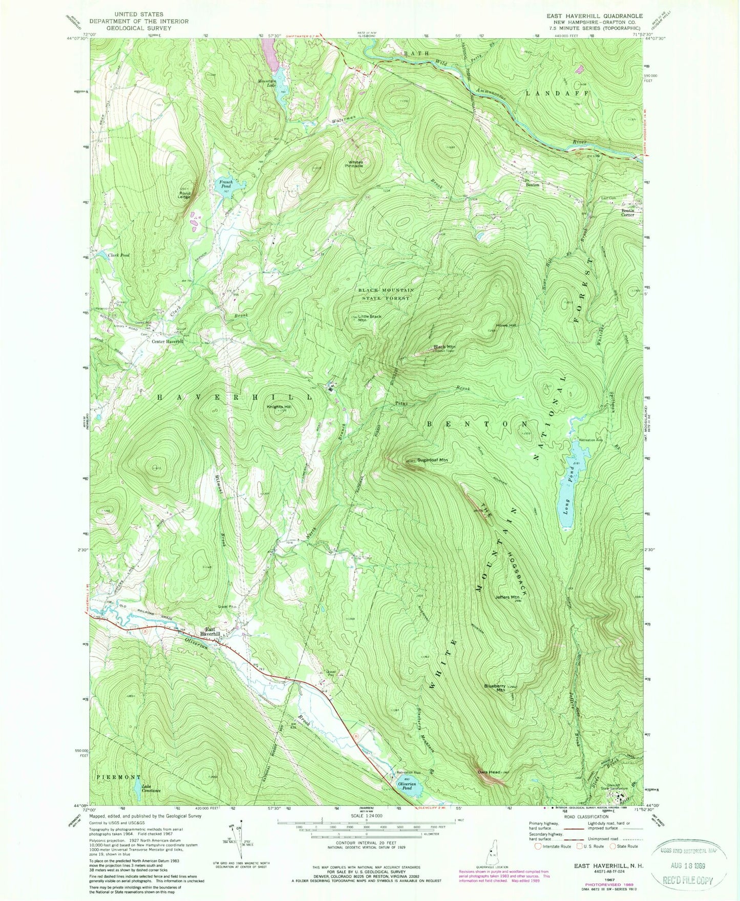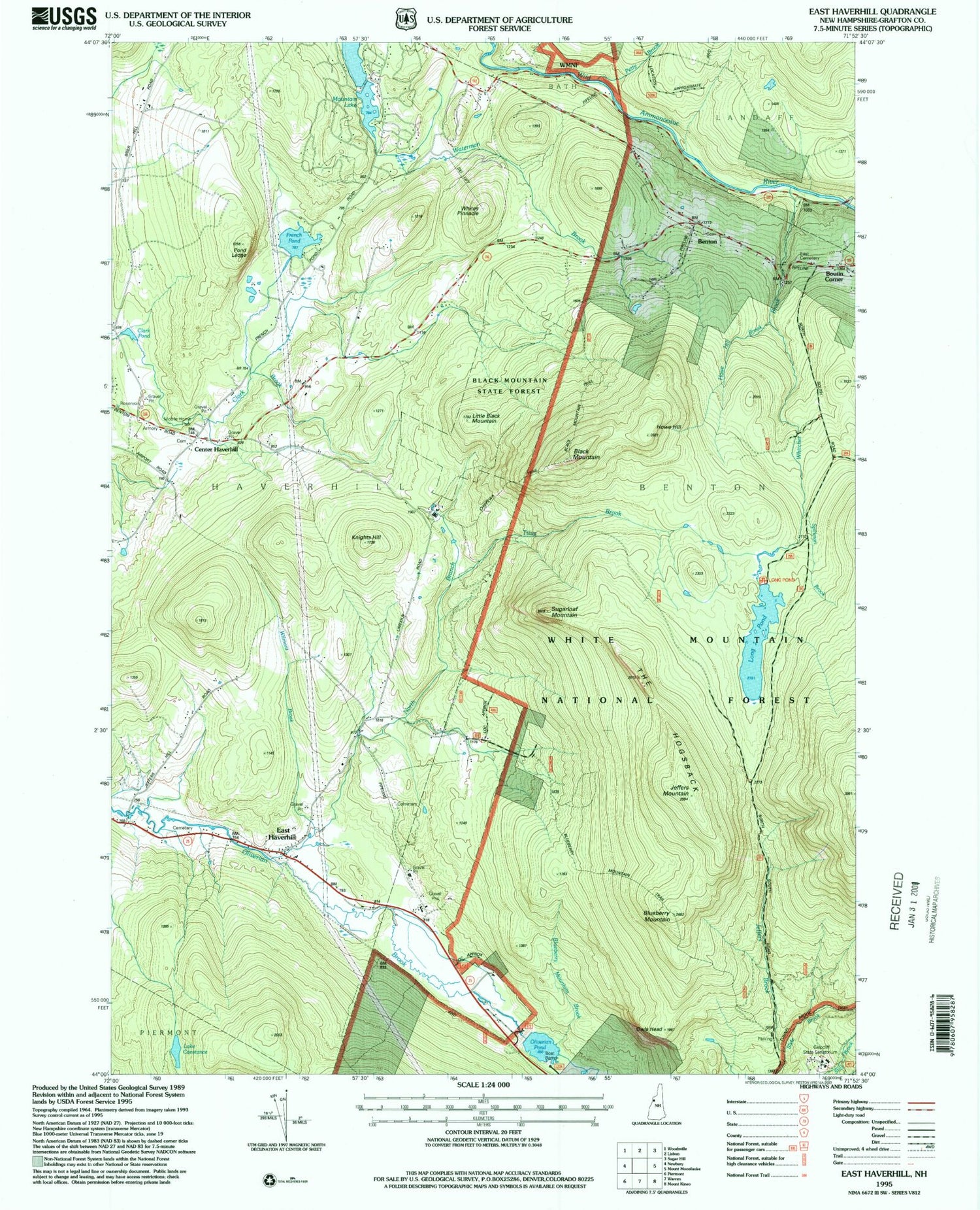
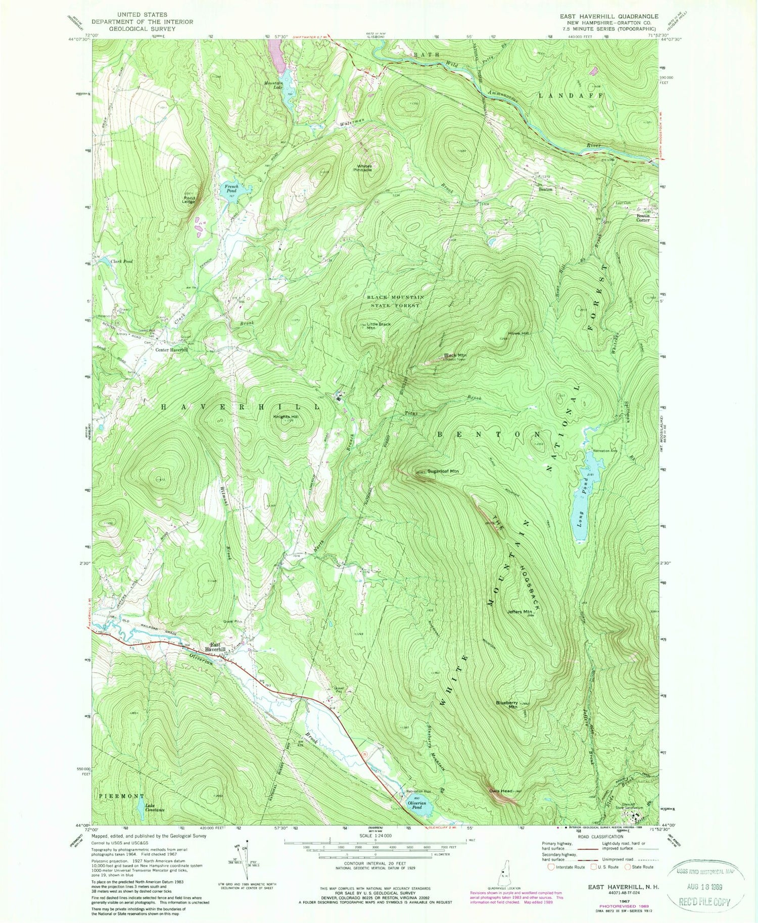
MyTopo
Classic USGS East Haverhill New Hampshire 7.5'x7.5' Topo Map
Couldn't load pickup availability
Historical USGS topographic quad map of East Haverhill in the state of New Hampshire. Typical map scale is 1:24,000, but may vary for certain years, if available. Print size: 24" x 27"
This quadrangle is in the following counties: Grafton.
The map contains contour lines, roads, rivers, towns, and lakes. Printed on high-quality waterproof paper with UV fade-resistant inks, and shipped rolled.
Contains the following named places: Benton, Black Mountain, Black Mountain State Forest, Black Mountain Trail, Blueberry Mountain, Blueberry Mountain Brook, Blueberry Mountain Trail, Boutin Corner, Center Haverhill, Chippewa Trail, Clark Pond, Lake Constance, East Cemetery, East Haverhill, French Pond, Glencliff State Sanatorium, Howe Hill, Howe Hill, Jeffers Brook, Jeffers Mountain, Knights Hill, Little Black Mountain, Long Pond, North Branch Oliverian Brook, Oliverian Pond, Owls Head, Petty Brook, Pond Ledge, Spillman Brook, Sugarloaf Mountain, The Hogsback, Titus Brook, Whitcher Brook, Whites Pinnacle, Wilmont Brook, Long Pond Picnic Ground, WYKR-FM (Haverhill), Town of Benton, Town of Haverhill, Upper Mountain Lake Dam, Lower Mountain Lake, Upper Mountain Lake, Long Pond Dam, Oliverian Dam, Ammonoosuc Fish and Game Club, Benton Cemetery, Brier Hill School (historical), Center Haverhill Cemetery, Church at the Crossroads Advent Christian Church, East Haverhill Cemetery, East Haverhill United Methodist Church, Haverhill Cooperative Middle School, Long Pond Picnic Area, Oliverian Station (historical), School Number 6 (historical), Mountain Lakes, Mountain Lakes Census Designated Place, Upper Mountain Lake Dam