MyTopo
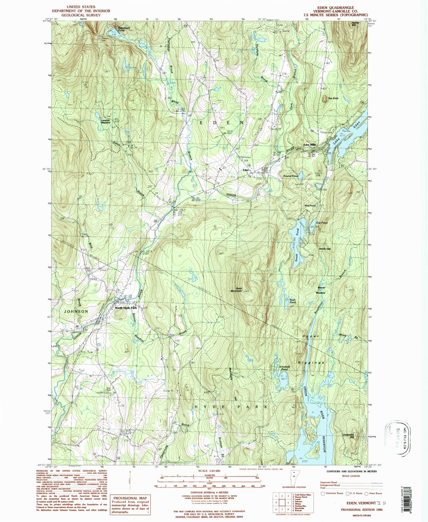
Classic USGS Eden Vermont 7.5'x7.5' Topo Map
Couldn't load pickup availability
Historical USGS topographic quad map of Eden in the state of Vermont. Typical map scale is 1:24,000, but may vary for certain years, if available. Print size: 24" x 27"
This quadrangle is in the following counties: Lamoille.
The map contains contour lines, roads, rivers, towns, and lakes. Printed on high-quality waterproof paper with UV fade-resistant inks, and shipped rolled.
Contains the following named places: Bean Mountain, Beaver Meadow, Beaver Meadow Brook, Blake Cemetery, Boomhour Branch, Dark Branch, Devils Gap, Dodge Cemetery, Eden, Eden Mills, Lake Eden, Fryingpan Brook, Green River Reservoir, Gut Pond, Hutchins Brook, Lanpher Meadow, McKinstry Hill, Mud Pond, North Hyde Park, Ritterbush Camp, Ritterbush Pond, Round Pond, Rush Pond, Schofield Pond, South Pond, Stony Brook, The Knob, Umbrella Hill, Upper Diggings, White Branch, Wild Brook, Wiley Brook, Town of Eden, Green River Dam, Lake Eden Dam, South Pond Dam, Balch - Town Line Cemetery, Dodge Cemetery, Eden Central School, Eden Corner Cemetery, Eden Mills Congregational Church, Holbrook Cemetery, Hooper Cemetery, Lakeview Campground, North Hyde Park Cemetery, North Hyde Park Post Office, Saint Gabriels Catholic Church, North Hyde Park - Eden Fire Department, Eden Post Office, North Hyde Park Census Designated Place