MyTopo
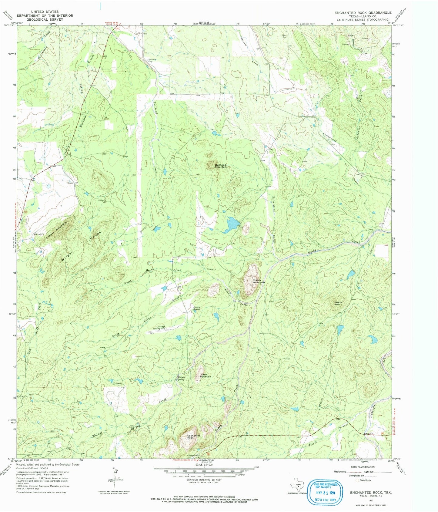
USGS Classic Enchanted Rock Texas 7.5'x7.5' Topo Map
Couldn't load pickup availability
Historical USGS topographic quad map of Enchanted Rock in the state of Texas. Scale: 1:24000. Print size: 24" x 27"
This quadrangle is in the following counties: Llano.
The map contains contour lines, roads, rivers, towns, lakes, and grids including latitude / longitude and UTM / MGRS. Printed on high-quality waterproof paper with UV fade-resistant inks.
Contains the following named places: Bullhead Mountain, Cottonwood Creek, Dutch Mountain, Enchanted Rock, Graze Mountain, Helms Creek, Honey Spring, Keener Branch, Moss Cemetery, North Helms Creek, Prairie Mountain, Rossberg Cemetery, Silvermine Creek, South Helms Creek, Walnut Spring, Walnut Spring Creek, Watch Mountain, Wright Knobs, McDavid Ranch Airport, Bullhead Heliport, Ratliff Dam, Ratliff Lake, Enchanted Rock State Natural Area, Echo Canyon Trail, Summit Trail