MyTopo
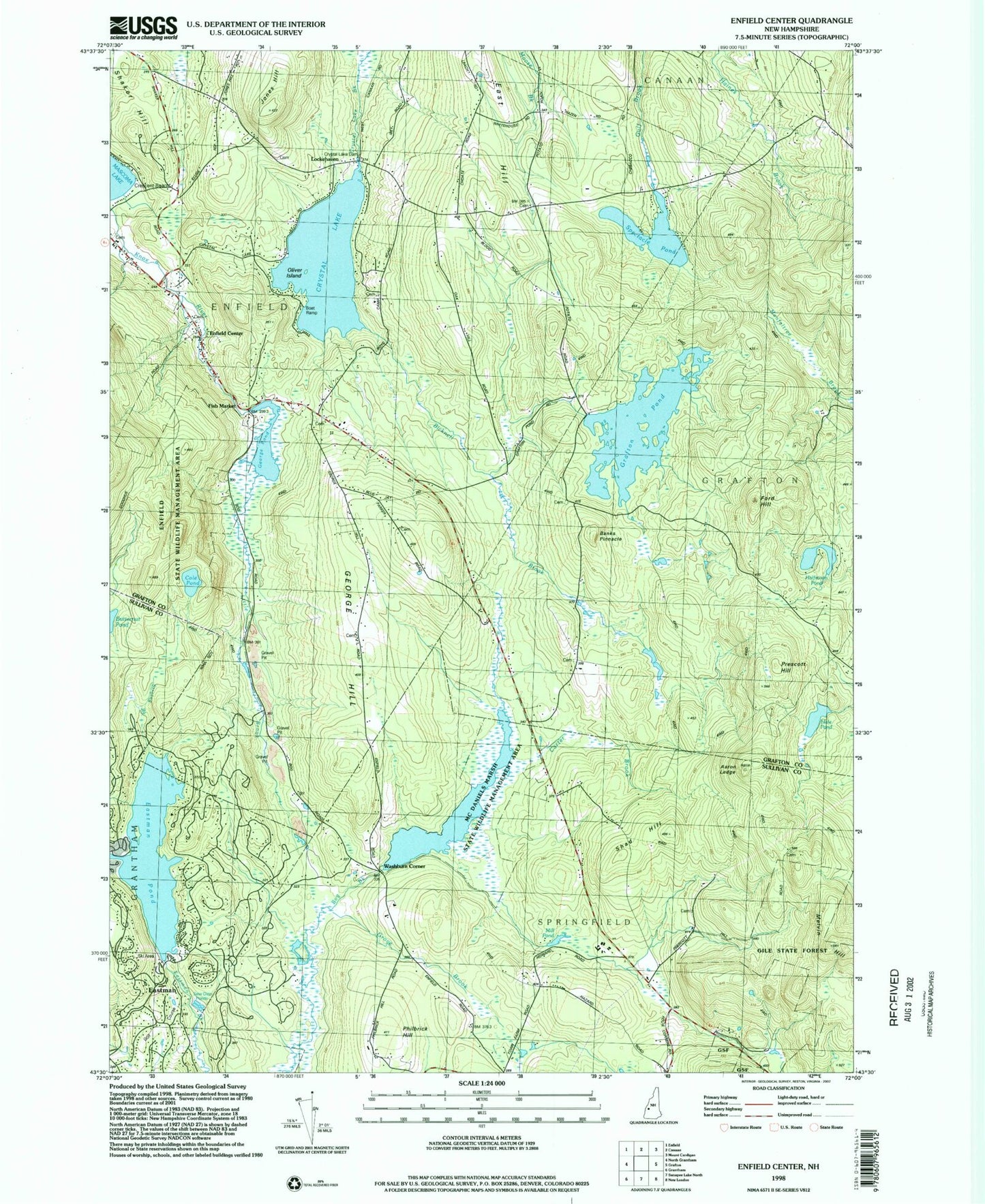
Classic USGS Enfield Center New Hampshire 7.5'x7.5' Topo Map
Couldn't load pickup availability
Historical USGS topographic quad map of Enfield Center in the state of New Hampshire. Typical map scale is 1:24,000, but may vary for certain years, if available. Print size: 24" x 27"
This quadrangle is in the following counties: Grafton, Sullivan.
The map contains contour lines, roads, rivers, towns, and lakes. Printed on high-quality waterproof paper with UV fade-resistant inks, and shipped rolled.
Contains the following named places: Aaron Ledge, Banks Pinnacle, Bicknell Brook, Carter Brook, Cole Pond, Crystal Lake, East Hill, East Hill School, Eastman Pond, Enfield Center, Fish Market, Ford Hill, George Hill, George Hill School, George Pond, Grove Brook, Grafton Pond, Hale Pond, Halfmoon Pond, Height of Land School, Jones Hill, Jones Hill School, Little Brook, Maxfield School, Melvin Hill, Philbrick Hill, Prescott Hill, Shad Hill, Shaker Hill, Spectacle Pond, Stroing Brook, Lockehaven, Washburn Corner, Town of Enfield, Smith Pond Dam, Smith Pond, Grafton Pond Dam, Bog Brook Dam, Crystal Lake Enfield Dam, George Pond Dam, Eastman, Enfield Center Post Office, Enfield Wildlife Management Area, Union Church, McDaniels Marsh State Wildlife Management Area, Butternut Pond, Crescent Beach, Enfield Fire Department Center Station