MyTopo
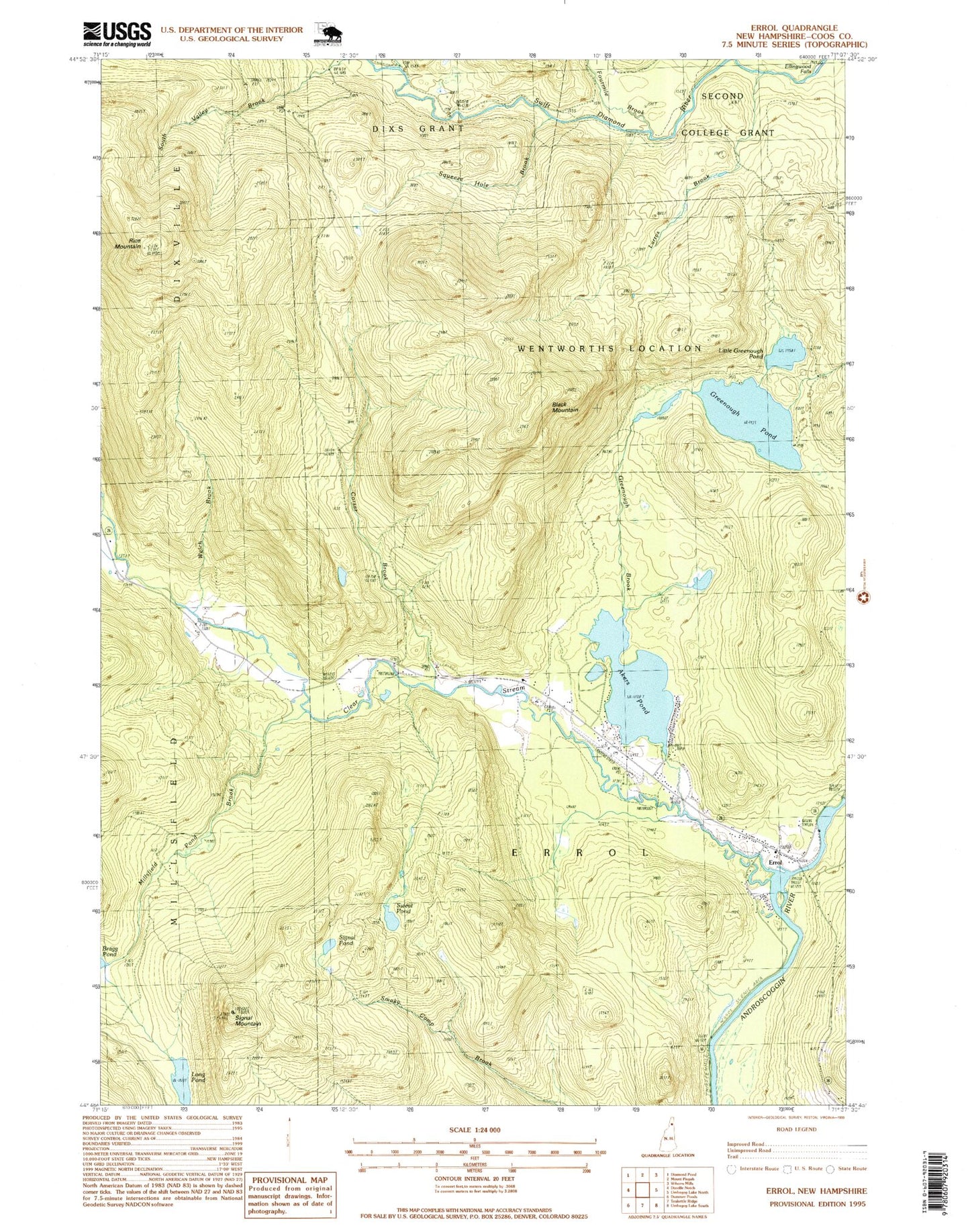
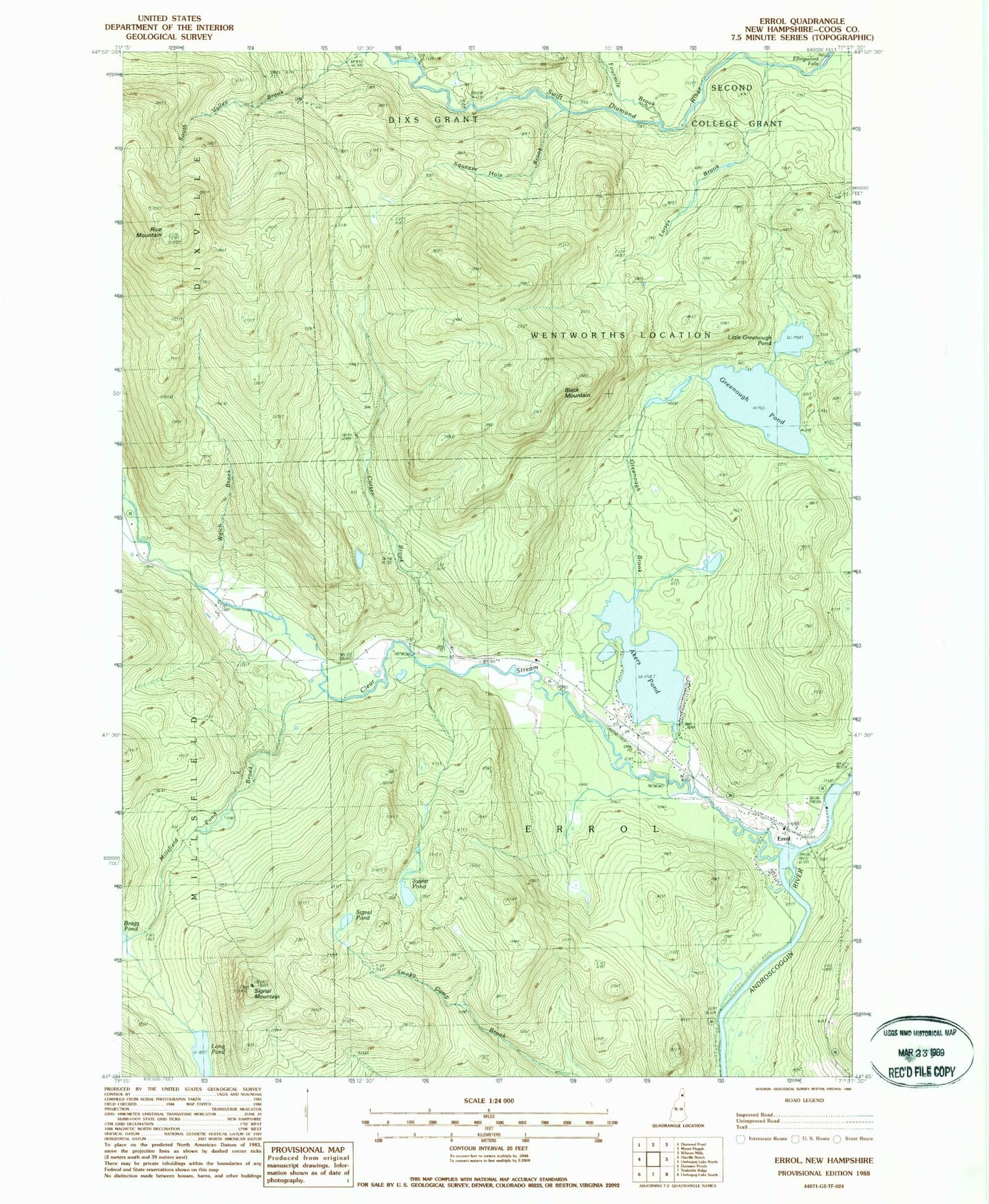
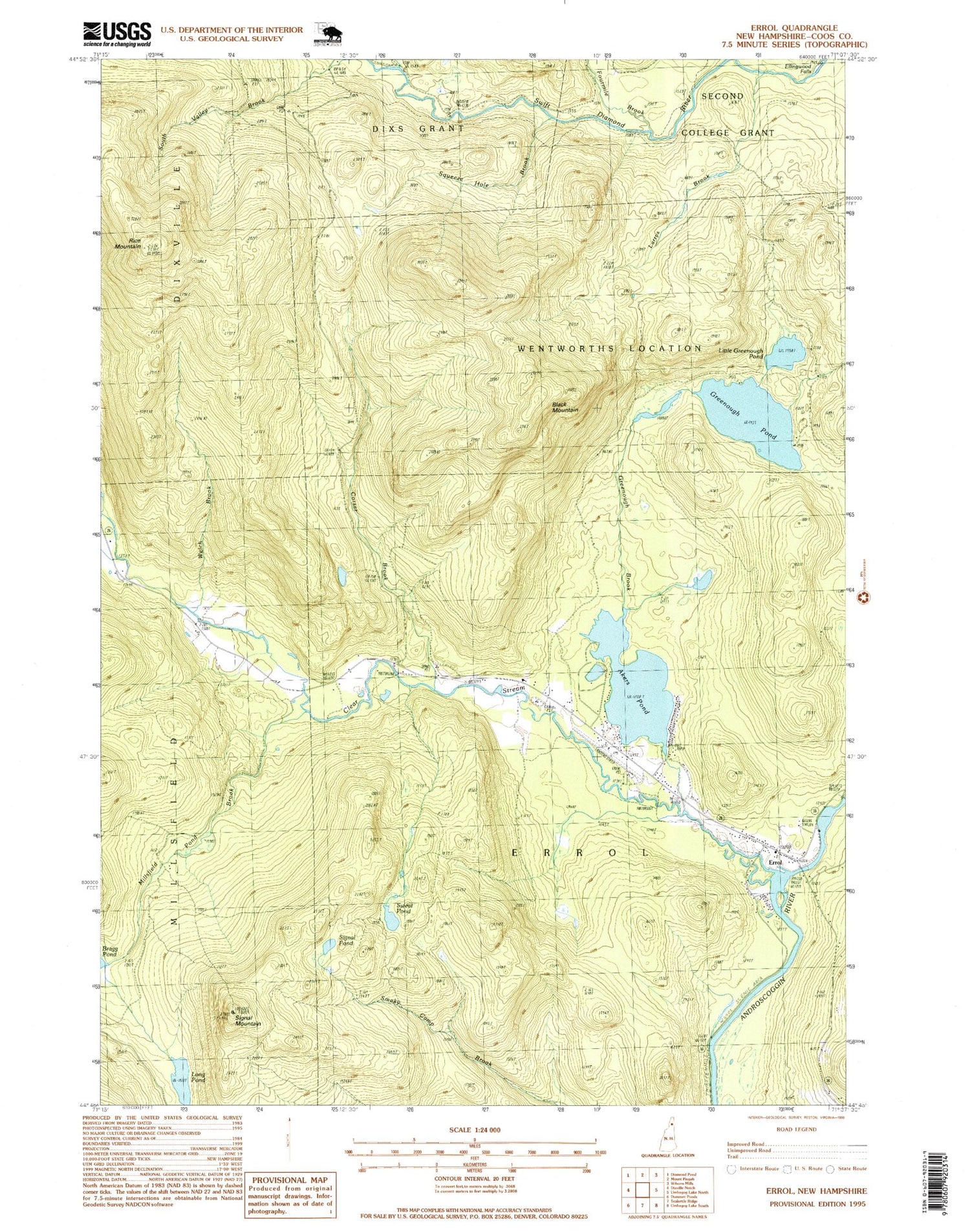
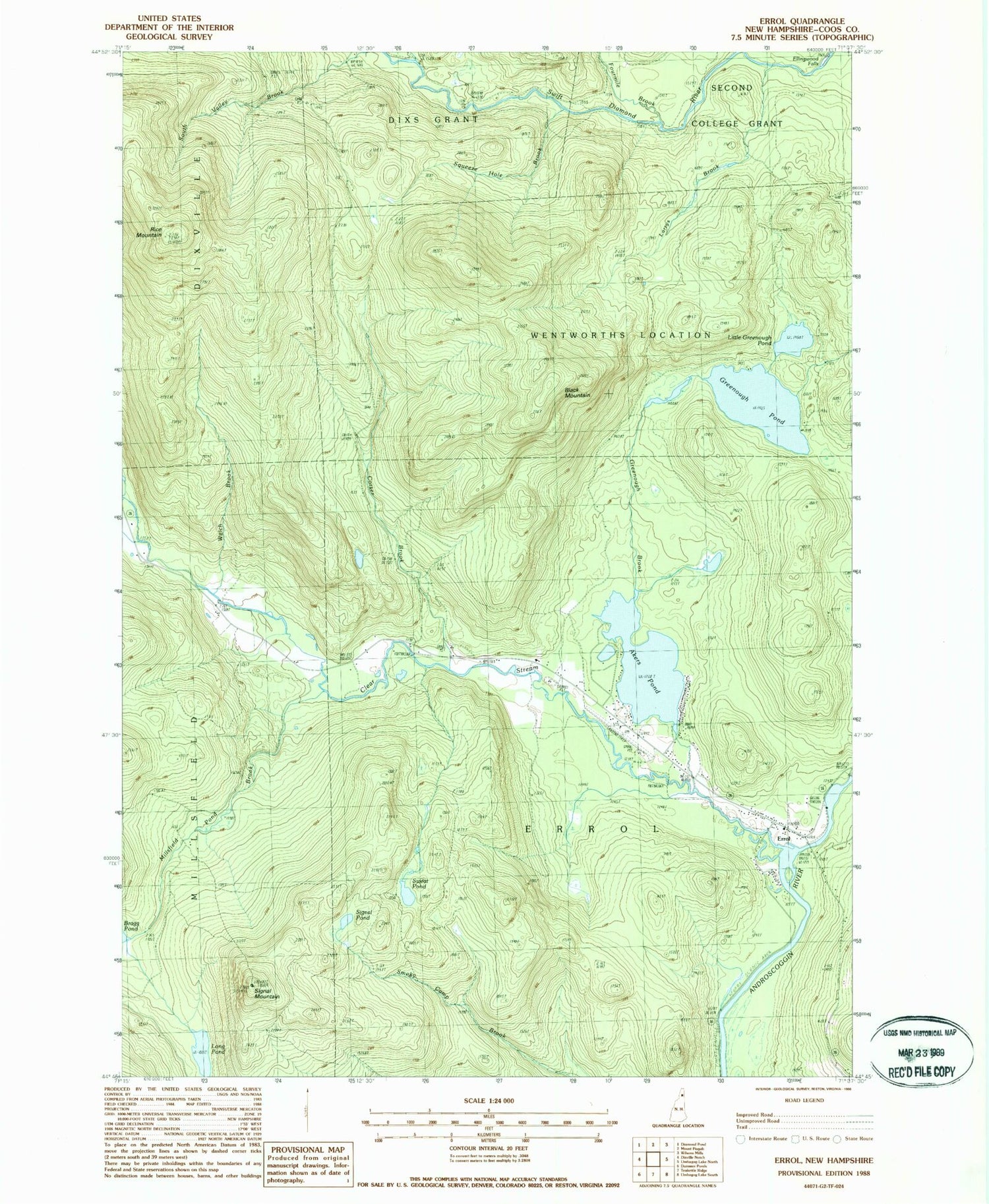
Classic USGS Errol New Hampshire 7.5'x7.5' Topo Map
Couldn't load pickup availability
Historical USGS topographic quad map of Errol in the state of New Hampshire. Typical map scale is 1:24,000, but may vary for certain years, if available. Print size: 24" x 27"
This quadrangle is in the following counties: Coos.
The map contains contour lines, roads, rivers, towns, and lakes. Printed on high-quality waterproof paper with UV fade-resistant inks, and shipped rolled.
Contains the following named places: Akers Pond, Black Mountain, Clear Stream, Corser Brook, Dixie Dam, East Branch Swift Diamond River, Ellingwood Falls, Errol, Greenough Brook, Greenough Pond, Larrys Brook, Little Greenough Pond, Long Pond, Millsfield Pond Brook, Palmers Cabin, Rice Mountain, Signal Mountain, Signal Pond, Squeeze Hole Brook, Sweat Pond, Welch Brook, West Branch Clear Stream, Errol Airport, Town of Errol, Wentworth Location, Akers Pond Dam, Errol Consolidated Elementary School, Errol Post Office, Errol Fire Department, Errol Emergency Medical Services, Errol Police Department, Errol Village Cemetery