MyTopo
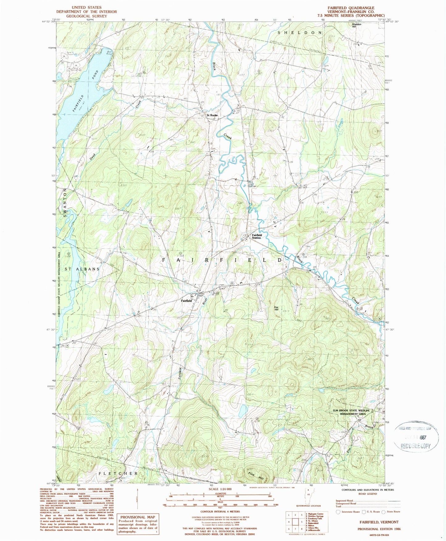
Classic USGS Fairfield Vermont 7.5'x7.5' Topo Map
Couldn't load pickup availability
Historical USGS topographic quad map of Fairfield in the state of Vermont. Map scale may vary for some years, but is generally around 1:24,000. Print size is approximately 24" x 27"
This quadrangle is in the following counties: Franklin.
The map contains contour lines, roads, rivers, towns, and lakes. Printed on high-quality waterproof paper with UV fade-resistant inks, and shipped rolled.
Contains the following named places: Barlow Cemetery, Bradley Cemetery, Callan School, Creek School, Dead Creek, Diamond Cemetery, Elm Brook, Elm Brook State Wildlife Management Area, Fairfield, Fairfield Center School, Fairfield Fire Department, Fairfield Pond, Fairfield Post Office, Fairfield River, Fairfield Station, Fairfield Swamp Dam, Fairview Cemetery, Fox Hill, Franklin County, Gould School, Kirley Cemetery, Leach Cemetery, Lost Nation School, McCarty School, Morey Cemetery, Pine Hill, Pumpkin Village Cemetery, Pumpkin Village School, Saint Patricks Cemetery, Saint Patricks Church, Saint Rocks, Saint Rocks Cemetery, School Number 6, Soule School, Town of Fairfield, Waite Cemetery, ZIP Codes: 05448, 05455