MyTopo
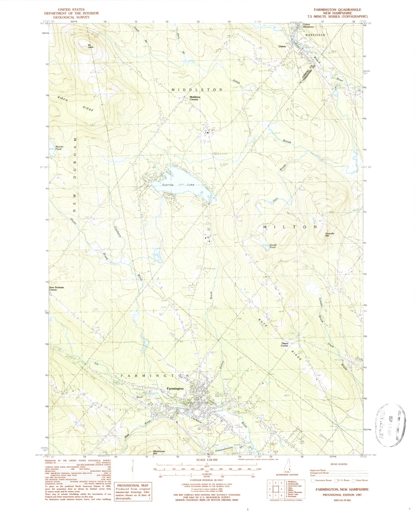
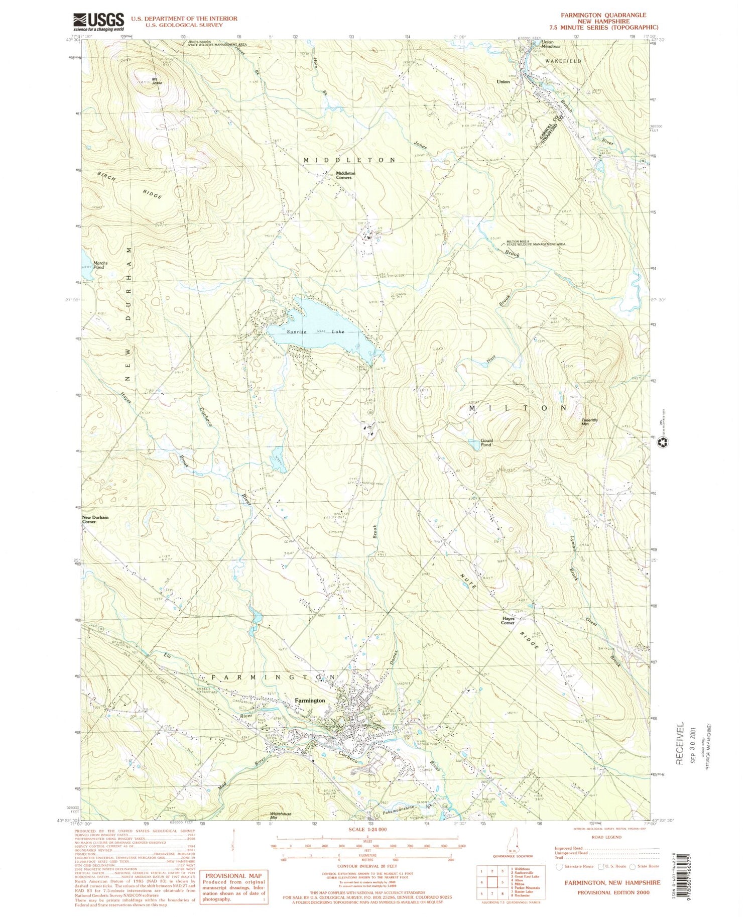
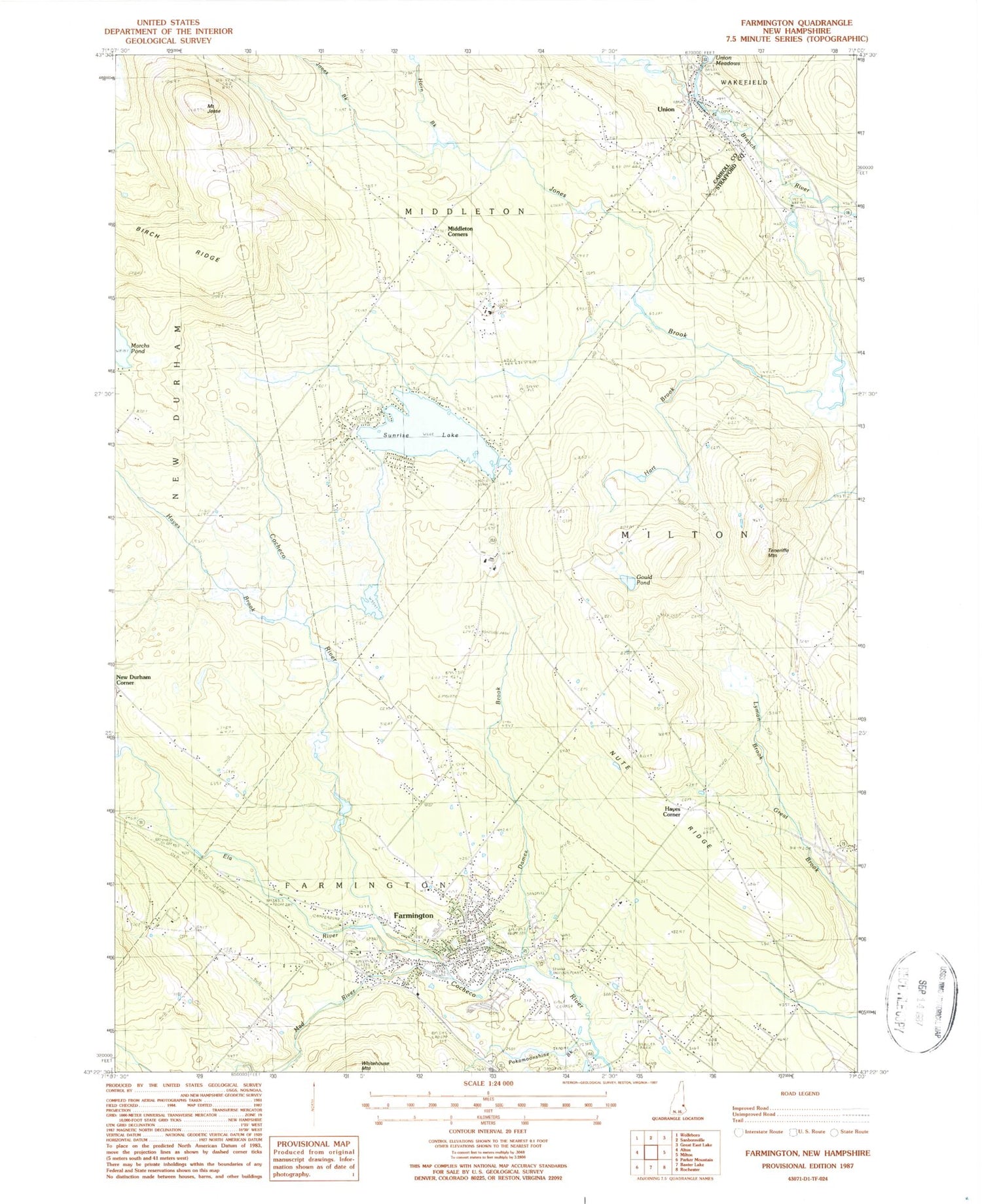
Classic USGS Farmington New Hampshire 7.5'x7.5' Topo Map
Couldn't load pickup availability
Historical USGS topographic quad map of Farmington in the state of New Hampshire. Typical map scale is 1:24,000, but may vary for certain years, if available. Print size: 24" x 27"
This quadrangle is in the following counties: Carroll, Strafford.
The map contains contour lines, roads, rivers, towns, and lakes. Printed on high-quality waterproof paper with UV fade-resistant inks, and shipped rolled.
Contains the following named places: Lyman Brook, Birch Ridge, Dames Brook, Ela River, Farmington, Gould Pond, Hart Brook, Hayes Brook, Hayes Corner, Horn Brook, Mount Jesse, Jones Brook, Mad River, Memorial Drive School, Middleton Corners, New Durham Corner, Nute Ridge, Nute Ridge School, Pokamoonshine Brook, Saint Peters School, Sunrise Lake, Teneriffe Mountain, Union, Whitehouse Cemetery, Town of Middleton, Town of Milton, Union Meadows Dam, Sunrise Lake Dam, Branch River Dam Number 1, Branch River Reservoir, Currier Dam, Currier Pond, Farmington Country Club, Farmington Pentecostal Church, Farmington Post Office, Goodwin Library, Hayes Cemetery, Henry Wilson Memorial School, Main Street School, Nutes Ridge Cemetery, Waldron Mill Pond, Wentworth Cemetery, Union Post Office, Farmington Census Designated Place, Farmington Senior High School, Valley View Community Elementary School, Wakefield Fire and Rescue Station 3, Farmington Fire Rescue, Middleton Fire and Rescue, Union Census Designated Place, Middleton Police Department, Farmington Police Department, Therriaults Landing, Pine Grove Cemetery