MyTopo
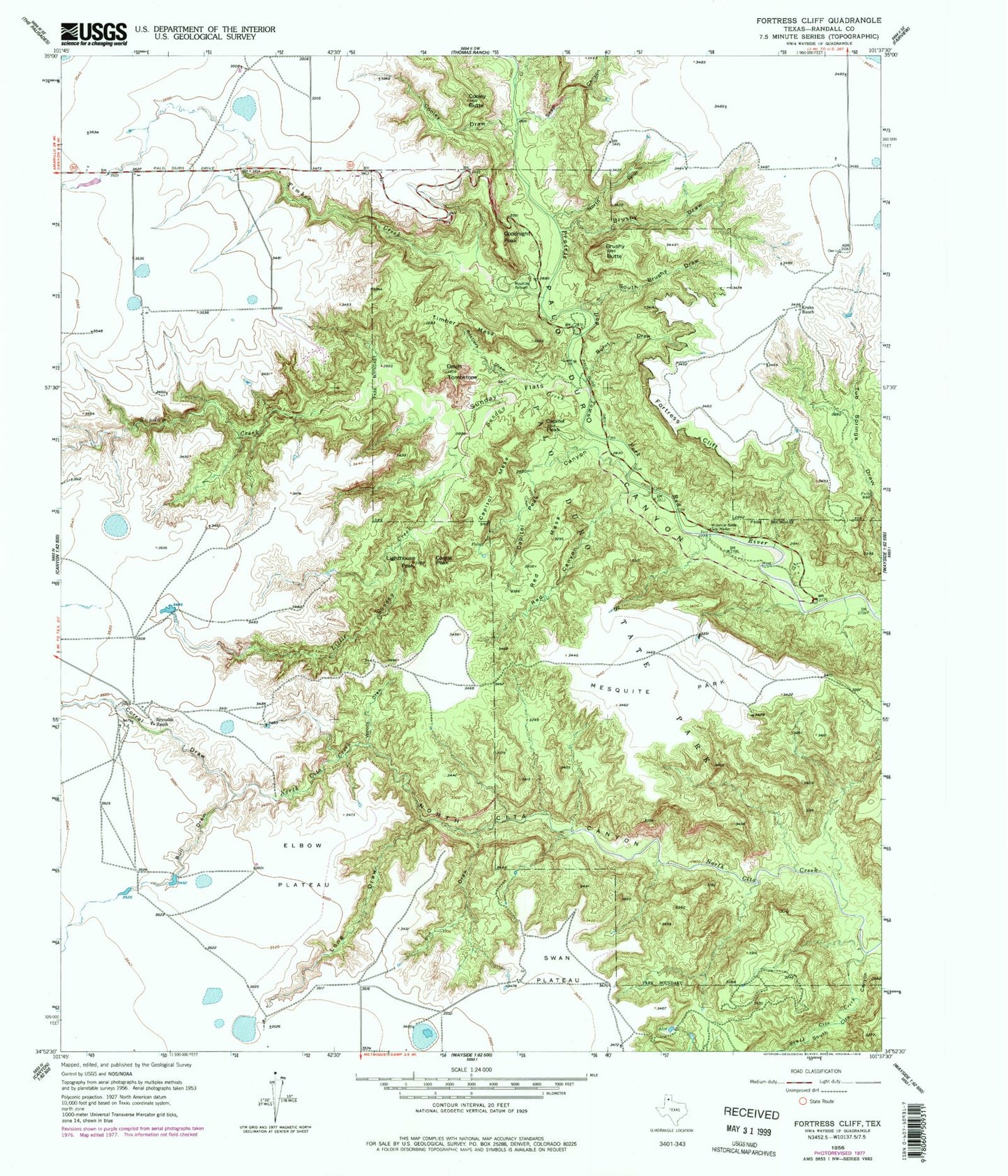
USGS Classic Fortress Cliff Texas 7.5'x7.5' Topo Map
Couldn't load pickup availability
Historical USGS topographic quad map of Fortress Cliff in the state of Texas. Scale: 1:24000. Print size: 24" x 27"
This quadrangle is in the following counties: Armstrong, Randall.
The map contains contour lines, roads, rivers, towns, lakes, and grids including latitude / longitude and UTM / MGRS. Printed on high-quality waterproof paper with UV fade-resistant inks.
Contains the following named places: Brushy Butte, Brushy Draw, Bull Draw, Burnt Draw, Capitol Mesa, Capitol Peak, Capitol Peak Canyon, Castle Peak, Cooley Butte, Cooley Draw, Corral Draw, Devils Tombstone, Elbow Plateau, Fortress Cliff, Goodnight Peak, Krahn Ranch, Lighthouse Peak, Little Sunday Creek, Long Draw, Mesquite Park, North Cita Canyon, North Cita Creek, North Spur Valley, Pin Draw, Red Canyon, Red Mesa, Reynolds Ranch, Rustlers Draw, Seep Canyon, South Brushy Draw, South Cita Creek, Sunday Flats, Swan Plateau, Timber Mesa, Tub Springs Draw, Woody Draw, Palo Duro State Park, South Cita Canyon, Sunday Creek, Timber Creek, Tub Springs, Palo Duro Canyon State Park Trail, Judys Arch