
MyTopo
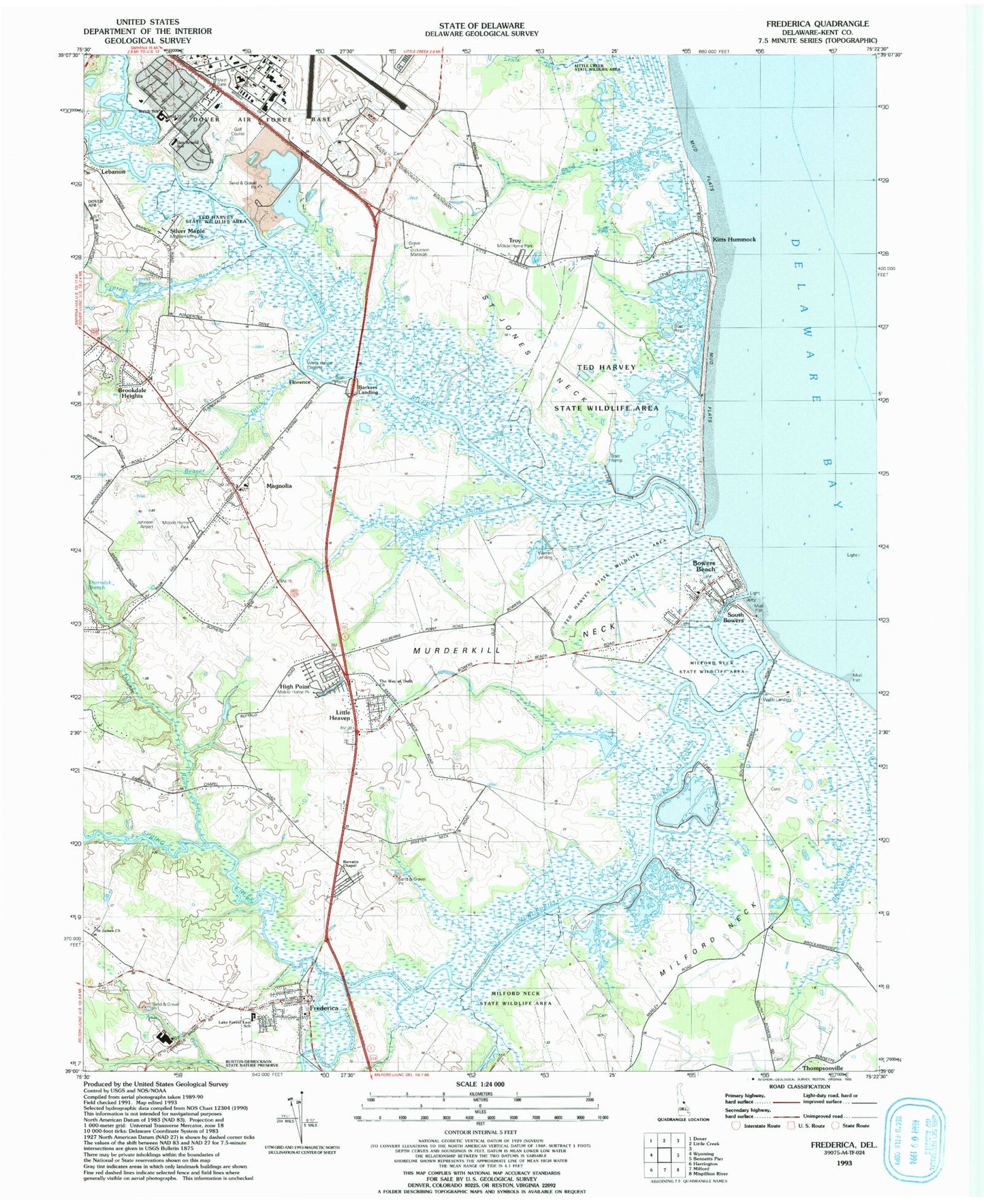
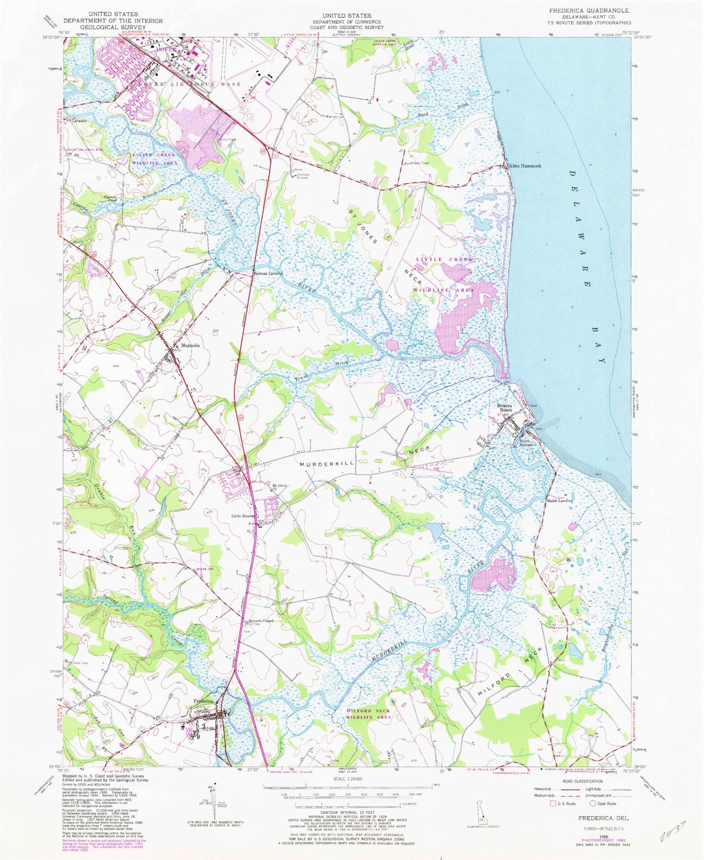
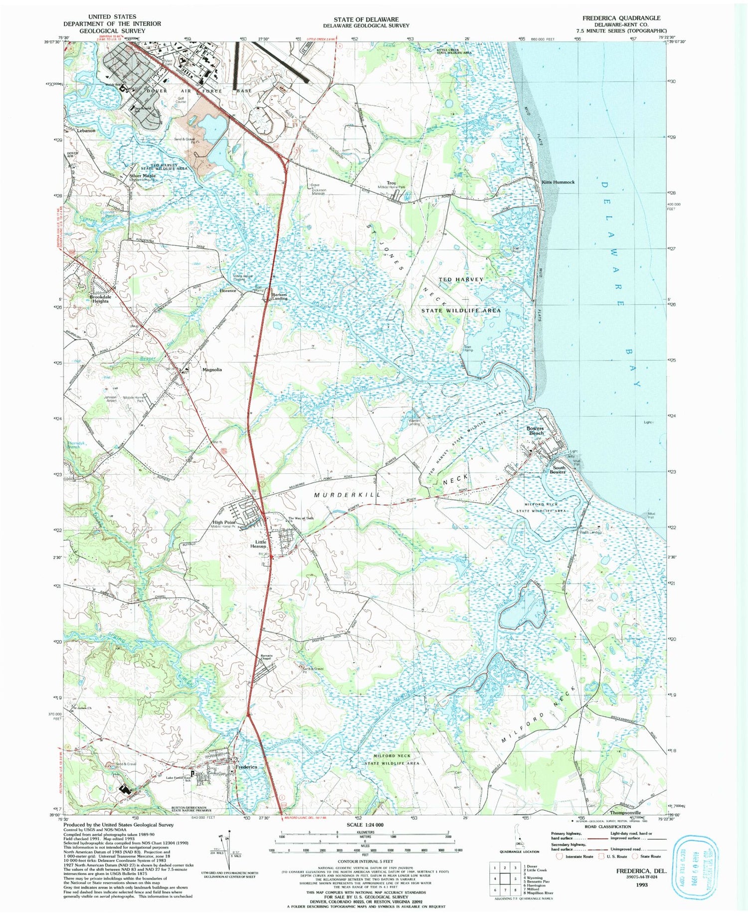
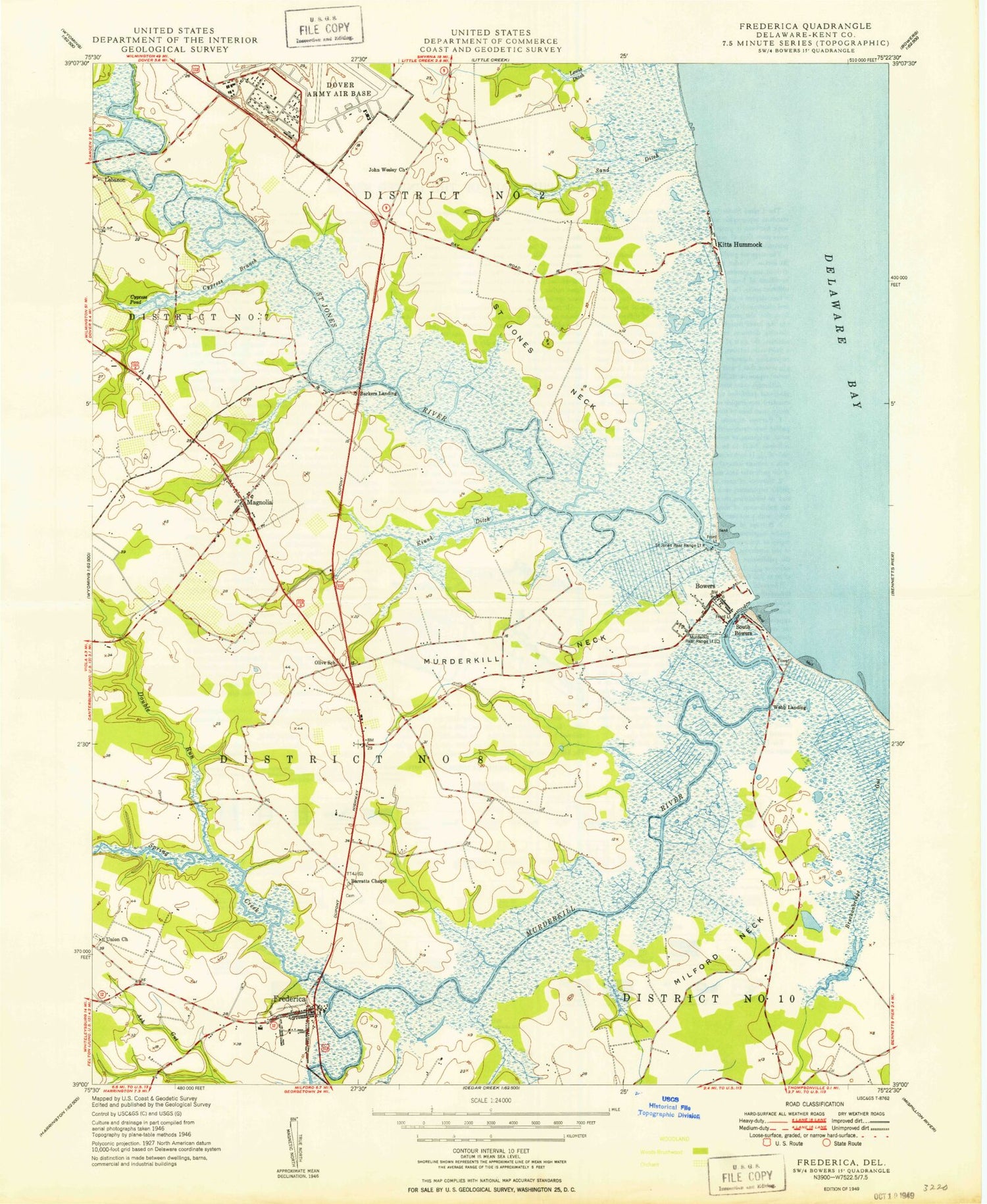
Classic USGS Frederica Delaware 7.5'x7.5' Topo Map
Couldn't load pickup availability
Historical USGS topographic quad map of Frederica in the state of Delaware. Map scale may vary for some years, but is generally around 1:24,000. Print size is approximately 24" x 27"
This quadrangle is in the following counties: Kent.
The map contains contour lines, roads, rivers, towns, and lakes. Printed on high-quality waterproof paper with UV fade-resistant inks, and shipped rolled.
Contains the following named places: Barkers Landing, Barkers Landing Bridge, Barkers Landing Estates, Barratt House, Barratts Chapel, Bay View Heights, Bayview Heights, Beaver Gut Ditch, Bowers Beach, Bowers Beach Maritime Museum, Bowers Fire Company, Bowers Landing, Bowers Town Hall, Brockonbridge Gut, Brookdale Heights, Brookhaven Estates, Calvary Community Center, Church Creek, Cypress Branch, Cypress Gardens, Cypress Pond, Delaware State Police Troop 3, Dickinson Mansion, Double Run, Dover Air Force Base Fire Department, Dover Air Force Base Junior High School, Dover Air Force Base Post Office, Dover Base Housing Census Designated Place, Eagle Heights, Florence, Frederica, Frederica Police Department, Frederica Post Office, Frederica Town Hall, Frederica Volunteer Fire Company, General Henry H Arnold Elementary School, George Meyers Development, Grandview Meadows, Hideaway Acres, High Point Mobile Home Park, Hubert American Methodist Episcopal Church, Hudson Branch, Hunters Ridge, Island Field Site, J. Ralph McIlvaine Elementary School, Jehu Reed House, John Dickinson Plantation, Johnsons Airport, Kitts Hummock, Lake Forest East Elementary School, Lebanon Bridge, Lindale House, Little Creek Wildlife Area Logan Tract, Little Heaven, Locustville, Logan School, Magnolia, Magnolia Mobile Home Park, Magnolia Post Office, Magnolia Town Hall, Magnolia United Methodist Church, Magnolia Volunteer Fire Company, Major George S Welch Elementary School, Milford Neck, Milford Neck Wildlife Area, Misty Pines, Mount Olive Church, Murderkill Neck, Murderkill River, Olive School, Otters Run, Pratt Branch, Saint James American Methodist Episcopal Church, Saint James Cemetery, Saint Jones Access Area, Saint Jones Neck, Saint Jones River, Sand Ditch, Saxton United Methodist Church, Shirleys Bar, Silver Maple Mobile Home Park, South Bowers, Spring Creek, Ted Harvey Conservation Area Logan Lane Tract, The Way of Truth Church, Thorndyk Branch, Tidbury Creek, Town of Bowers, Town of Frederica, Town of Magnolia, Town Point, Trinity United Methodist Church, Trunk Ditch, Warren Landing, Webb Landing, White House Landing, Wickham Woods, ZIP Codes: 19946, 19962