
MyTopo
Classic USGS Georgia Plains Vermont 7.5'x7.5' Topo Map
Couldn't load pickup availability
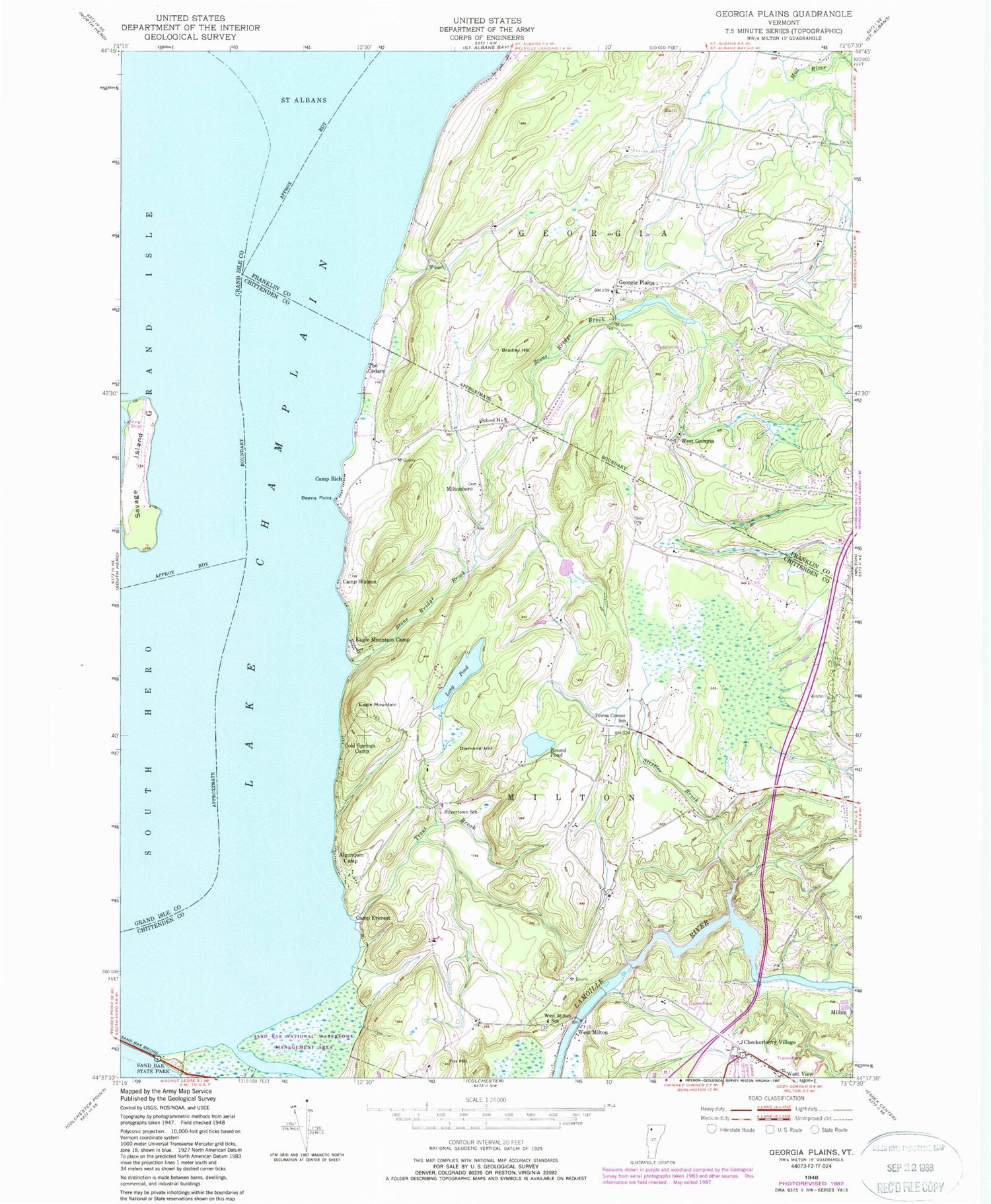
Historical USGS topographic quad map of Georgia Plains in the state of Vermont. Map scale may vary for some years, but is generally around 1:24,000. Print size is approximately 24" x 27"
This quadrangle is in the following counties: Chittenden, Franklin, Grand Isle.
The map contains contour lines, roads, rivers, towns, and lakes. Printed on high-quality waterproof paper with UV fade-resistant inks, and shipped rolled.
Contains the following named places: Algonquin Camp, Beans Point, Bradley Hill, Camp Everest, Camp Rich, Camp Watson, Checkerberry Cemetery, Checkerberry Village, Cold Springs Camp, Crown Cemetery, Diamond Hill, Eagle Mountain, Eagle Mountain Camp, Fox Hill, Georgia Plains, Georgia Plains Cemetery, Long Pond, Miltonboro, Miltonboro Cemetery, New West Milton Cemetery, Old West Milton Cemetery, Peterson Dam, Round Pond, Sabin Cemetery, Sand Bar State Park, Savage Island, Savage Island Airport, School Number 8, Shaw Meadow Airport, Silvertown School, Stone Bridge Brook, Streeter Brook, The Cedars, Town of Georgia, Town of Milton, Towns Corner School, Trout Brook, West Georgia, West Milton, West Milton School, West View, ZIP Code: 05468


