
MyTopo
Classic USGS Gilmanton Ironworks New Hampshire 7.5'x7.5' Topo Map
Couldn't load pickup availability
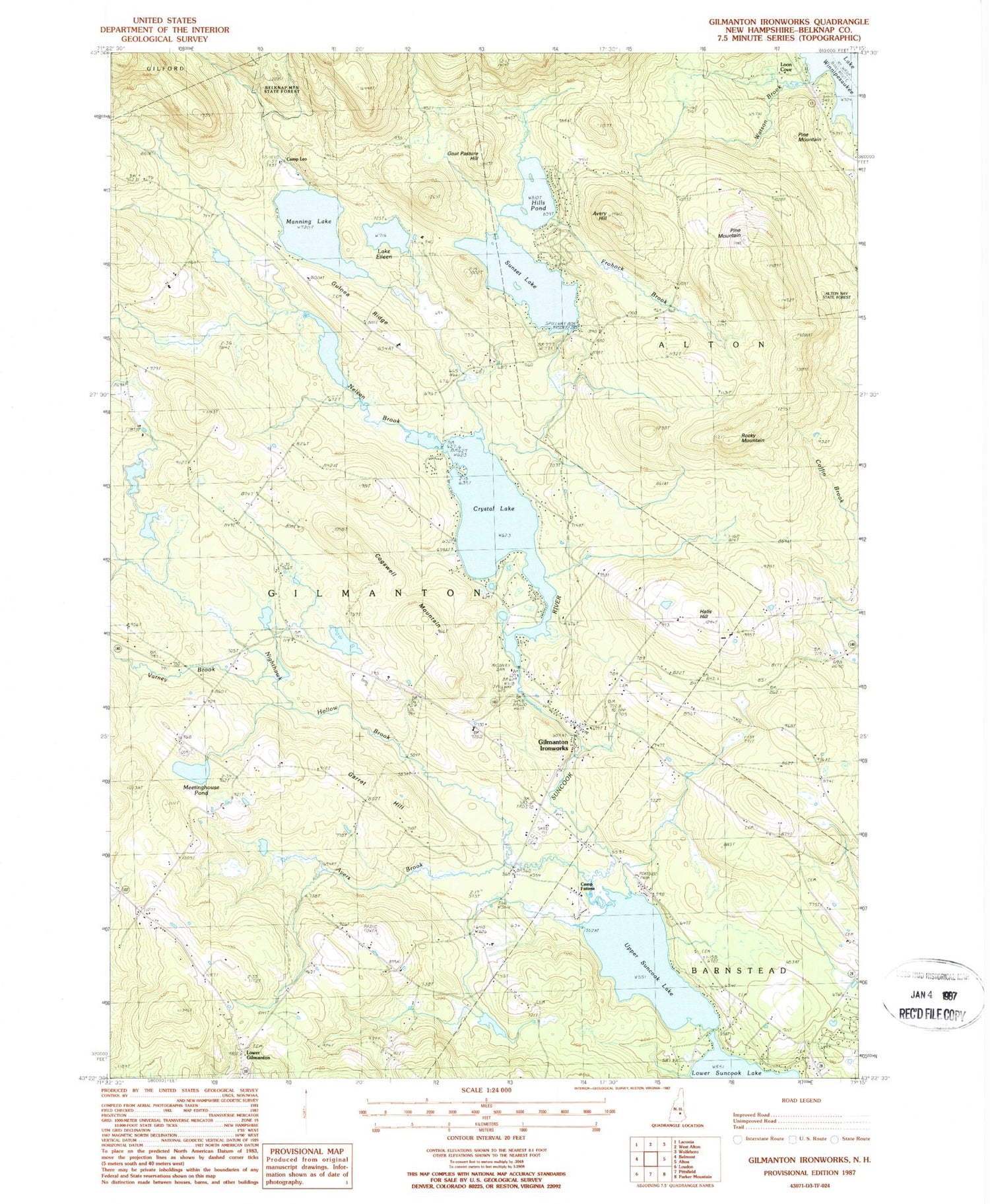
Historical USGS topographic quad map of Gilmanton Ironworks in the state of New Hampshire. Typical map scale is 1:24,000, but may vary for certain years, if available. Print size: 24" x 27"
This quadrangle is in the following counties: Belknap.
The map contains contour lines, roads, rivers, towns, and lakes. Printed on high-quality waterproof paper with UV fade-resistant inks, and shipped rolled.
Contains the following named places: Avery Hill, Ayers Branch, Camp Fatima, Camp Leo, Cogswell Mountain, Crystal Lake, Frohock Brook, Garret Hill, Gilmanton Ironworks, Goat Pasture Hill, Guinea Ridge, Halls Hill, Hills Pond, Loon Cove, Lower Gilmanton, Manning Lake, Meetinghouse Pond, Nelson Brook, Nighthawk Hollow Brook, Parsonage Hill, Pine Grove Cemetery, Pine Mountain, Rocky Mountain, Lake Eileen, Smith Meeting House, Sunset Lake, Upper Suncook Lake, Varney Brook, Watson Brook, Whiteoak School, Town of Gilmanton, Sunset Lake Dam, Suncook Ponds, Crystal Lake-Gilmanton Dam, Gillan Pond Dam, Gillan Pond, Barnstead Cemetery, Gilmanton School, Gilmanton Iron Works Post Office, Pickering Lot Cemetery, Rainbow Rod and Gun Club, Second Cemetery, Smith Meeting House Cemetery, United Church of Gilmanton, Gilmanton Fire Department Station 1


