
MyTopo
Classic USGS Gilsum New Hampshire 7.5'x7.5' Topo Map
Couldn't load pickup availability
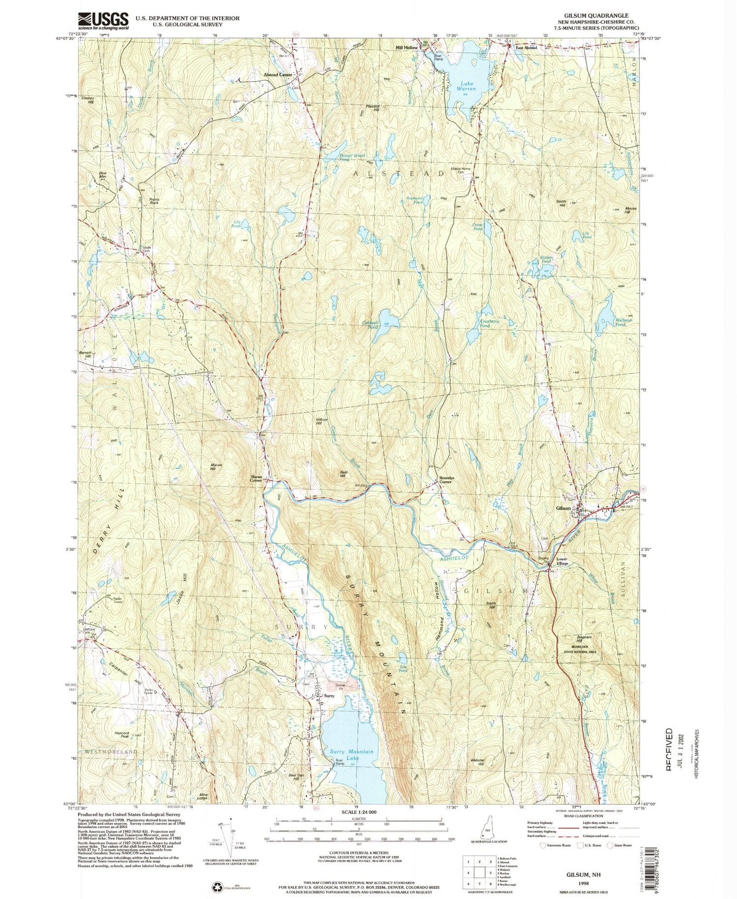
Historical USGS topographic quad map of Gilsum in the state of New Hampshire. Typical map scale is 1:24,000, but may vary for certain years, if available. Print size: 24" x 27"
This quadrangle is in the following counties: Cheshire.
The map contains contour lines, roads, rivers, towns, and lakes. Printed on high-quality waterproof paper with UV fade-resistant inks, and shipped rolled.
Contains the following named places: Alstead Center, Bald Hill, Barnett Hill, Bear Den Hill, Bingham Hill, Caldwell Pond, Cannon Brook, Carpenter Hill, Cheney Hill, Cranberry Pond, Crane Pond, Crehore Cemetery, Dart Brook, Derry Hill, East Alstead, Gilsum, Hale Brook, Hammond Hollow, Hancock Peak, Hayward Brook, Joslin Hill, Kidders Pond, Lily Pond, Lily Pond, Lily Pond, Lower Village, Marvin Hill, May Brook, Merriam Brook, Mill Hollow, Moose Hill, Pratts Rock, Prentice Hill, Raymond Pond, Rice Mountain, Roundys Corner, Shaws Corner, Slade Cemetery, Smith Hill, Smith Hill, Surry, Surry Mountain, Thompson Brook, Lake Warren, Webster Hill, Wellman Pond, White Brook, Beaver Wood Pond, WKNE-FM (Keene), WKNE-FM (Keene), WEKW-TV (Keene), Town of Alstead, Town of Gilsum, Town of Surry, Surry Mountain Lake, Lake Warren Dam, Cranberry Pond Dam, Alstead Center Congregational Church, Beth-el Bible Church, Center Cemetery, Gilsum Congregational Church, Gilsum Elementary School, Gilsum Post Office, Gilsum Stone Arch Bridge, Pot Holes and Bears Den State Forest, Surry Mountain Gold Mine (historical), Monadnock Community Connections School, Surry Volunteer Fire Department, Gilsum Volunteer Fire Department and Rescue Squad, Surry Police Department, Centennial Cemetery, Surry Village Cemetery


