
MyTopo
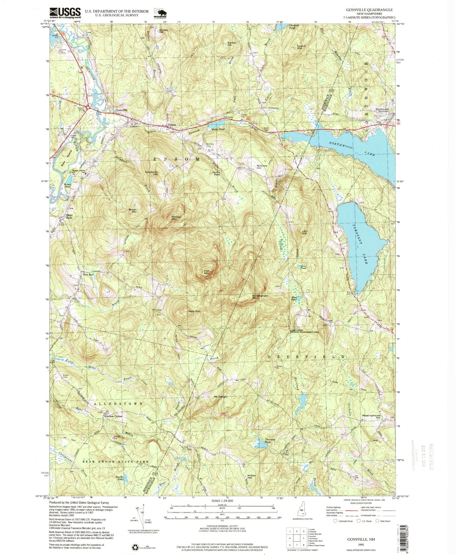
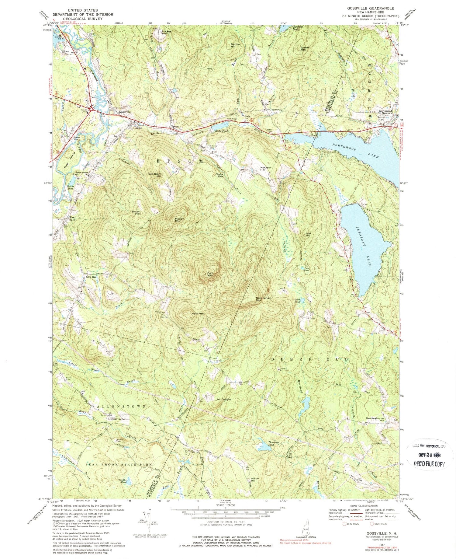
Classic USGS Gossville New Hampshire 7.5'x7.5' Topo Map
Couldn't load pickup availability
Historical USGS topographic quad map of Gossville in the state of New Hampshire. Typical map scale is 1:24,000, but may vary for certain years, if available. Print size: 24" x 27"
This quadrangle is in the following counties: Merrimack, Rockingham.
The map contains contour lines, roads, rivers, towns, and lakes. Printed on high-quality waterproof paper with UV fade-resistant inks, and shipped rolled.
Contains the following named places: Barton Hill, Bear Island, Bixby Pond, Blake Brook, Brush Hill, Catamount Trail, Mount Delight, Dow Pond, Epsom, Epsom Central School, Epsom Mountain, Evans Cemetery, Fairview Cemetery, Flat Meadow Brook, Fort Mountain, Gossville, Griffin Brook, Gulf Brook, Leighton Brook, Levi Hill, Little Bear Brook, Little Suncook River, Lockes Brook, Lockes Hill, Mason Brook, McClary Cemetery, McClary Hill, McCoy Mountain, Meetinghouse Hill, Mud Pond, Narrows Brook, Nats Mountain, New Rye, Northwood Lake, Nottingham Mountain, Pease Brook, Pleasant Lake, Round Pond, Sandborn Hill, Short Falls, Smiths Pond, Steeles Falls, Thurston Pond, Willow Hill, Epsom Circle, WNHT-TV (Concord), Town of Deerfield, Town of Epsom, Pleasant Lake Dam, Northwood Lake Dam, Hayes Swamp Dam, Bixby Pond Dam, Huckins Dam, Little River Reservoir, Number 13 School (historical), Center School (historical), Epsom Baptist Church, Epsom Baptist Church, Epsom Post Office, Gossville Cemetery, Mountain School (historical), New Orchard School (historical), New Rye Congregational Church, North Road School (historical), Cornerstone Christian Academy, Pathfinder Academy, Epsom Fire Department, Epsom Police Department


