MyTopo
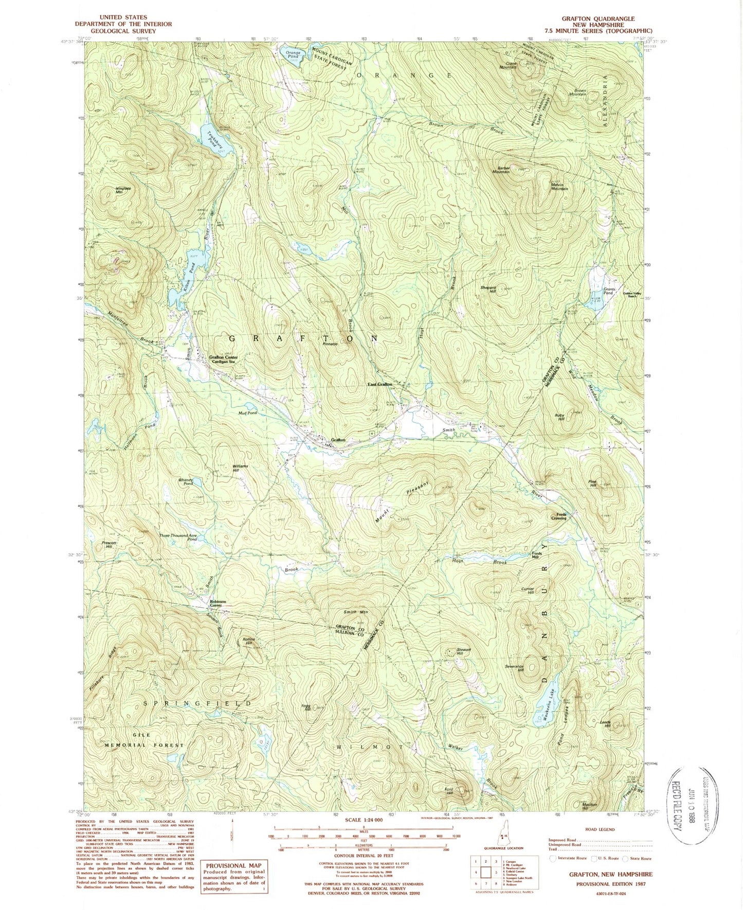
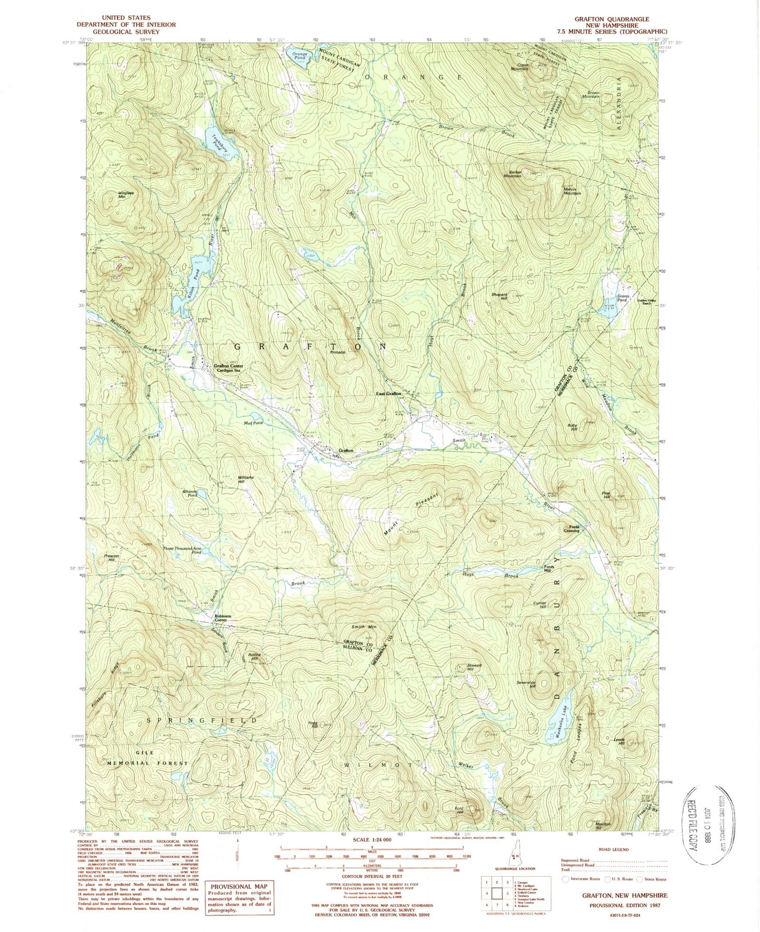
Classic USGS Grafton New Hampshire 7.5'x7.5' Topo Map
Couldn't load pickup availability
Historical USGS topographic quad map of Grafton in the state of New Hampshire. Typical map scale is 1:24,000, but may vary for certain years, if available. Print size: 24" x 27"
This quadrangle is in the following counties: Grafton, Merrimack, Sullivan.
The map contains contour lines, roads, rivers, towns, and lakes. Printed on high-quality waterproof paper with UV fade-resistant inks, and shipped rolled.
Contains the following named places: Barber Mountain, Brown Brook, Brown Mountain, Cardigan Station, Crane Mountain, Currier Hill, East Grafton, Fogg Hill, Ford Hill, Garnet Mine, Golden Valley Ranch, Grafton, Grafton Center, Grants Pond, Halfmoon Pond Brook, Hoyt Brook, Hoyt Brook, Isinglass Mountain, Kilton Pond, Leeds Hill, Manfeltree Brook, Melvin Mountain, Mill Brook, Moulton Hill, Mount Pleasant, Mud Pond, Orange Pond, Pillsbury Ridge, Pine Hill, Pond Ledges, Prescott Hill, Prescott Hill Cemetery, Roby Hill, Rollins Hill, Sanders Brook, Severance Hill, Shepard Hill, Smith Brook, Smith Mountain, Stewart Hill, Tewksbury Pond, Three Thousand Acre Pond, Waukeena Lake, Whitney Pond, Williams Hill, Fords Crossing, Fords Mill, Robinson Corner, Town of Grafton, Kilton Pond Dam, Grants Pond Dam, Hoyt Brook Dam, Hoyt Brook Pond, Grafton Post Office, Unification Church, Grafton Volunteer Fire Department, Grafton Ambulance Association, Grafton Police Department