
MyTopo
Classic USGS Grantham New Hampshire 7.5'x7.5' Topo Map
Couldn't load pickup availability
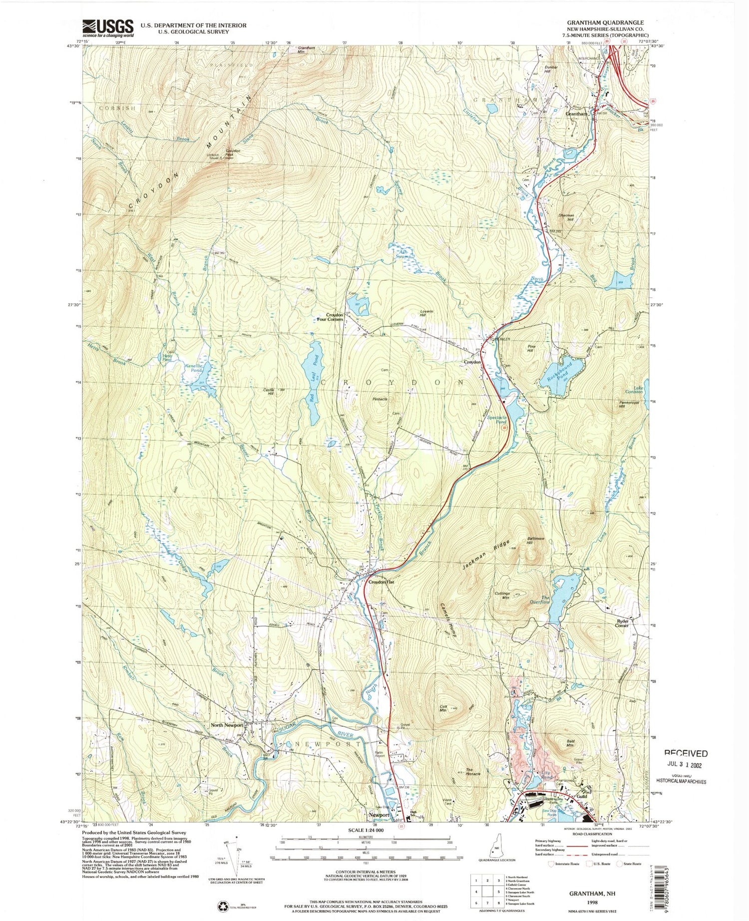
Historical USGS topographic quad map of Grantham in the state of New Hampshire. Typical map scale is 1:24,000, but may vary for certain years, if available. Print size: 24" x 27"
This quadrangle is in the following counties: Sullivan.
The map contains contour lines, roads, rivers, towns, and lakes. Printed on high-quality waterproof paper with UV fade-resistant inks, and shipped rolled.
Contains the following named places: Ash Swamp Brook, Bald Mountain, Baltimore Hill, Beaver Brook, Bog Brook, Camels Hump, Castle Hill, Coit Mountain, Croydon, Croydon Flat, Croydon Four Corners, Croydon Mountain, Croydon Peak, Cuttings Mountain, Dodge Brook, Dunbar Hill, East Branch Beaver Brook, Grantham, Guild, Hetty Brook, Jackman Ridge, Kimball Brook, Ledge Pond Brook, Littlefield Brook, Lity Pond, Long Pond Brook, North Branch Sugar River, North Newport, Pennyroyal Hill, Perkins Brook, Pine Hill, Pinegrove Cemetery, Pinnacle, Red Leaf Pond, Rockybound Pond, Sawyer Brook, Sherman Hill, Spectacle Pond, Stocker Brook, Stone Brook, The Overflow, The Pinnacle, West Branch Beaver Brook, Ryder Corner, Parlin Field, Town of Croydon, Red Leaf Pond Dam, Long Pond Brook Dam, The Overflow Reservoir, Guild Post Office, Grantham Post Office, Corbin Bridge, Croydon Village School, Grantham United Methodist Church, Grantham Village School, Newport Middle High School, North Newport Cemetery, The Pinacle Cemetery, East Village Cemetery, Hetti Pond, Loverin Hill, Dunbar Hill Cemetery, Grantham Fire Department, Croydon Volunteer Fire and Rescue, Sugar Springs Farm, Grantham Emergency Medical Services, Grantham Police Department, Croydon Police Department


