MyTopo
Classic USGS Great Point Massachusetts 7.5'x7.5' Topo Map
Regular price
$16.95
Regular price
Sale price
$16.95
Unit price
per
Couldn't load pickup availability
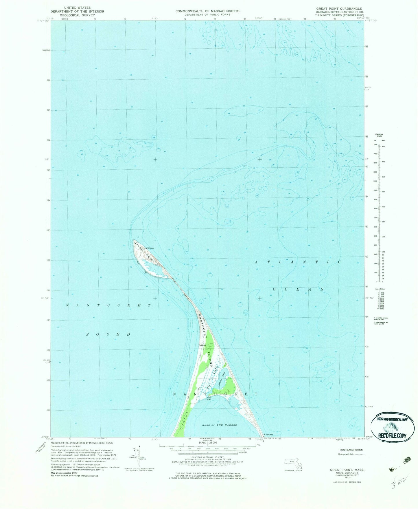
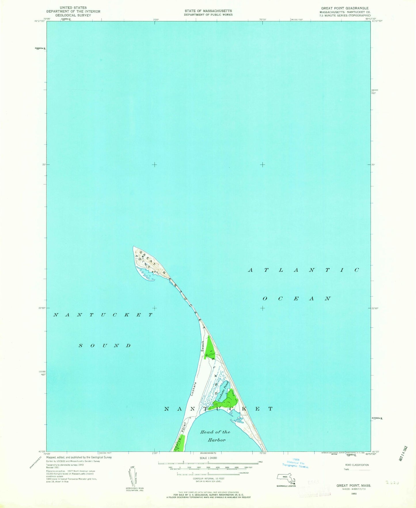
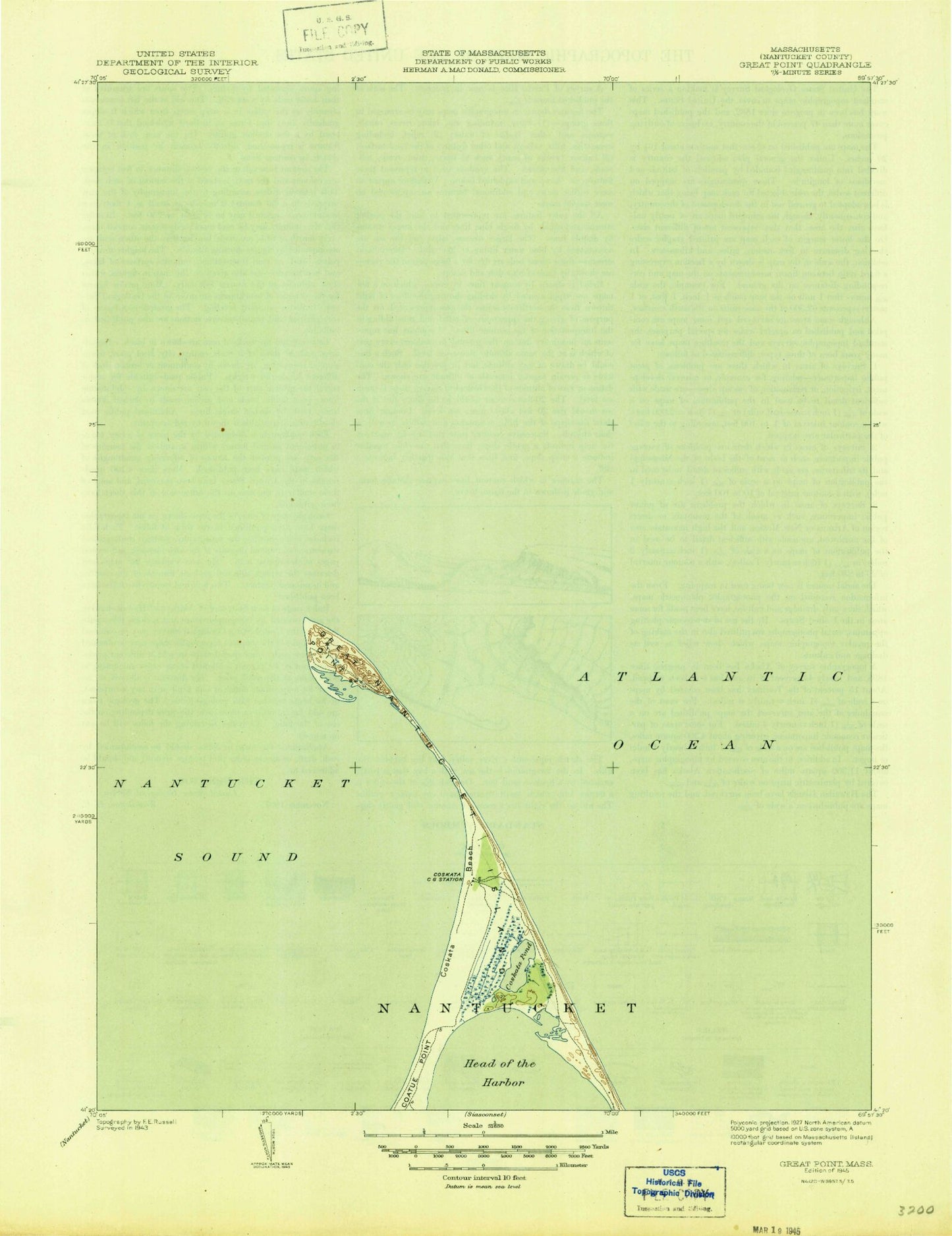
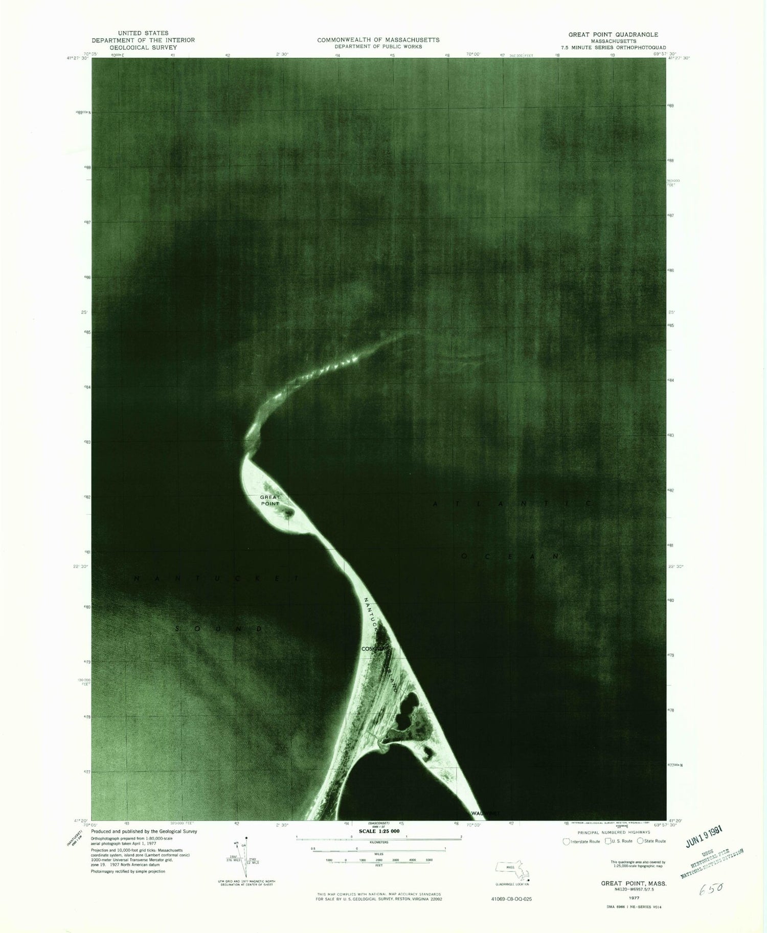
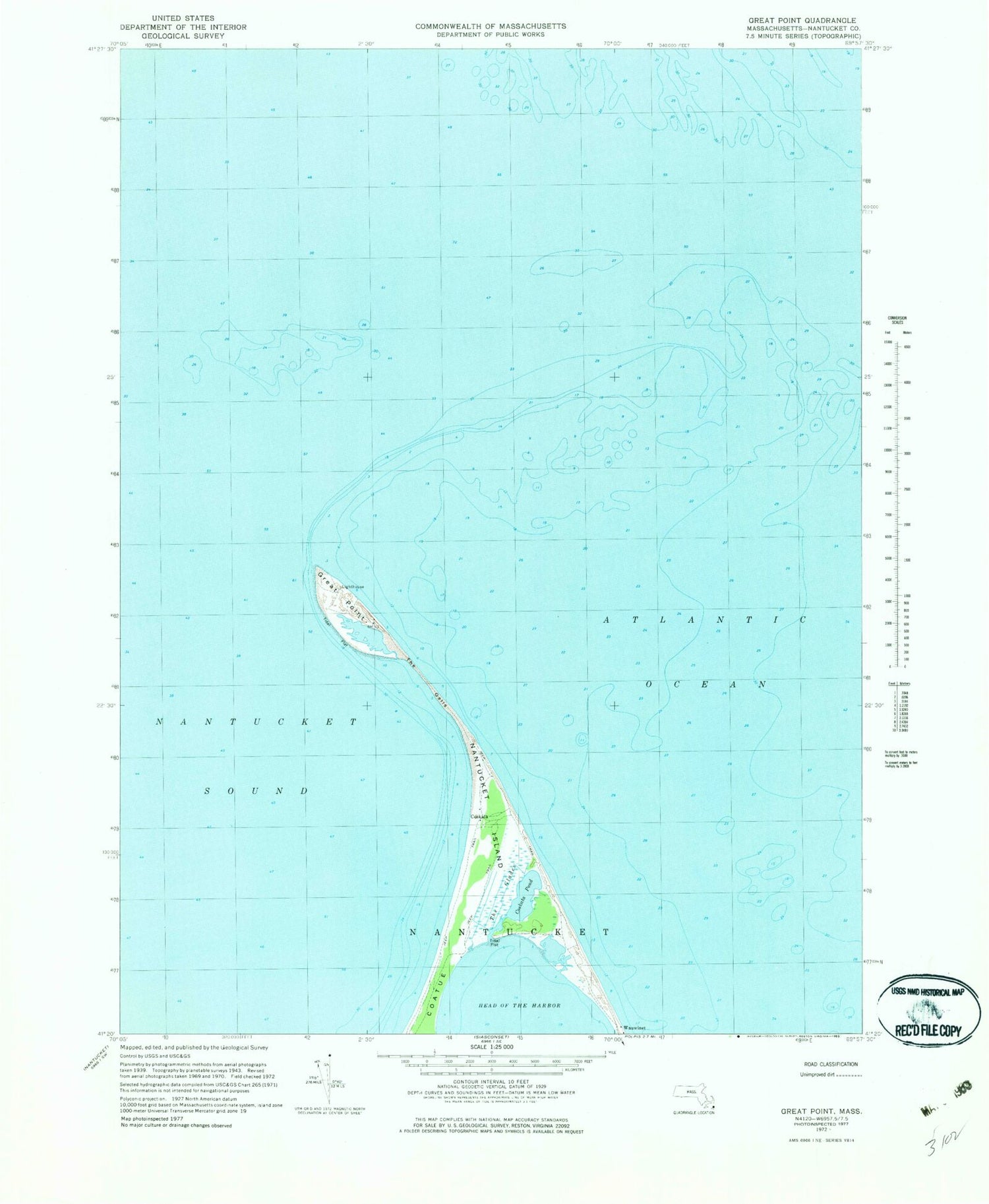
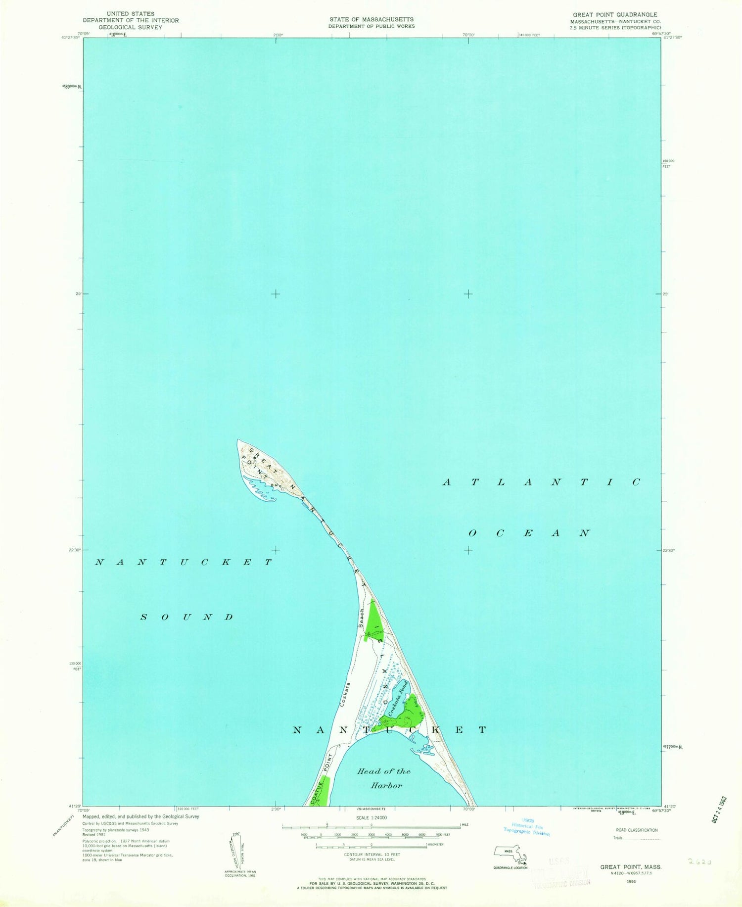
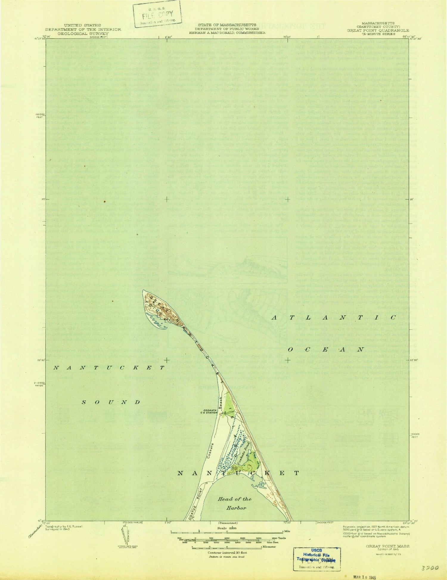
Historical USGS topographic quad map of Great Point in the state of Massachusetts. Map scale may vary for some years, but is generally around 1:24,000. Print size is approximately 24" x 27"
This quadrangle is in the following counties: Nantucket.
The map contains contour lines, roads, rivers, towns, and lakes. Printed on high-quality waterproof paper with UV fade-resistant inks, and shipped rolled.
Contains the following named places: Coatue, Coskata, Coskata Beach, Coskata Pond, Cosuata, Great Point, Great Point Lighthouse, Great Round Shoal Channel, Grout Round Reef, Haulover, Nantucket Light, Nantucket National Wildlife Refuge, Point Rip, The Galls, The Glades