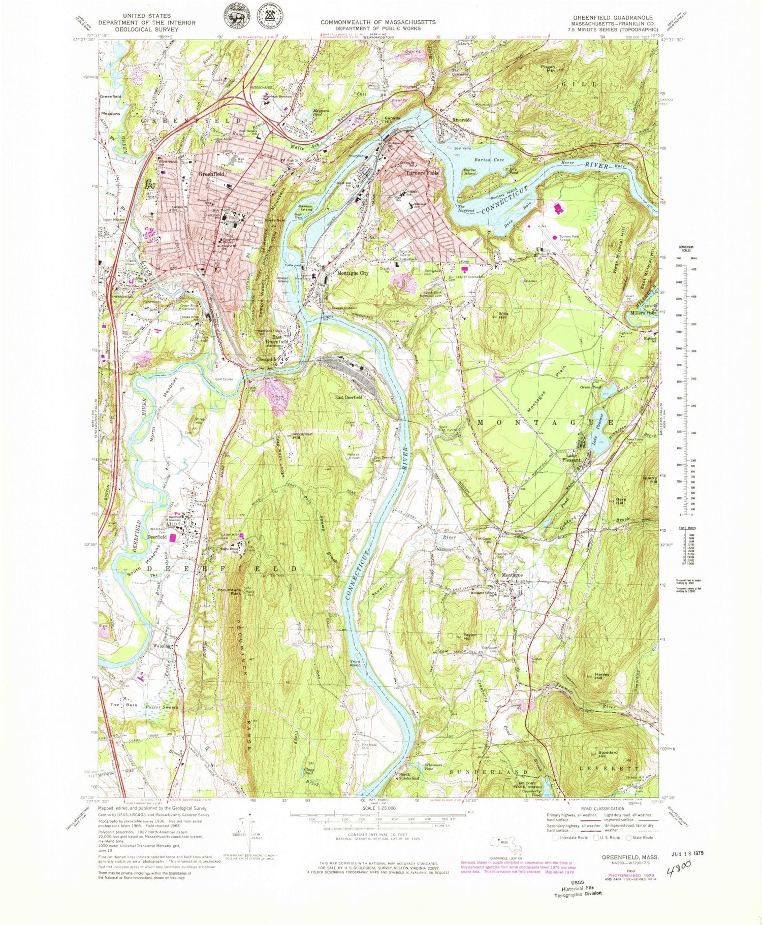

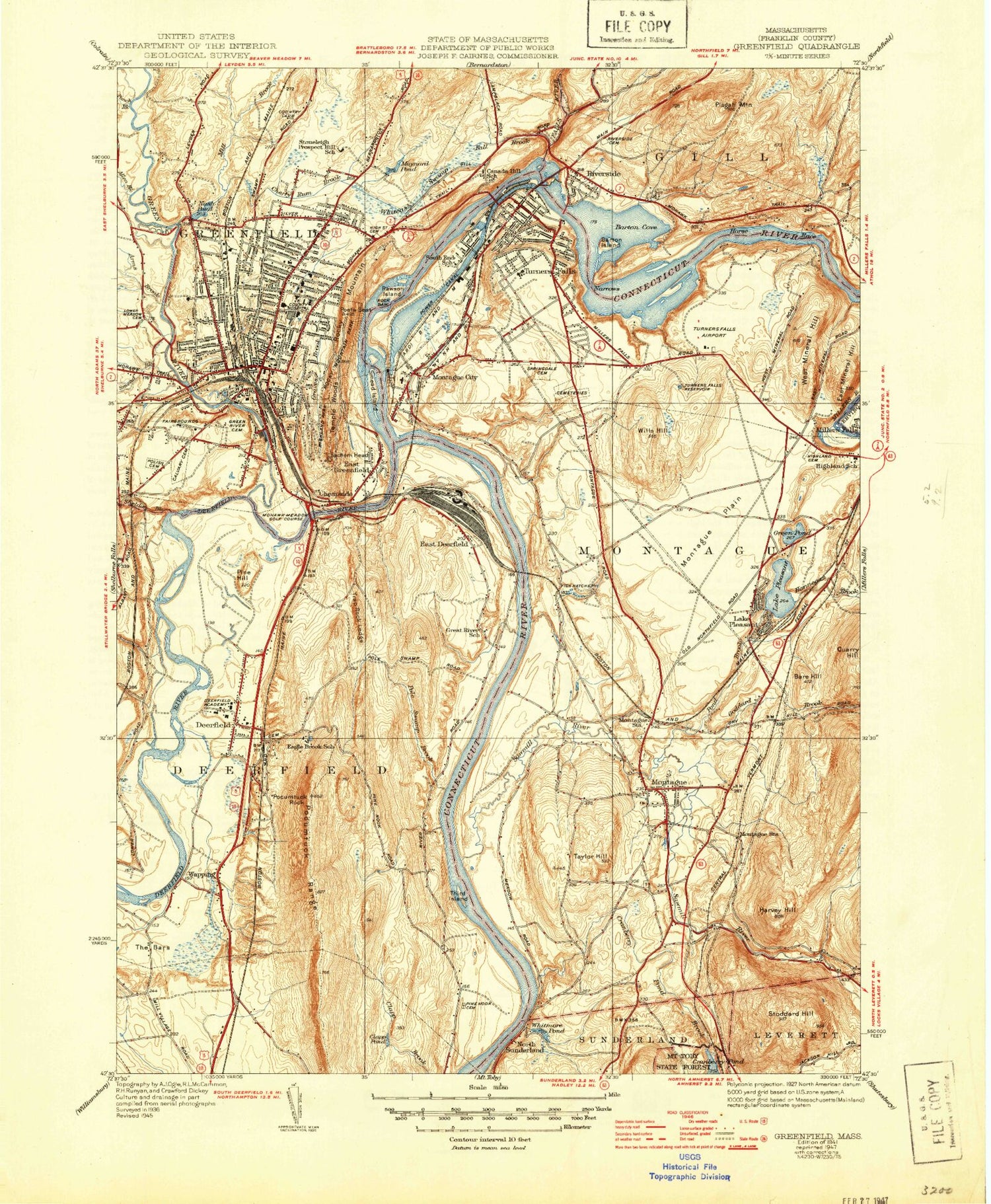
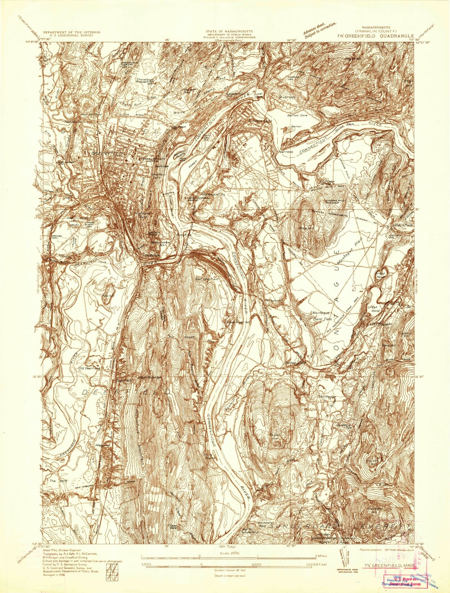
MyTopo
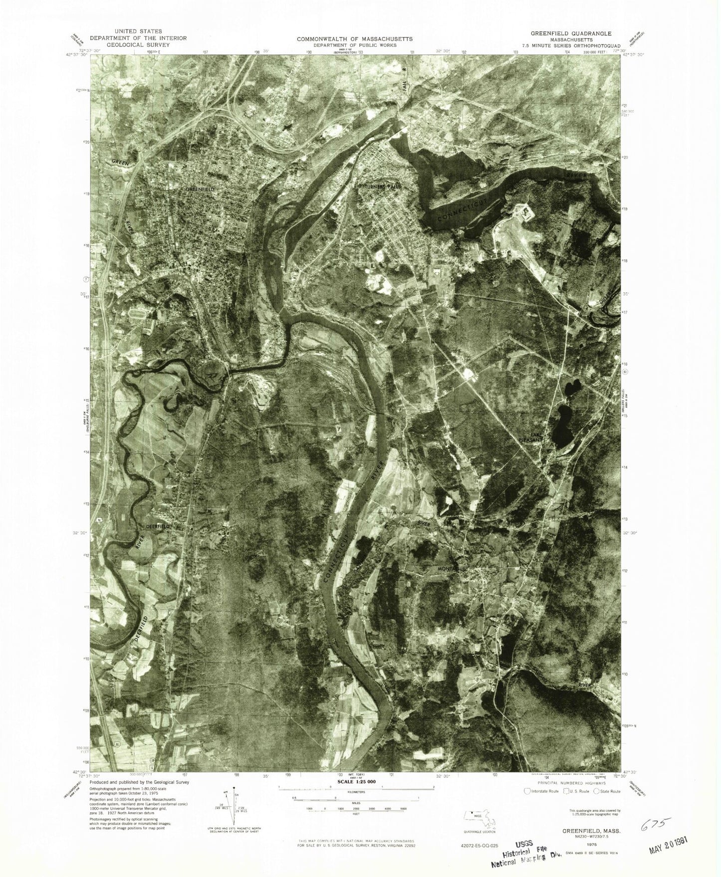
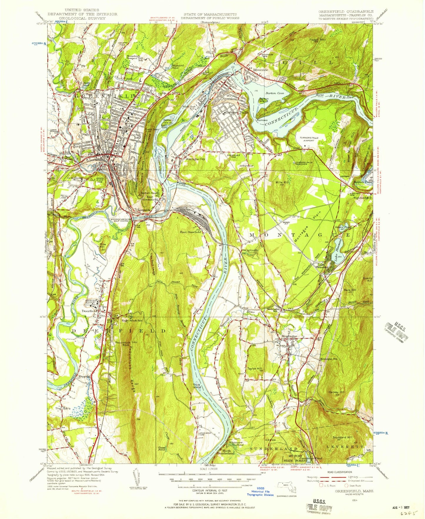
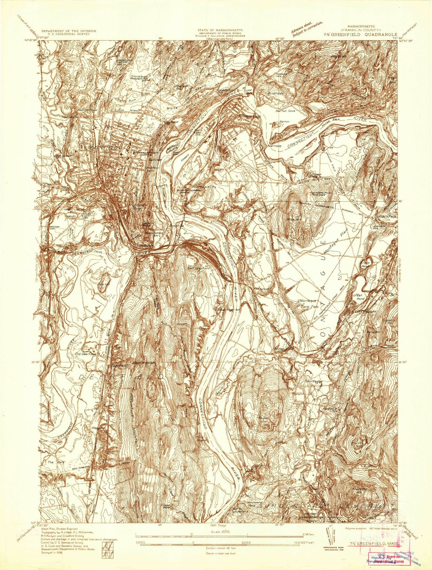
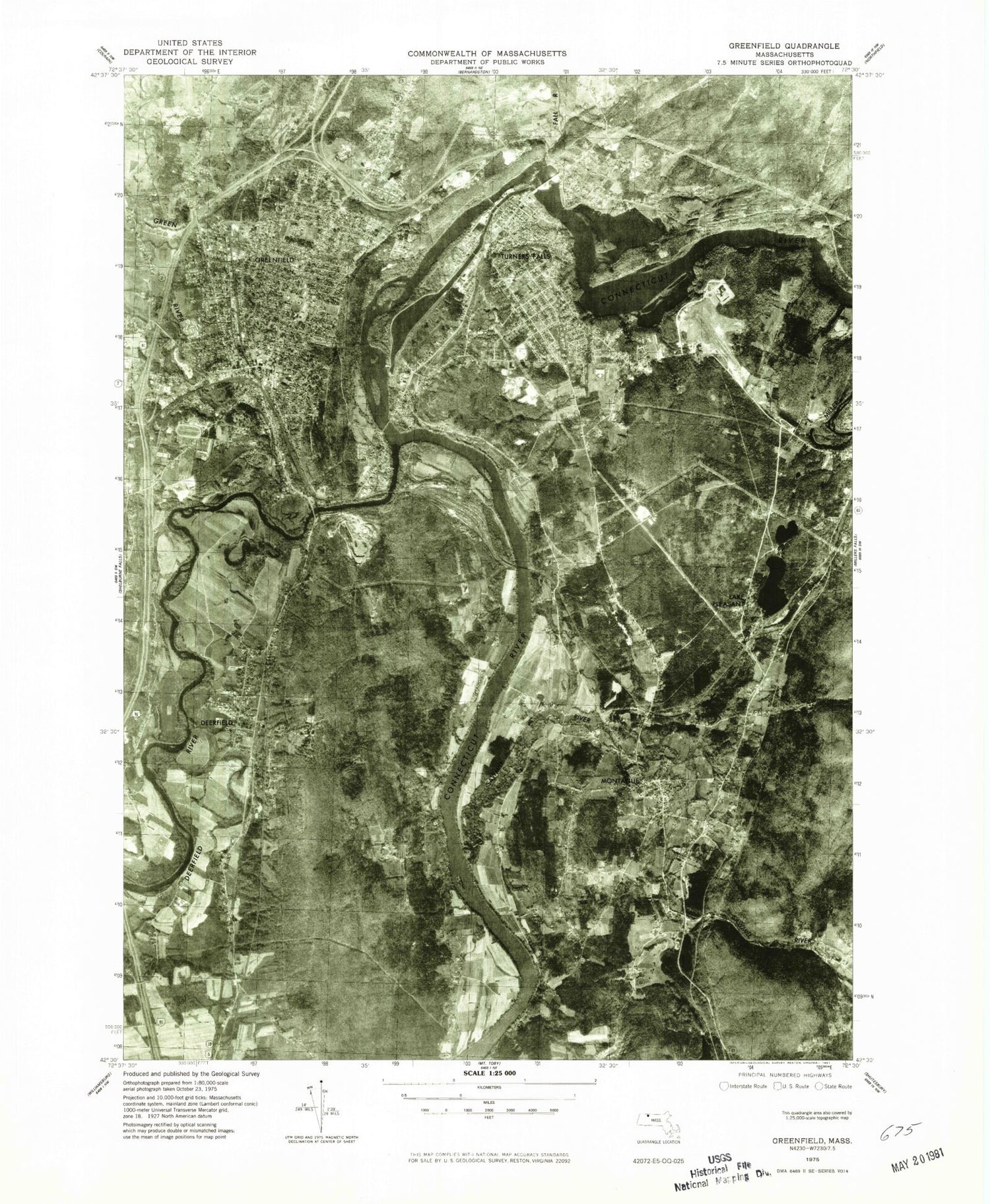
Classic USGS Greenfield Massachusetts 7.5'x7.5' Topo Map
Couldn't load pickup availability
Historical USGS topographic quad map of Greenfield in the state of Massachusetts. Typical map scale is 1:24,000, but may vary for certain years, if available. Print size: 24" x 27"
This quadrangle is in the following counties: Franklin.
The map contains contour lines, roads, rivers, towns, and lakes. Printed on high-quality waterproof paper with UV fade-resistant inks, and shipped rolled.
Contains the following named places: Rocky Mountain Park, Highland Park, Deerfield Academy, Laurel Hill Cemetery, Eagle Brook School, Pine Nook Cemetery, Green River School, Mount Toby State Forest, Riverside Cemetery, Highland School, Highland Cemetery, Springdale Cemetery, Aaron Clark Memorial Cemetery, Our Lady of Czechowski Cemetery, Elm Grove Cemetery, Montague Center School, Old South Cemetery, Marvell Cemetery, Jackson Hill Cemetery, Town Farm Cemetery, East Deerfield Cemetery, Old Albany Cemetery, Turners Falls High School, Newton School, Calvary Cemetery, Mater Dolorosa Cemetery, Federal Street School, Abercrombie School, Farren Memorial Hospital, Stoneleigh-Burnham School, High Street Cemetery, South End School, Saint Annes School, Hillcrest School, Central Street School, Turners Falls Junior High School, Academy of Early Learning, Conway Street School, Franklin County Jail, Lower Meadows Cemetery, Pierce Street School, Greenfield High School, Pine Acres Church, Holy Trinity School, Greenfield Junior High School, Baystate Franklin Medical Center, North Cemetery, Riverside Cemetery, Greenfield Plaza, Cherry Rum Shopping Plaza, Green River Cemetery, Massachusetts State Fish Hatchery, Cranberry Pond Dam, Whitmore Pond Dam, Bowens Pond Dam, Bowens Pond, Greenfield Electric Light and Power Dam, Cabot Station Power Plant Dam, Montague Power Canal Reservoir, Turners Falls Number 1 Dam, Connecticut River Reservoir, Turners Falls Dam, Turners Falls Canal Headgates, Whittemores Ferry (historical), Rices Ferry (historical), Factory Village (historical), Montague State Wildlife Management Area, Temple Woods, Eagle Brook School, Spaulding Brook, Bement School, Franklin County, Locust Hill Cemetery, Punch Brook, Allen Brook, Arms Brook, Bare Hill, Barton Island, Canada Hill, The Cascades, Cheapside, Cherry Rum Brook, Clapp Pond, Cranberry Pond Brook, Deerfield, Deerfield Meadows, Doctors Island, East Deerfield, East Greenfield, East Mineral Hill, Fall Brook, Fall River, Fuller Swamp, Fuller Swamp Brook, Greenfield, Green Pond, Gunn Brook, Harvey Hill, Horse Race, Lake Pleasant, Maynard Pond, Mill Brook, Montague, Montague City, Montague Plain, The Narrows, Nash Pond, North Meadows, North Sunderland, The Oxbow, Pine Hill, Pisgah Mountain, Lake Pleasant, Pocumtuck Range, Pocumtuck Rock, Poets Seat, Pole Swamp Brook, Pond Brook, Power Canal, Rawson Island, Riverside, Sachem Head, Sheldon Brook, Smead Brook, Smead Island, South Meadows, Stoddard Hill, Taylor Hill, Third Island, Trap Rock Ledge, Turners Falls, Turners Falls, Turners Falls Reservoir, Wapping, West Mineral Hill, Wheeler Brook, Whitmore Pond, Wills Hill, Woolman Hill, Goddard Brook, White Ash Swamp, Graves Brook, Rocky Mountain, The Bars, Mill Brook Stream, Montague Station, Sawmill River, Town of Deerfield, City of Greenfield, Town of Montague, Sheldons Fort (historical), Lily Pond, Franklin County Vocational-Technical School, Hannegan Brook, Barton Cove, Deep Hole, WHAI-AM (Greenfield), WGAM-AM (Greenfield), WGAJ-FM (Deerfield), WHAI-FM (Greenfield), Turners Falls Airport, Four Corners School, Green River, Deerfield River, Peskeomskut Island, All Souls Church, Christian and Missionary Church, The Church of Jesus Christ of Latter Day Saints, Deerfield Post Office, First Baptist Church, First Church of Christ Scientist, First Church of Deerfield, First Congregational Church, First Congregational Church, First United Methodist Church, Forgiven Heart Fellowship Church, Franklin County Technical School, Franklin Law Library, Grace Church, Great Falls Middle School, Greenfield Beach, Greenfield Middle School, Historic Deerfield and Pocumtuck Valley Memorial Library, Lake Minola Park, Lake Pleasant Post Office, Living Water Assembly of God Church, Main Street Historic District, Montague Post Office, Montague Town Hall, Montague Wildlife Management Area, Old Deerfield Village Historic District, Saint Andrews Episcopal Church, Saint James Episcopal Church, Saint Pauls Lutheran Church, Salvation Army, Second Congregational Church, Sheffield Elementary School, Son Beam Christian School, Turner Falls Historic District, Turner Falls High School, Turners Falls Post Office, Pumping Station Covered Bridge, MacAlaster Library, Robin Crest Learner Center, Eaglebrook School, Greenfield High School Library, Greenfield Middle School Library, Stoneleigh Burnham School, Greenfield Census Designated Place, Turners Falls Census Designated Place, Deerfield Greenhouse, Deerfield Census Designated Place, Turners Falls Fire Department, Deerfield Fire Department Station 1 Headquarters, Montague Fire Department, Greenfield Fire Department, Baystate Health System Ambulance Service, Montague Town Police Department, Franklin County Sheriff's Office, Greenfield Police Department, Greenfield Post Office, Rocky Mountain Park, Highland Park, Deerfield Academy, Laurel Hill Cemetery, Eagle Brook School, Pine Nook Cemetery, Green River School, Mount Toby State Forest, Riverside Cemetery, Highland School, Highland Cemetery, Springdale Cemetery, Aaron Clark Memorial Cemetery, Our Lady of Czechowski Cemetery, Elm Grove Cemetery