MyTopo
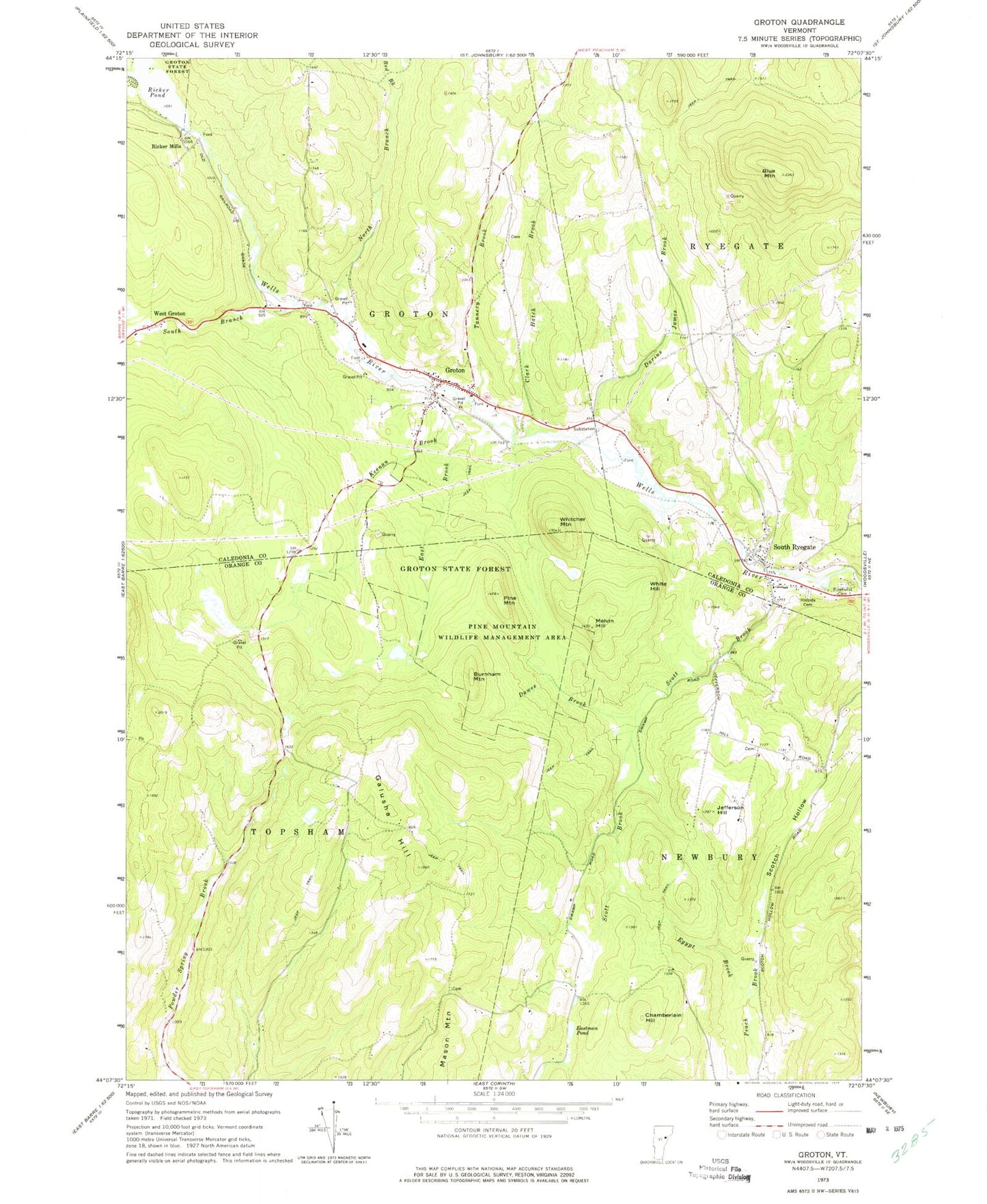
Classic USGS Groton Vermont 7.5'x7.5' Topo Map
Couldn't load pickup availability
Historical USGS topographic quad map of Groton in the state of Vermont. Typical map scale is 1:24,000, but may vary for certain years, if available. Print size: 24" x 27"
This quadrangle is in the following counties: Caledonia, Orange.
The map contains contour lines, roads, rivers, towns, and lakes. Printed on high-quality waterproof paper with UV fade-resistant inks, and shipped rolled.
Contains the following named places: Blue Mountain, Burnham Mountain, Clark Hatch Brook, Darius James Brook, Dawes Brook, East Brook, Eastman Pond, Egypt Brook, Galusha Hill, Groton, Hillside Cemetery, Jefferson Hill, Keenan Brook, Mason Mountain, Melvin Hill, North Branch Wells River, Pine Mountain Wildlife Management Area, Pine Mountains, Pinehurst Cemetery, Powder Spring Brook, Red Brook, Ricker Mills, Ricker Pond, Scotch Hollow, Scott Brook, South Branch Wells River, South Ryegate, Tannery Brook, West Groton, Whitcher Mountain, White Hill, Town of Topsham, Norwich Reservoir Dam, Norwich Reservoir, Clark Site Number 2 Dam, Bonazzi Quarry, First Baptist Church, Gibson Granite Quarry, Groton Post Office, Groton Village Cemetery, Heath Cemetery, North Ryegate Cemetery, Ryegate Quarry, School Number 3 (historical), South Groton School (historical), South Ryegate Post Office, South Ryegate Presbyterian Church, South Ryegate Public Library, Huckins - Caldwell Hill Cemetery, Jefferson Hill Cemetery, Lime Kiln Cemetery, Lime Kiln School (historical), Newbury Municipal Forest, Round Top Cemetery, Groton Volunteer Fire Department, Groton - Ryegate Emergency Medical Services, Groton Census Designated Place, Groton Constable