MyTopo
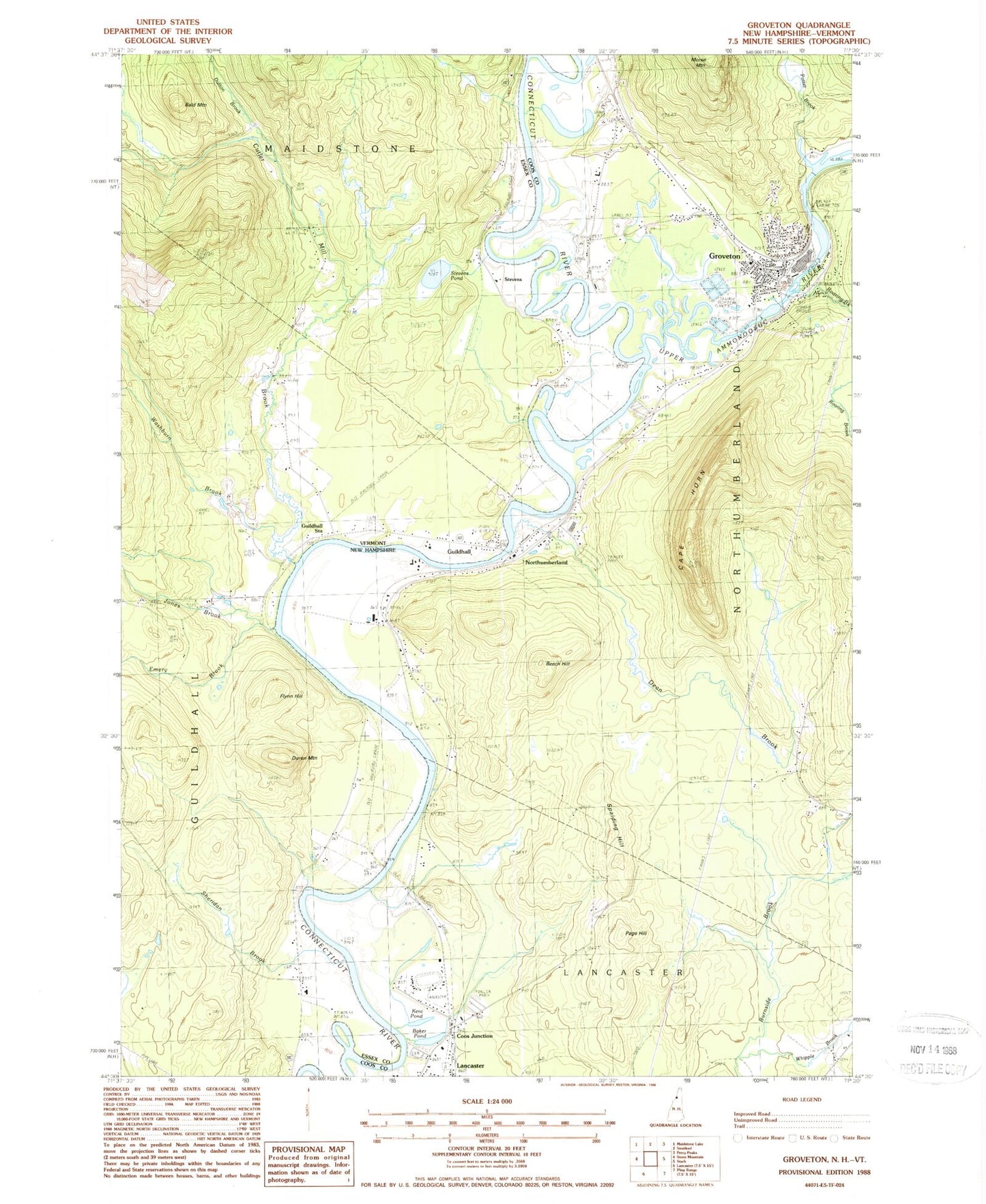
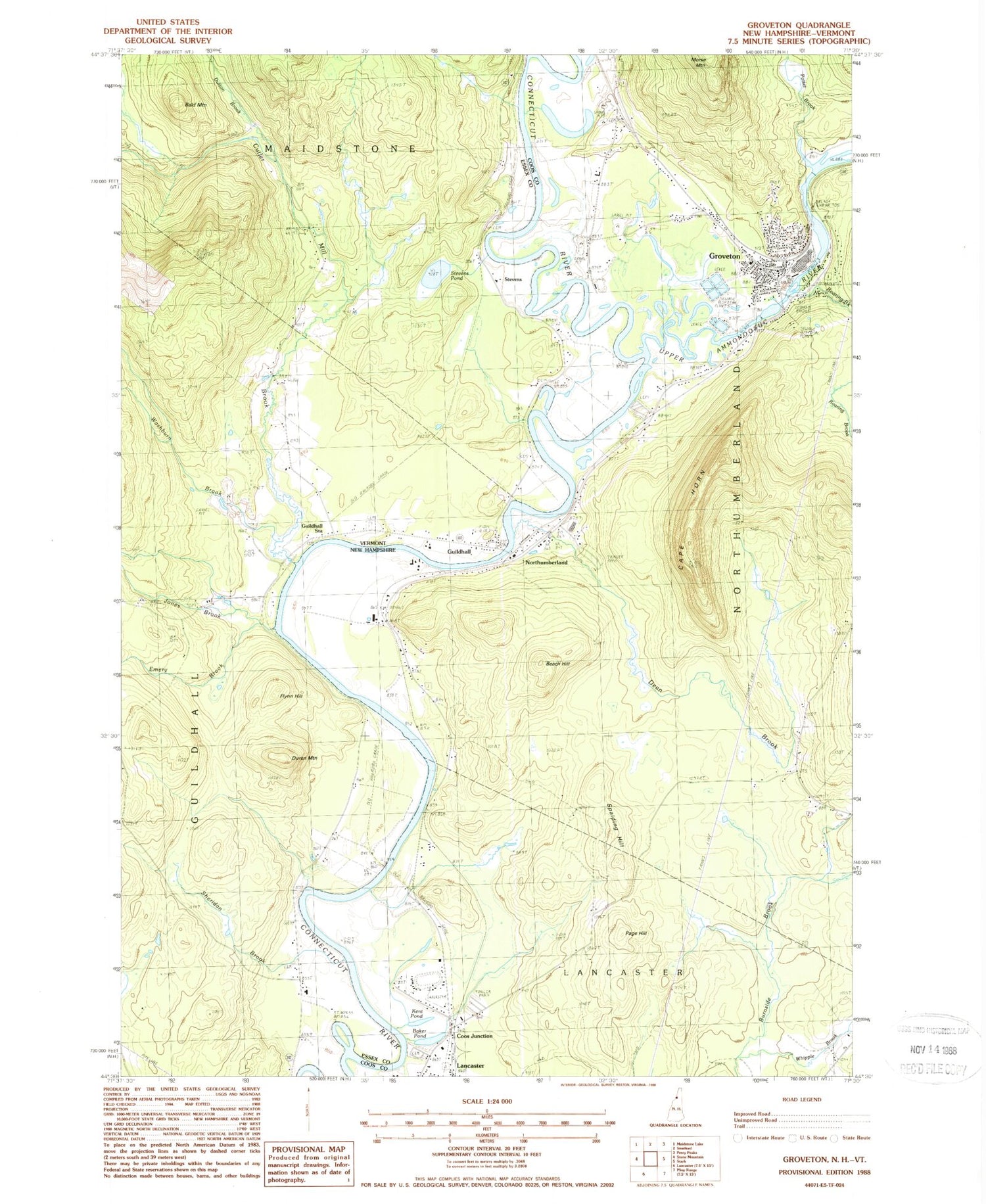
Classic USGS Groveton New Hampshire 7.5'x7.5' Topo Map
Couldn't load pickup availability
Historical USGS topographic quad map of Groveton in the states of New Hampshire, Vermont. Map scale may vary for some years, but is generally around 1:24,000. Print size is approximately 24" x 27"
This quadrangle is in the following counties: Coos, Essex.
The map contains contour lines, roads, rivers, towns, and lakes. Printed on high-quality waterproof paper with UV fade-resistant inks, and shipped rolled.
Contains the following named places: Baker Pond, Bald Mountain, Beech Hill, Cape Horn, Central School, Connecticut Groveton Dam, Connecticut River Reservoir, Coos Junction, Court House Hill Cemetery, Cutler Mill Brook, Dean Brook, Duren Mountain, Dutton Brook, Eames Wayside Area, Emery Brook, Essex County Courthouse, Flynn Hill, Groveton, Groveton Ambulance Service, Groveton Bridge, Groveton Census Designated Place, Groveton Elementary School, Groveton Fire and Rescue, Groveton High School, Groveton Middle School, Groveton Post Office, Guildhall, Guildhall Elementary School, Guildhall Post Office, Guildhall Square, Guildhall Station, Guildhall Village Historic District, Jones Brook, Keith - Crawford - North Burial Ground, Kent Pond, Lancaster Heliport, Lower Groveton Dam, Moore Brook, North Country Charter Academy Lancaster Center, Northumberland, Northumberland Police Department, Northumberland Public Library, Northumberland Shopping Center, Page Hill, Parks Brook, Potter Brook, Rich Cemetery, Ridgewell - Central Cemetery, Riverside - Smart - Fellows - South Cemetery, Roaring Brook, Saint Francis Xavier Church, Sheridan Brook, Spalding Hill, Stevens, Stevens - McDade Cemetery, Stevens Pond, Town of Northumberland, Upper Ammonoosuc Dam, Upper Ammonoosuc River, Upper Groveton Dam, Washburn Brook, Webb Cemetery, Whipple Brook