MyTopo
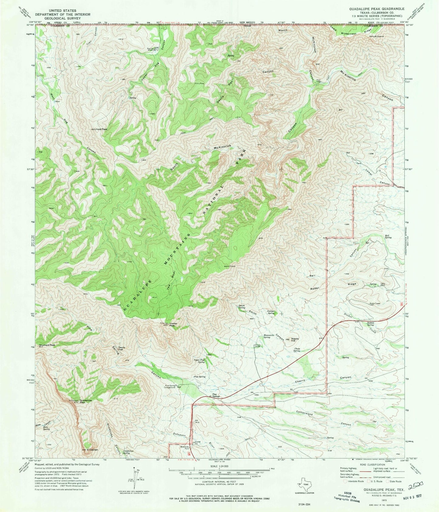
USGS Classic Guadalupe Peak Texas 7.5'x7.5' Topo Map
Couldn't load pickup availability
Historical USGS topographic quad map of Guadalupe Peakin the states of Texas, New Mexico. Scale: 1:24000. Print size: 24" x 27"
This quadrangle is in the following counties: Culberson.
The map contains contour lines, roads, rivers, towns, lakes, and grids including latitude / longitude and UTM / MGRS. Printed on high-quality waterproof paper with UV fade-resistant inks.
Contains the following named places: North McKittrick Canyon, Guadalupe Mountains, McKittrick Canyon, Bell Spring, Bone Spring, Choza Spring, Devils Den Canyon, Devils Hall, Dog Canyon Ranger Station, El Capitan, Frijole Ranch, Guadalupe Peak, Guadalupe Spring, Hunter Peak, Juniper Spring, Ligon Ranch, Lost Peak, Manzanita Spring, Nipple Hill, Pine Spring, Pine Spring Campground, Pine Spring Canyon, Wallace Pratt Lodge, Rader Ridge, Shumard Peak, Smith Canyon, Smith Spring, Soldier Spring, South McKittrick Canyon, The Bowl, Upper Pine Spring, Pine Springs, Pine Springs, Pinery Station, Guadalupe Ranch, Bowl Trail, Wilderness Ridge - Shumard Trail, Tejas Trail, Marcus Trail, Frijole (historical), Pinery (historical), Guadalupe Mountains Wilderness, Guadalupe Mountains National Park Fire Department, Tejas Arch, Pratt Arch, North McKittrick Canyon, Guadalupe Mountains, Guadalupe Mountains Wilderness