MyTopo
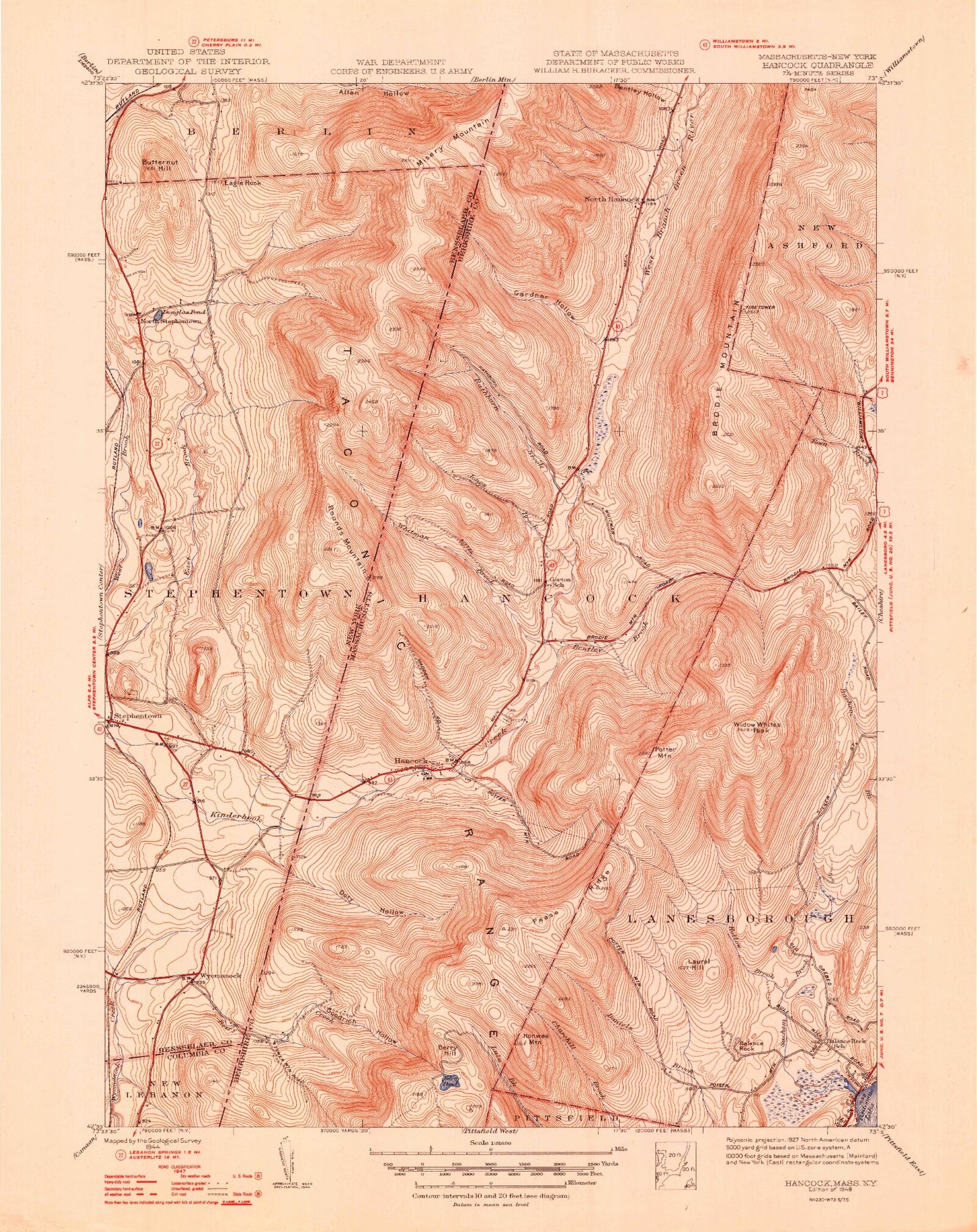
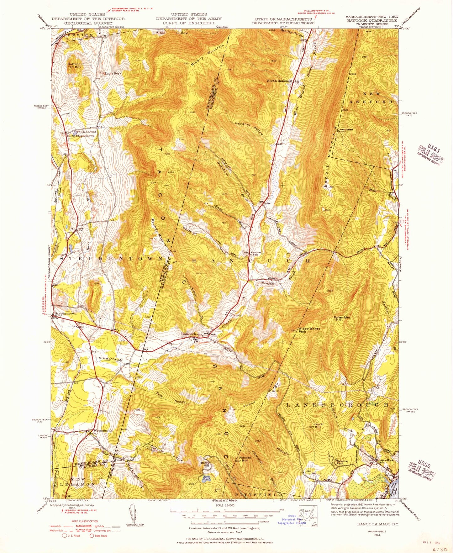
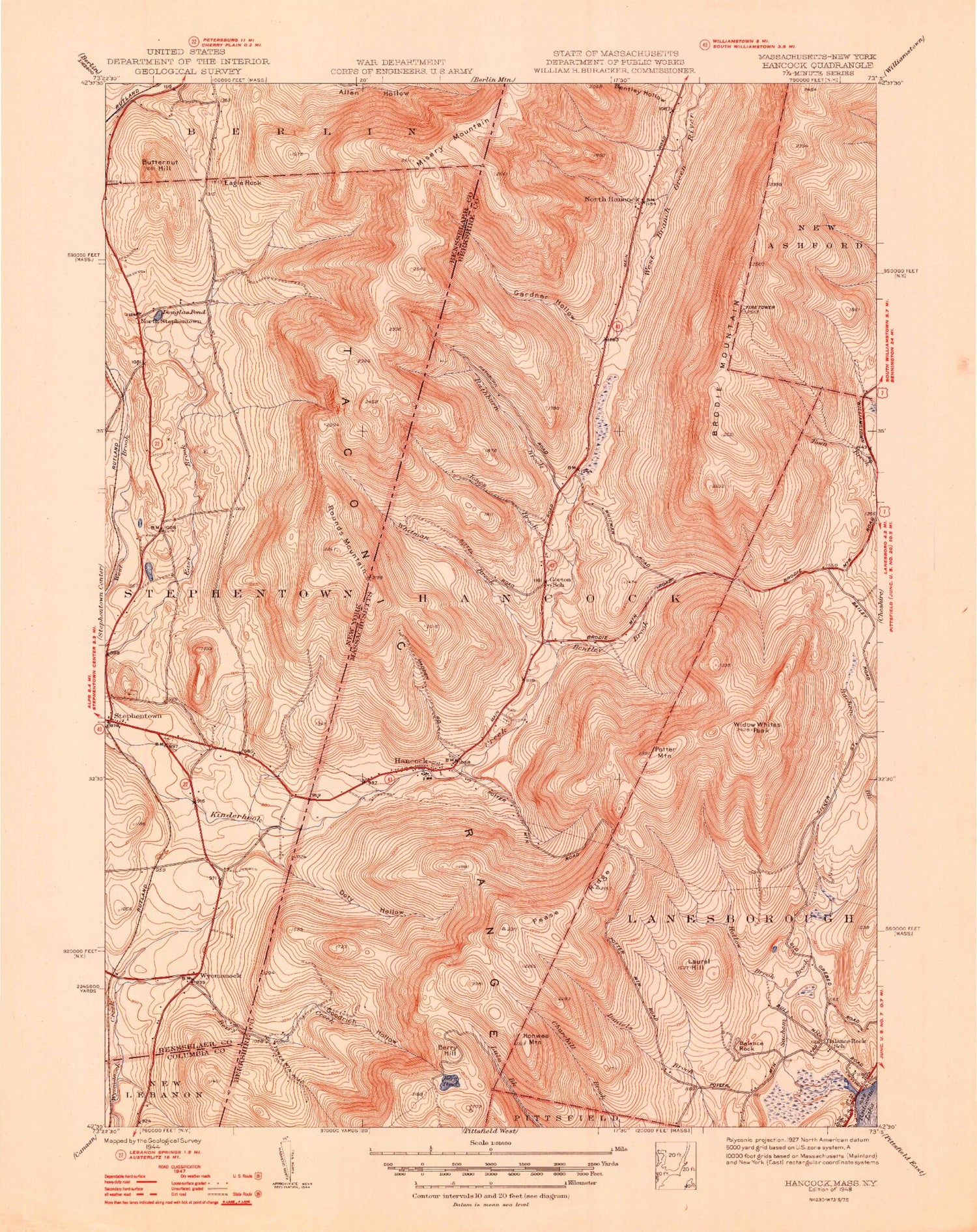
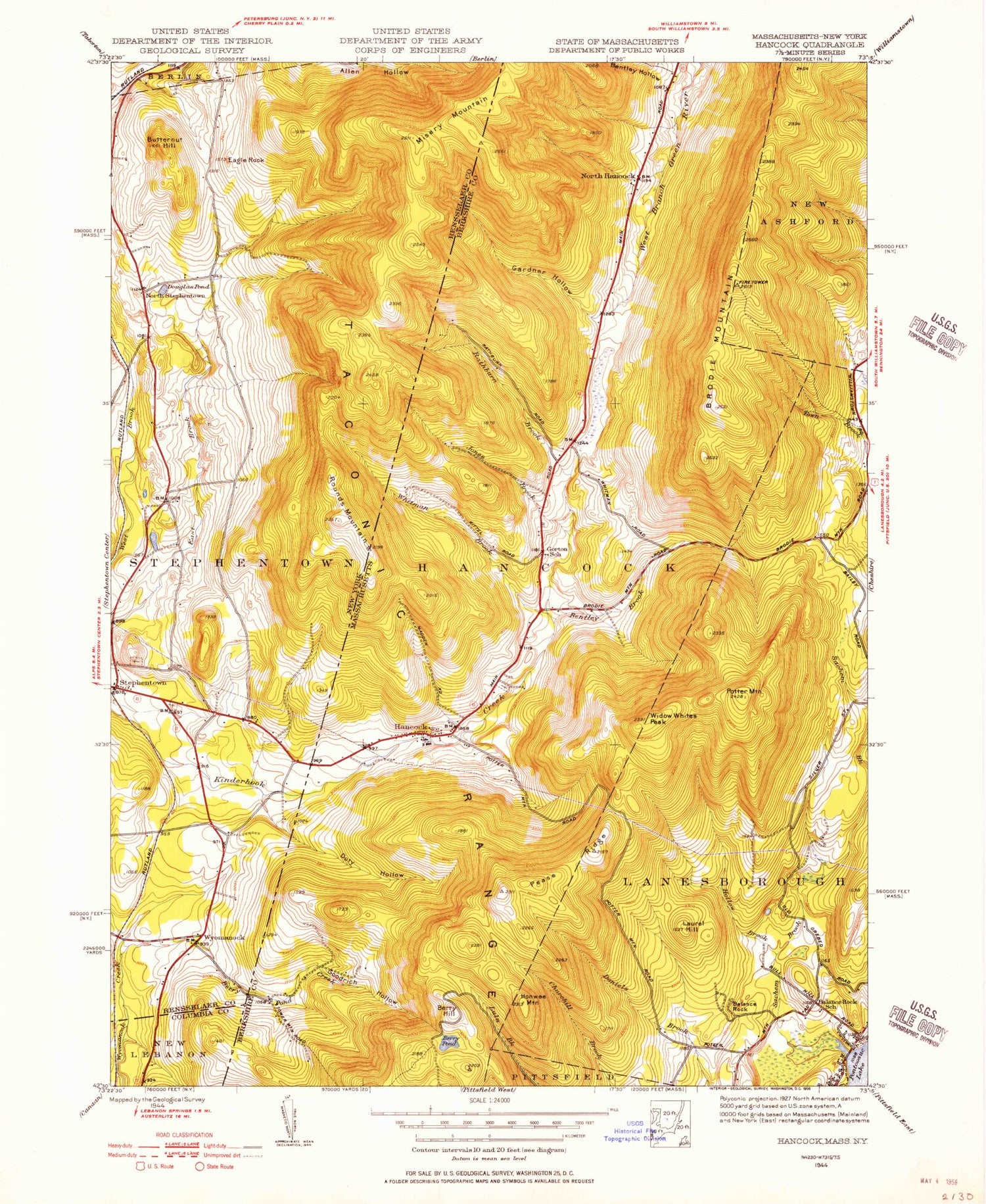
Classic USGS Hancock Massachusetts 7.5'x7.5' Topo Map
Couldn't load pickup availability
Historical USGS topographic quad map of Hancock in the states of Massachusetts, New York. Typical map scale is 1:24,000, but may vary for certain years, if available. Print size: 24" x 27"
This quadrangle is in the following counties: Berkshire, Columbia, Rensselaer.
The map contains contour lines, roads, rivers, towns, and lakes. Printed on high-quality waterproof paper with UV fade-resistant inks, and shipped rolled.
Contains the following named places: Hancock Cemetery, Balance Rock State Park, Hancock Central School, Forbush Wildlife Sanctuary, Jiminy Peak Ski Area, Brodie Mountain Ski Area, East Mountain, Beoadic Mountain, Gardner Cemetery, Hancock, Appletree Hill, Bentley Brook, Bentley Hollow, Berry Hill, Berry Mountain, Berry Pond, Berry Pond Creek, Brodie Mountain, Gardner Hollow, Hollow Brook, Honwee Mountain, Jones Brook, Laurel Hill, North Hancock, Pease Ridge, The Pinnacle, Potter Mountain, Rathburn Brook, Secum Brook, Sheeps Heaven Mountain, Whitman Brook, Widow Whites Peak, Red Oak Brook, Jiminy Peak, Town of Hancock, Goodrich Hollow, Hancock Post Office, Hancock Town Hall, Hancock Fire Department Station 1 Headquarters, Hancock Police Department, Doty Hollow, Rounds Mountain, Butternut Hill, Douglas Pond, Eagle Rock, Griswold Pond, North Stephentown, Robinson Hollow, Saint Josephs Cemetery, Stephentown, Wyomanock, Chuckleberry Mobile Home Park, Sugar Bush Farm, Stone Wall Hill Farm, Evangelical Community Church, Stephentown Fire District 1, Stephentown Post Office