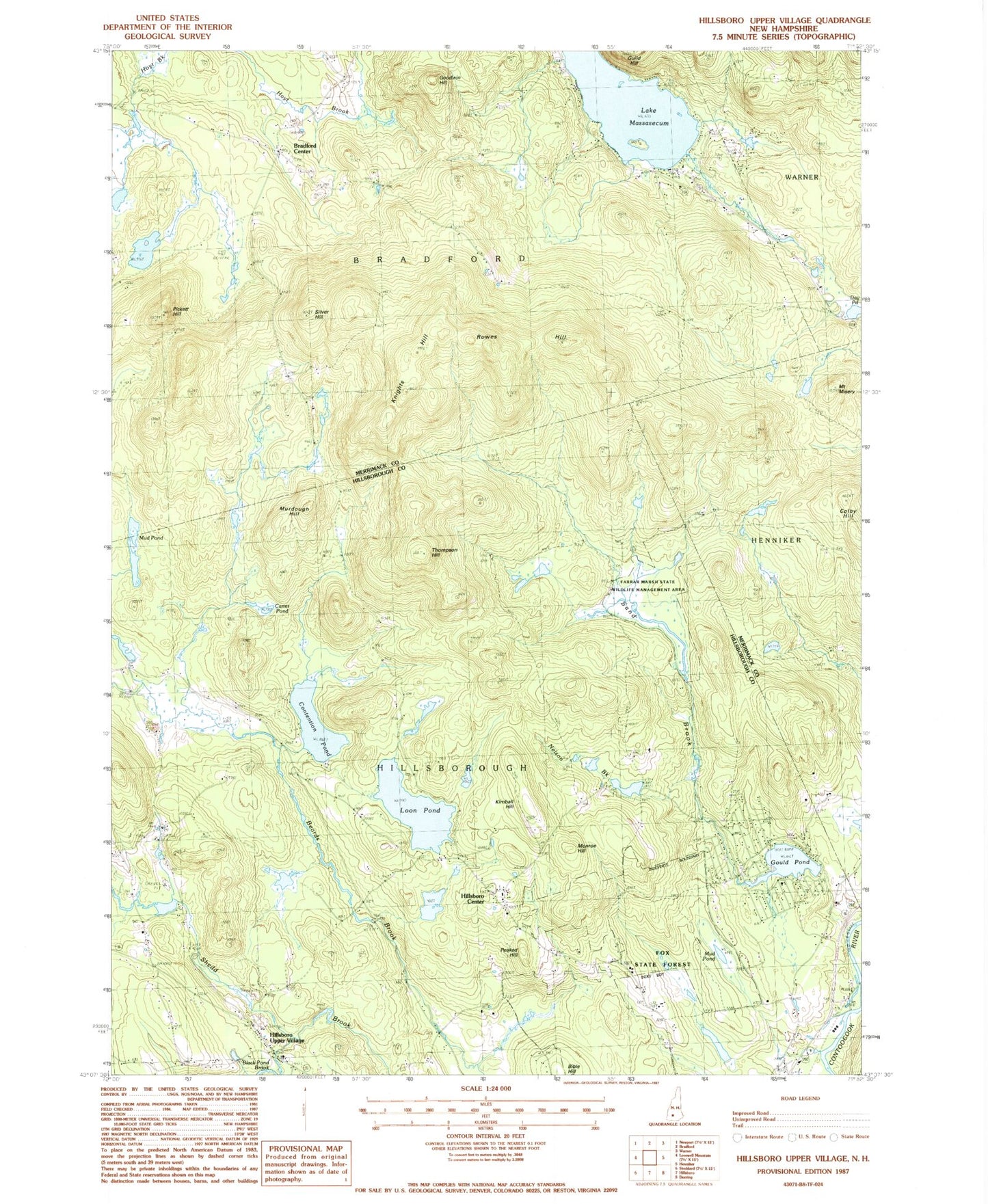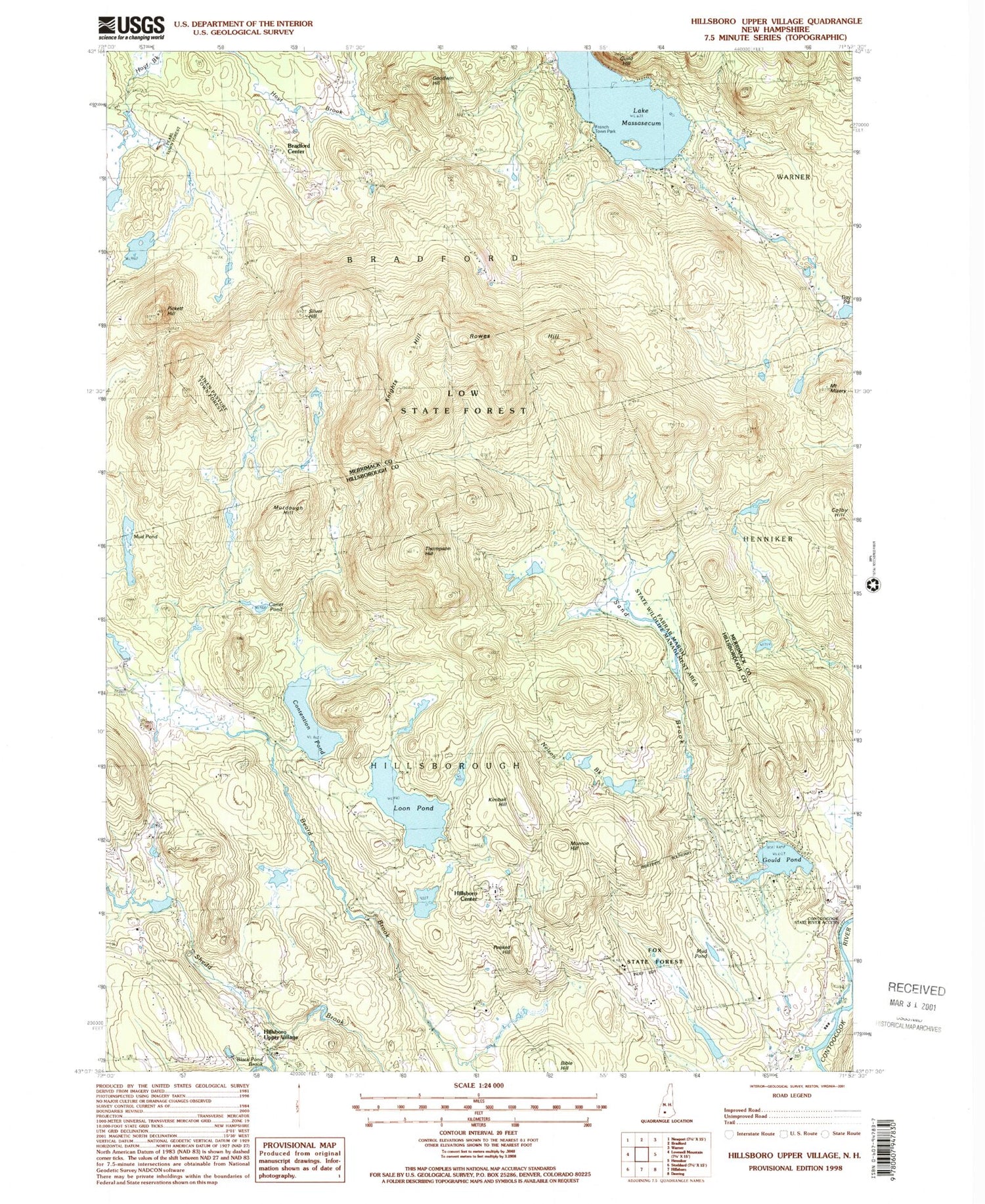
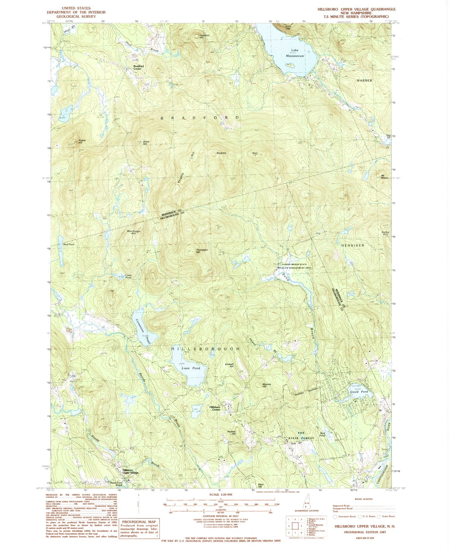
MyTopo
Classic USGS Hillsboro Upper Village New Hampshire 7.5'x7.5' Topo Map
Couldn't load pickup availability
Historical USGS topographic quad map of Hillsboro Upper Village in the state of New Hampshire. Typical map scale is 1:24,000, but may vary for certain years, if available. Print size: 24" x 27"
This quadrangle is in the following counties: Hillsborough, Merrimack.
The map contains contour lines, roads, rivers, towns, and lakes. Printed on high-quality waterproof paper with UV fade-resistant inks, and shipped rolled.
Contains the following named places: Black Pond Brook, Bradford Center, Carter Pond, Colby Hill, Contention Pond, Coolidge Cemetery, Day Pond, Farrar Cemetery, Fox State Forest, Gerry Cemetery, Goodwin Hill, Gould Pond, Guild Hill, Hillsboro Camp, Hillsboro Center, Hillsboro Upper Village, Kimball Corner Cemetery, Kimball Hill, Knights Hill, Loon Pond, Lake Massasecum, Mount Misery, Monroe Hill, Mud Pond, Mud Pond, Munroe Cemetery, Murdough Hill, Nelson Brook, Peaked Hill, Pickett Hill, Pond Cemetery, Presbury Cemetery, Rowes Hill, Sand Brook, Silver Hill, Thompson Hill, Town of Bradford, Town of Hillsborough, Lake Franklin Pierce Dam, Sand Brook Marsh Dam, Sand Brook Marsh, Farrar Marsh State Wildlife Management Area, First Meeting House, Bradford Center Cemetery, Bradford Congregational Church