
MyTopo
Classic USGS Hillsboro New Hampshire 7.5'x7.5' Topo Map
Couldn't load pickup availability
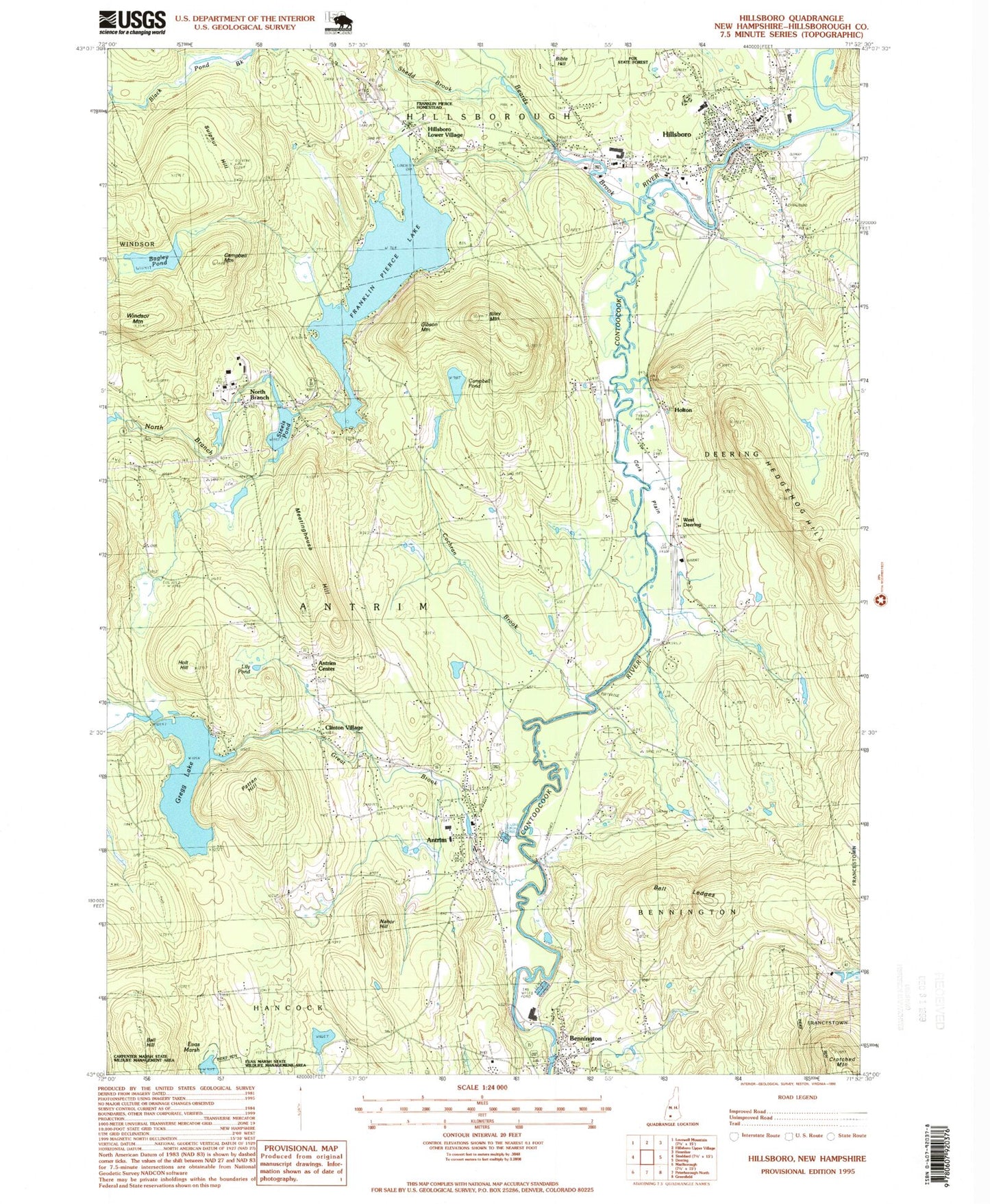
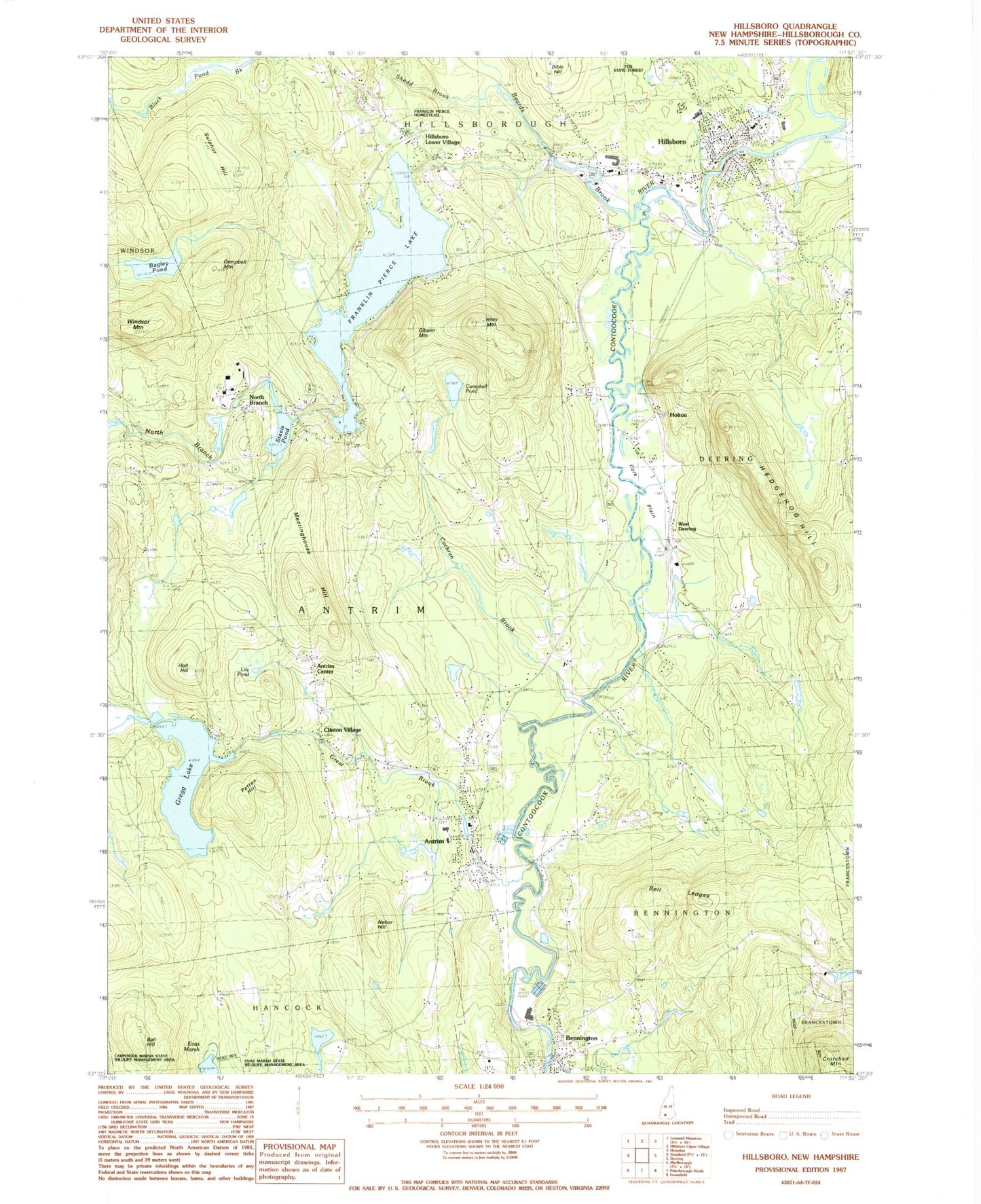
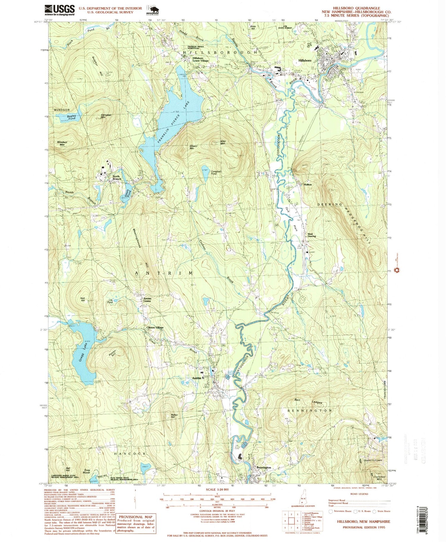
Historical USGS topographic quad map of Hillsboro in the state of New Hampshire. Typical map scale is 1:24,000, but may vary for certain years, if available. Print size: 24" x 27"
This quadrangle is in the following counties: Hillsborough.
The map contains contour lines, roads, rivers, towns, and lakes. Printed on high-quality waterproof paper with UV fade-resistant inks, and shipped rolled.
Contains the following named places: Antrim, Antrim Center, Appleton Cemetery, Bagley Pond, Ball Hill, Beard Brook, Bell Ledges, Bennington, Bible Hill, Birchmere Camp, Butler Cemetery, Camp Sachem, Campbell Mountain, Campbell Pond, Clinton Village, Cochran Brook, Corkplain, Franklin Pierce Lake, Gibson Mountain, Great Brook, Gregg Lake, Hedgehog Hill, Hillsboro, Hillsboro Lower Village, Holt Hill, Holton, Lily Pond, Maple Avenue Cemetery, Maplewood Cemetery, Meetinghouse Hill, Mount Calvary Cemetery, Nahor Hill, North Branch, North Branch River, Patten Hill, Pine Hill Cemetery, Preston Cemetery, Riley Mountain, Saint Mary Cemetery, Shedd Brook, Steels Pond, Sulphur Hill, West Deering, WRCI-FM (Hillsboro), Hawthorne-Feather Airpark, Town of Antrim, Town of Bennington, Steel Pond Dam, Gregg Lake Dam, Campbell Pond Dam, Monadnock Power Station Dam, Pierce Power Dam, Paper Mill Dam, Angus Lea Golf Course, Antrim Elementary School, Antrim Post Office, Antrim Station, Bennington Congregational Church, Bennington Country Store Post Office, Contoocook Mills Industrial Site (historical), Evas Marsh, Great Bridge, Great Brook School, Hillsborough Post Office, Hillsboro United Methodist Church, Hillsboro - Deering Elementary School, Hillsboro - Deering Middle School, Hillsboro - Deering High School, Hillsboro-Deering Railroad Covered Bridge, Hillsboro Chamber of Commerce, Hillsborough Town Offices, Oxbow Campground, Saint Marys Catholic Church, Antrim Census Designated Place, Hillsborough Census Designated Place, Pierce Elementary School, Antrim Girls Shelter School, Hillsborough Fire Department, Deering Fire and Rescue McCallister Station, Bennington Fire and Rescue, Antrim Fire Department Station 2, Deering Fire and Rescue Murdough Station, Antrim Fire Department Station Headquarters and Emergency Medical Services, Bennington Census Designated Place, Antrim Police Department, Bennington Police Dept, Hillsborough Police Department, Sunnyside Cemetery, Evergreen Cemetery