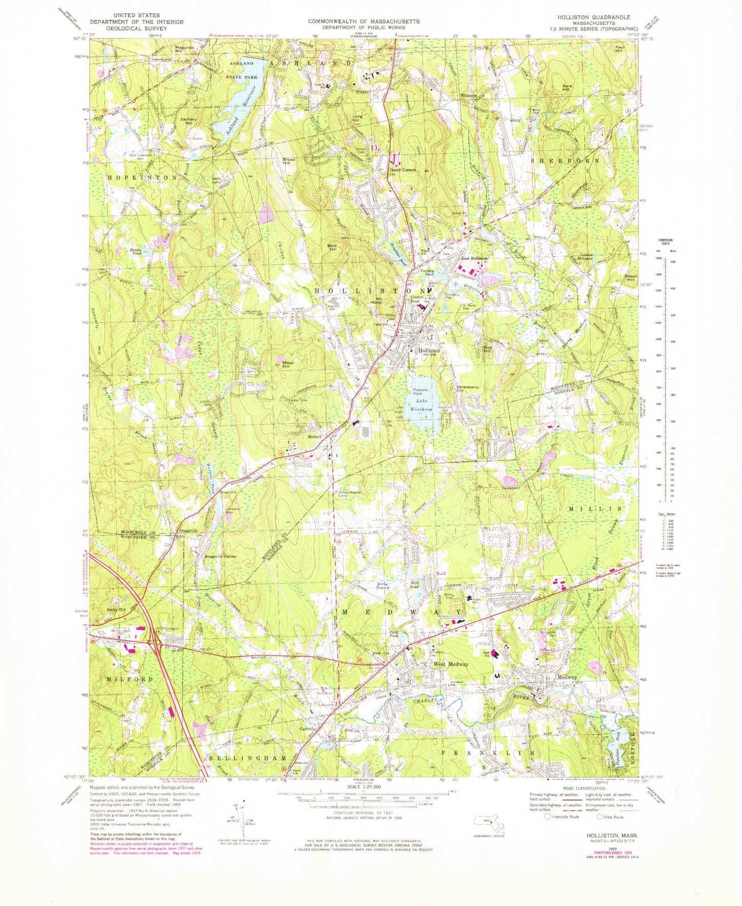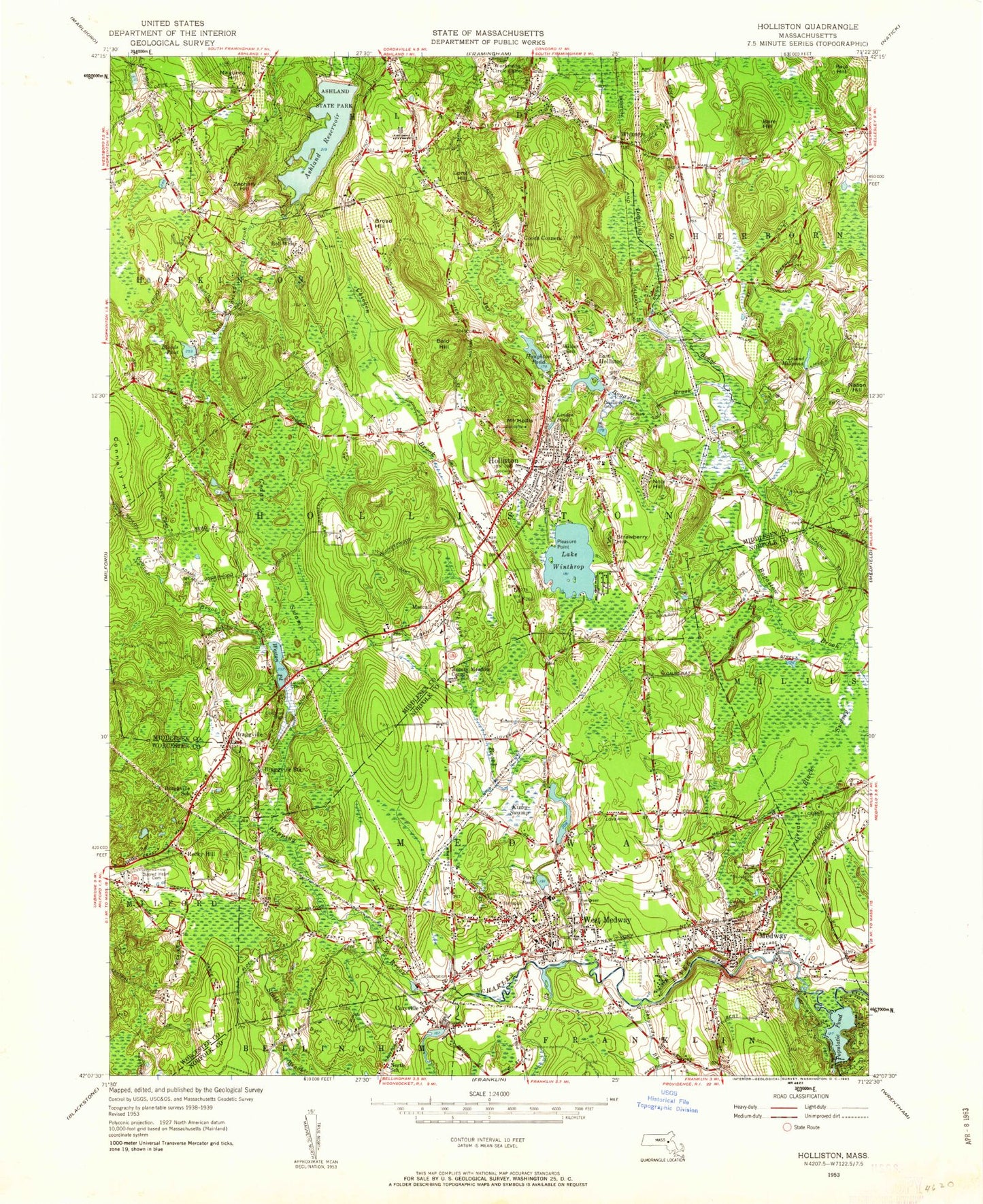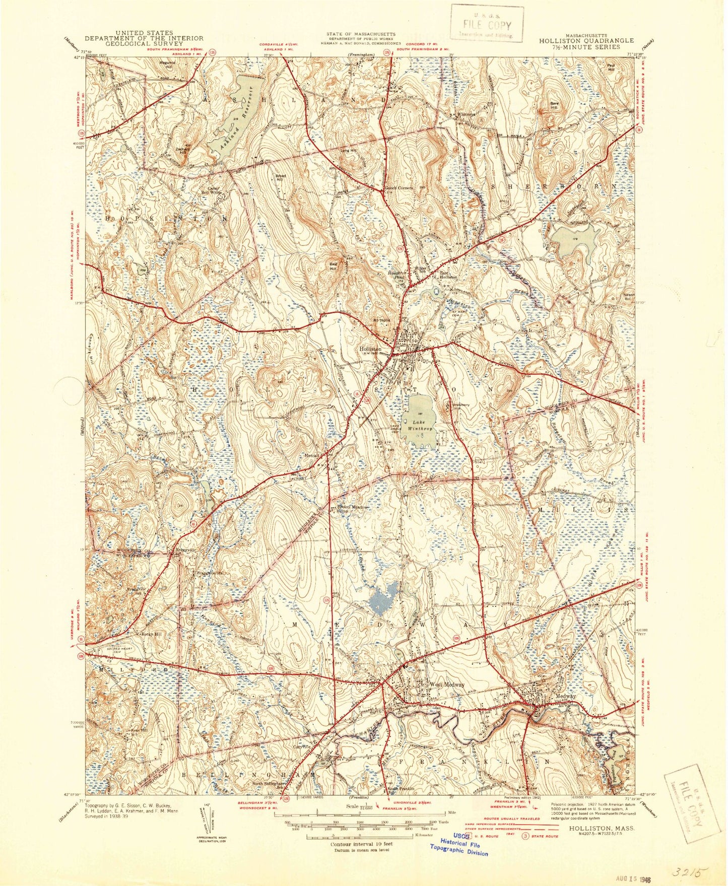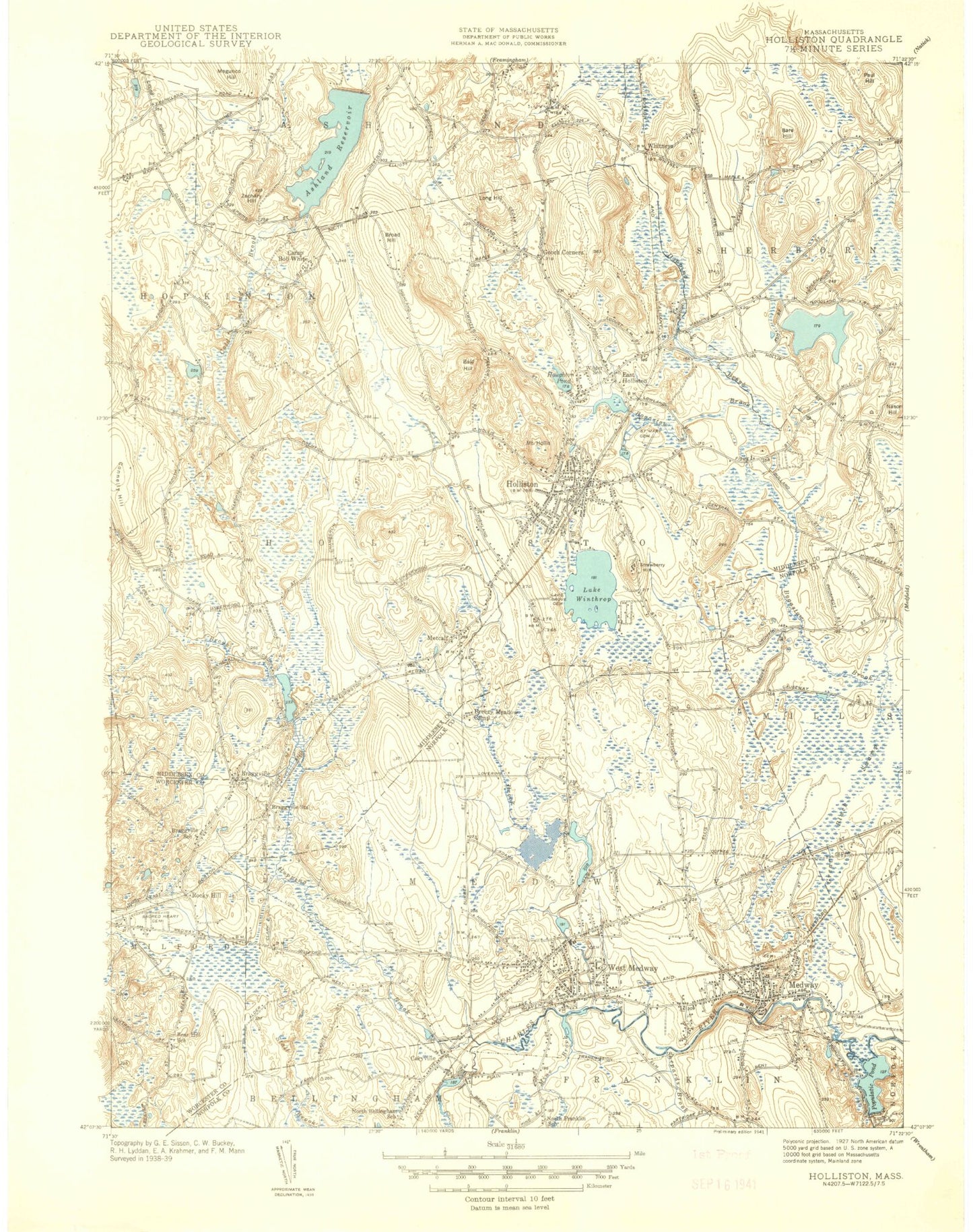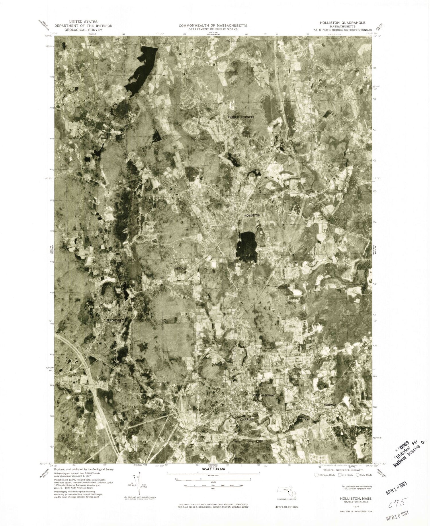

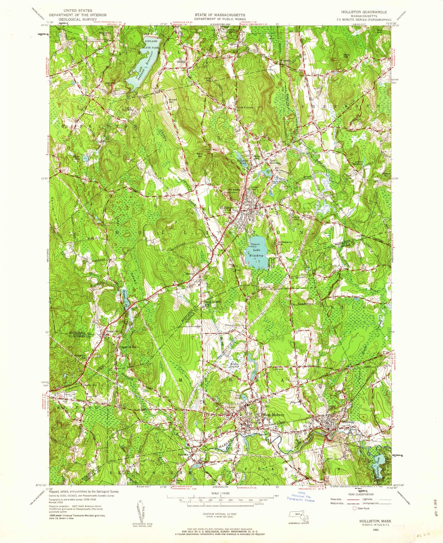
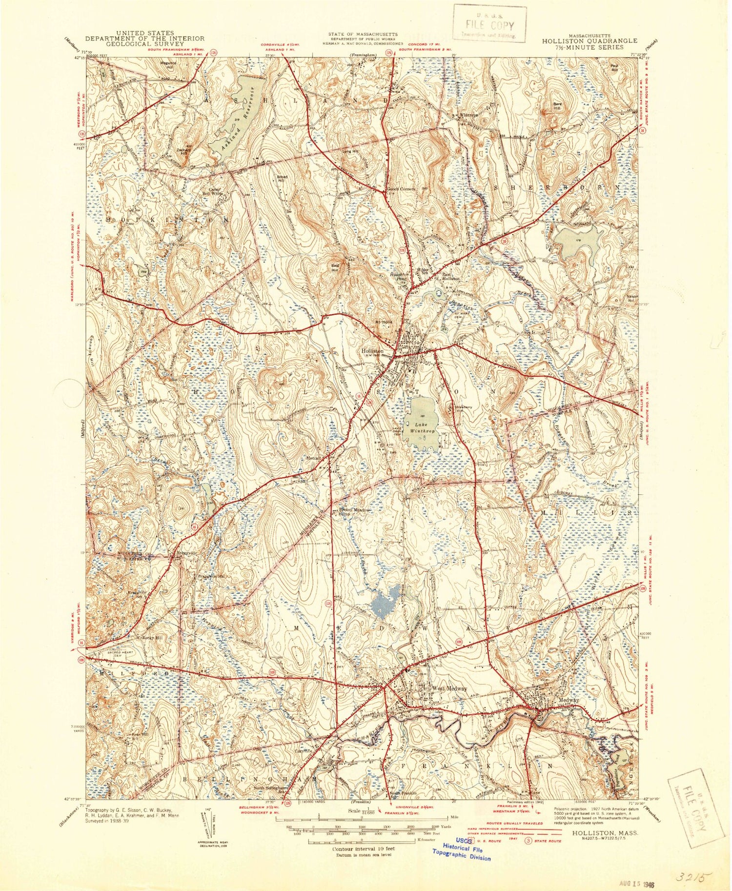
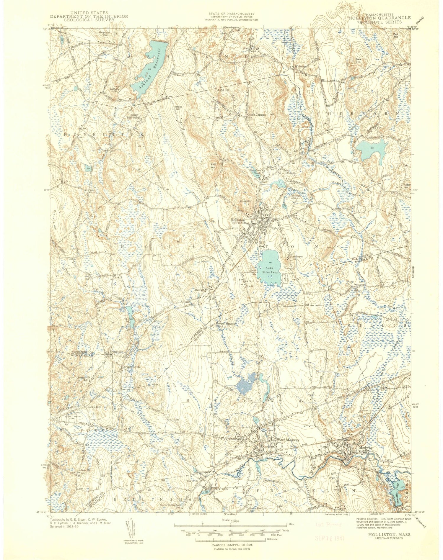
MyTopo
Classic USGS Holliston Massachusetts 7.5'x7.5' Topo Map
Couldn't load pickup availability
Historical USGS topographic quad map of Holliston in the state of Massachusetts. Typical map scale is 1:24,000, but may vary for certain years, if available. Print size: 24" x 27"
This quadrangle is in the following counties: Middlesex, Norfolk, Worcester.
The map contains contour lines, roads, rivers, towns, and lakes. Printed on high-quality waterproof paper with UV fade-resistant inks, and shipped rolled.
Contains the following named places: Caryville, Lincoln Cemetery, Breezy Meadow Camp, Oakland Cemetery, Sacred Heart Cemetery, Bragg Cemetery, East Hopkinton Cemetery, Fruit Street School, Holliston Junior High School, Wilder School, Cutler School, Holliston Center Cemetery, Holliston High School, Indian Cemetery, Saint Marys Cemetery, Miller School, Stoddard Park, Lake Grove Cemetery, West Burying Ground, John D McGovern Elementary School, Evergreen Cemetery, Anderson School, Medway School, Saint Josephs Cemetery, Medway Station (historical), Lily Pond (historical), West Medway Station (historical), Caryville Station (historical), Russells Shopping Center, Medway Shopping Center, Roaring Brook Pond, Roaring Brook Pond Dam, Sanford Mill Dam, Sanford Mill Pond, West Medway Dam, Charles River Reservoir, Houghton Pond Dam, Bogastere Swamp, Dapping Brook Swamp, Deer Brook, Dirty Meadow Swamp, Dirty Meadow Hill, Ashland State Park, College Rock, Ashland Reservoir, Bald Hill, Bare Hill, Beaver Brook, Bloods Pond, Camp Bob White, Braggville, Braggville Station, Camp Breezy Meadow, Broad Hill, Cedar Swamp, Chicken Brook, Connelly Hill, Dirty Meadow Brook, Dopping Brook, East Holliston, Factory Pond, Gooch Corners, Great Black Swamp, Mount Hollis, Holliston, Hopping Brook, Houghton Pond, Jar Brook, Kirby Swamp, Leland Millpond, Linden Pond, Long Hill, Medway, Metcalf, Milk Pond, Miller Hill, Mine Brook, Nason Hill, Nob Hill, Park Pond, Paul Hill, Pleasure Point, Populatic Pond, Rocky Hill, Strawberry Hill, West Medway, Weston Pond, Whitneys, Lake Winthrop, Winthrop Canal, Workmans Circle Camp, Zachary Hill, Vine Brook, Town of Holliston, Town of Sherborn, Medway Post Office (historical), Caryville Post Office (historical), Mellen Street Heliport, High School Heliport, Waters Associates Heliport, Davna Corporation Heliport, Nason Hill Heliport, Bellingham School, Shepards Brook, Town of Medway, WBIV-AM (Natick), WLVG-AM (Needham), WBMA-AM (Sherborn), WHHB-FM (Holliston), WHHB-FM (Holliston), Andrews School, Christ Episcopal Church, Christ the King Lutheran Church, Community Church, First Baptist Church, First Congregational Church, Francis J Burke Elementary School, Henry E Warren Elementary School, Holliston Middle School, Holliston Post Office, Holliston Public Library, Medway High School, Medway Post Office, New Englander Industrial Park, Northeastern University Warren Center, Rabbit Hil Historic District, Saint Marys Church, Saint Michaels Church, Shaws Townline Plaza Shopping Center, Center Cemetery, Saint Brendans Parish Center, Medway High-Middle School Library Media Center, Placentino Elementary School, Robert H Adams Middle School, Holliston High School Library, Arcadian Farms, Fairmount Fruit Farm, Highland Farm, Milford Fire Department Station 2 Headquarters, Medway Fire Department Station 1 - Headquarters, Medway Fire Department Station 2, Holliston Fire Department Station 1 Headquarters, Holliston Fire Department Station 2, Holliston Fire Department Station 4, Holliston Fire Department Station 3, Holliston Fire Department Station 4B, MetroWest Emergency Medical Services, Events EMS MEDWAY, Ashland Quarry, Holliston Police Department, Medway Police Department, Medway Village Post Office, Caryville, Lincoln Cemetery, Breezy Meadow Camp, Oakland Cemetery, Sacred Heart Cemetery, Bragg Cemetery, East Hopkinton Cemetery, Fruit Street School, Holliston Junior High School, Wilder School, Cutler School, Holliston Center Cemetery, Holliston High School, Indian Cemetery, Saint Marys Cemetery, Miller School, Stoddard Park, Lake Grove Cemetery, West Burying Ground, John D McGovern Elementary School, Evergreen Cemetery, Anderson School, Medway School, Saint Josephs Cemetery, Medway Station (historical), Lily Pond (historical), West Medway Station (historical), Caryville Station (historical), Russells Shopping Center, Medway Shopping Center, Roaring Brook Pond, Roaring Brook Pond Dam, Sanford Mill Dam, Sanford Mill Pond, West Medway Dam, Charles River Reservoir, Houghton Pond Dam, Bogastere Swamp, Dapping Brook Swamp, Deer Brook, Dirty Meadow Swamp, Dirty Meadow Hill, Ashland State Park, College Rock, Ashland Reservoir, Bald Hill, Bare Hill, Beaver Brook, Bloods Pond, Camp Bob White, Braggville, Braggville Station, Camp Breezy Meadow, Broad Hill, Cedar Swamp, Chicken Brook, Connelly Hill, Dirty Meadow Brook, Dopping Brook, East Holliston, Factory Pond, Gooch Corners, Great Black Swamp, Mount Hollis, Holliston, Hopping Brook, Houghton Pond, Jar Brook, Kirby Swamp, Leland Millpond, Linden Pond, Long Hill, Medway, Metcalf, Milk Pond, Miller Hill, Mine Brook, Nason Hill, Nob Hill, Park Pond, Paul Hill, Pleasure Point, Populatic Pond, Rocky Hill