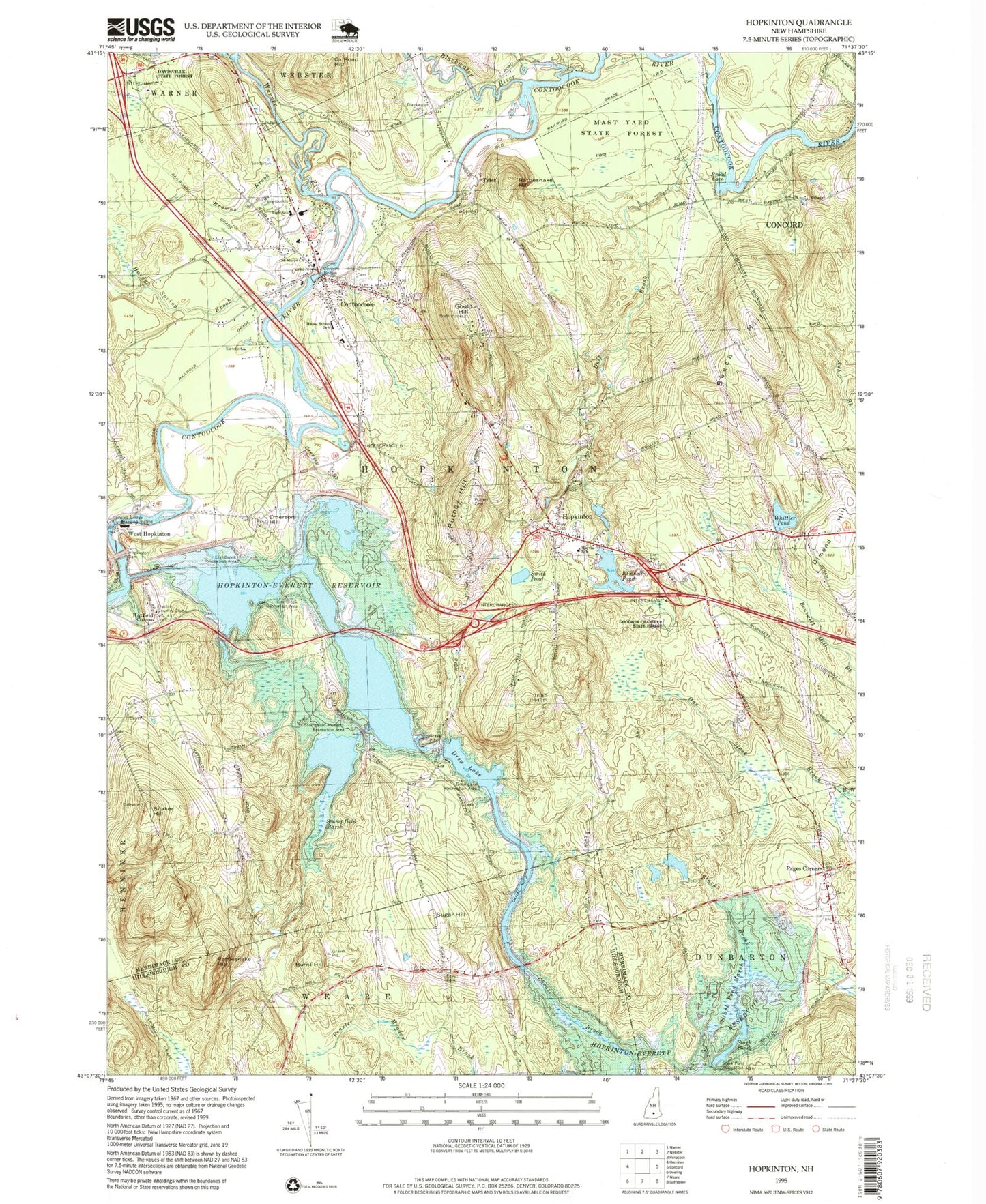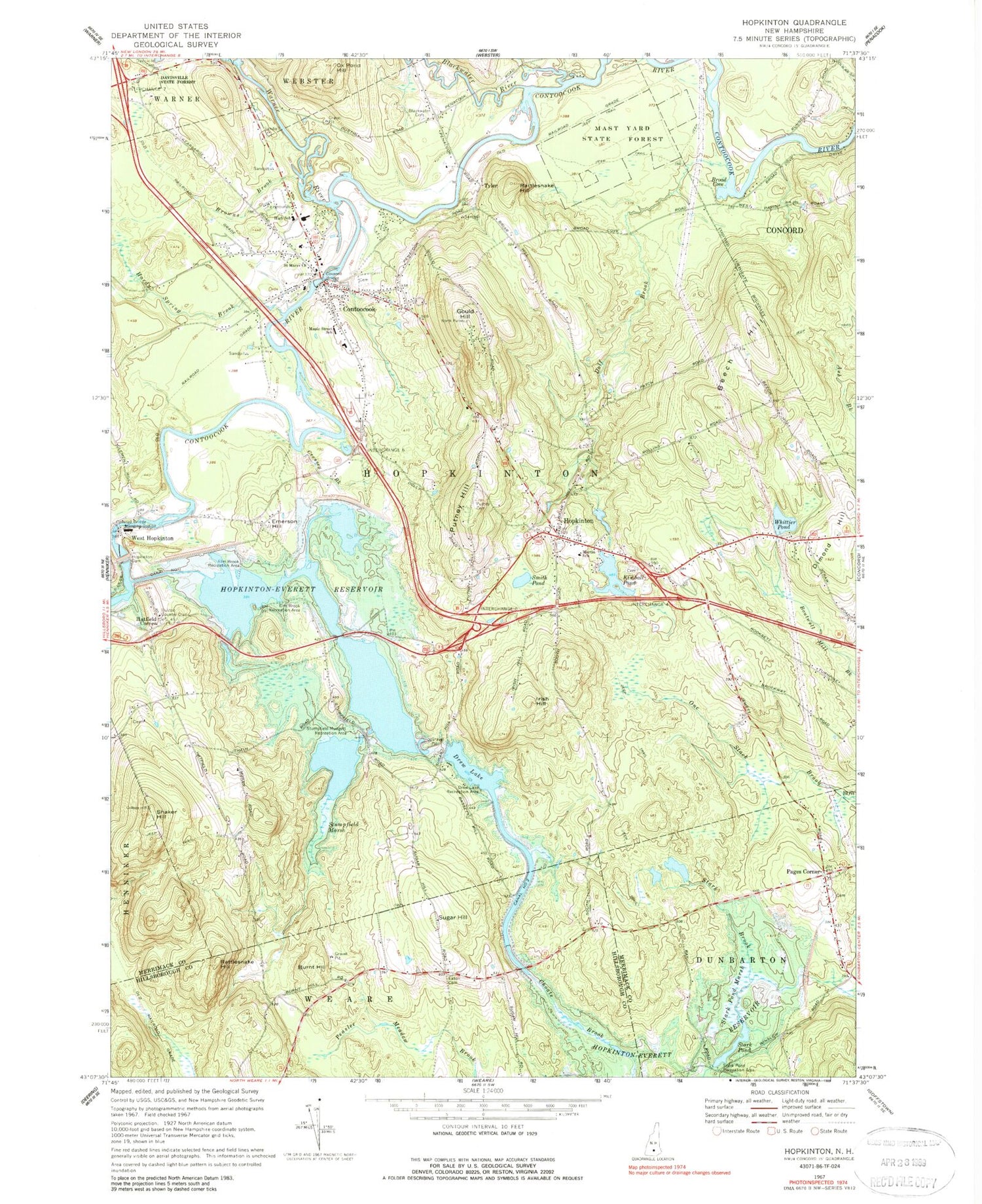
MyTopo
Classic USGS Hopkinton New Hampshire 7.5'x7.5' Topo Map
Couldn't load pickup availability
Historical USGS topographic quad map of Hopkinton in the state of New Hampshire. Map scale may vary for some years, but is generally around 1:24,000. Print size is approximately 24" x 27"
This quadrangle is in the following counties: Hillsborough, Merrimack.
The map contains contour lines, roads, rivers, towns, and lakes. Printed on high-quality waterproof paper with UV fade-resistant inks, and shipped rolled.
Contains the following named places: Bates Library, Beech Hill, Blackwater Cemetery, Blackwater River, Broad Cove, Browns Brook, Burnt Hill, Canal Number One, Canal Number Two, Contoocook, Contoocook Census Designated Place, Contoocook Covered Bridge, Contoocook Post Office, Contoocook River Reservoir, Contoocook Village Cemetery, Contoocook Village Dam, Cressey Brook, Davisville Cemetery, Davisville State Forest, Deer Meadow Brook, Dimond Hill, Dolf Brook, Drew Lake, Drew Lake Dam, Drew Lake Recreation Area, Duston Country Club, Eaton Cemetery, Elm Brook Marsh, Elm Brook Recreation Area, Emerson Hill, First Congregational Church, Gould Hill, Gould Hill Orchards, Hardy Spring Brook, Harold Martin School, Hatfield Corner, Hoague-Sprague Dam, Hopkinton, Hopkinton Dam, Hopkinton Fair Grounds, Hopkinton Fire Department Contoocook Station, Hopkinton Fire Department Hopkinton Station, Hopkinton Independent School, Hopkinton Lake, Hopkinton Middle High School, Hopkinton Middle School, Hopkinton Police Department, Hopkinton Town Hall, Irish Hill, Kimball Pond, Kimble Lake Dam, Little Nature Museum, Main Road School, Maple Street Elementary School, Mast Yard State Forest, New Hampshire Antiquarian Society, New Hampshire Antiquarian Society Library, New Hopkinton Village Cemetery, Old Hopkinton Cemetery, Ox Pond Hill, Pages Corner, Parkside Childrens House, Putney Hill, Putney Hill Cemetery, Rattlesnake Hill, Rowell Covered Bridge, Saint Andrews Episcopal Church, Saint Marys Church, Shaker Hill, Smith Pond, Smith Pond Bog, Stark Pond, Stark Pond Dam, Stark Pond Marsh, Stark Pond Recreation Area, Stumpfield Marsh, Stumpfield-Mudgett Recreation Area, Sugar Hill, Sugar Hill Cemetery, Sugar Hill School, The Contoocook School, Town of Hopkinton, Tyler, Warner River, Weare Fire Department East Station, West Hopkinton, Whittier Pond, William H Long Memorial Library, ZIP Code: 03229