MyTopo
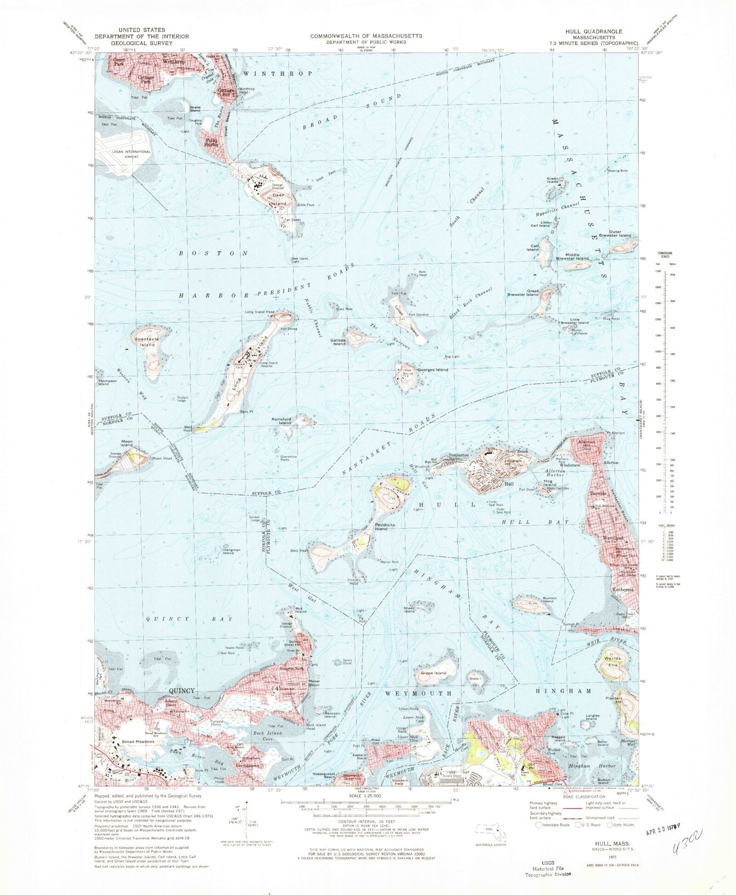
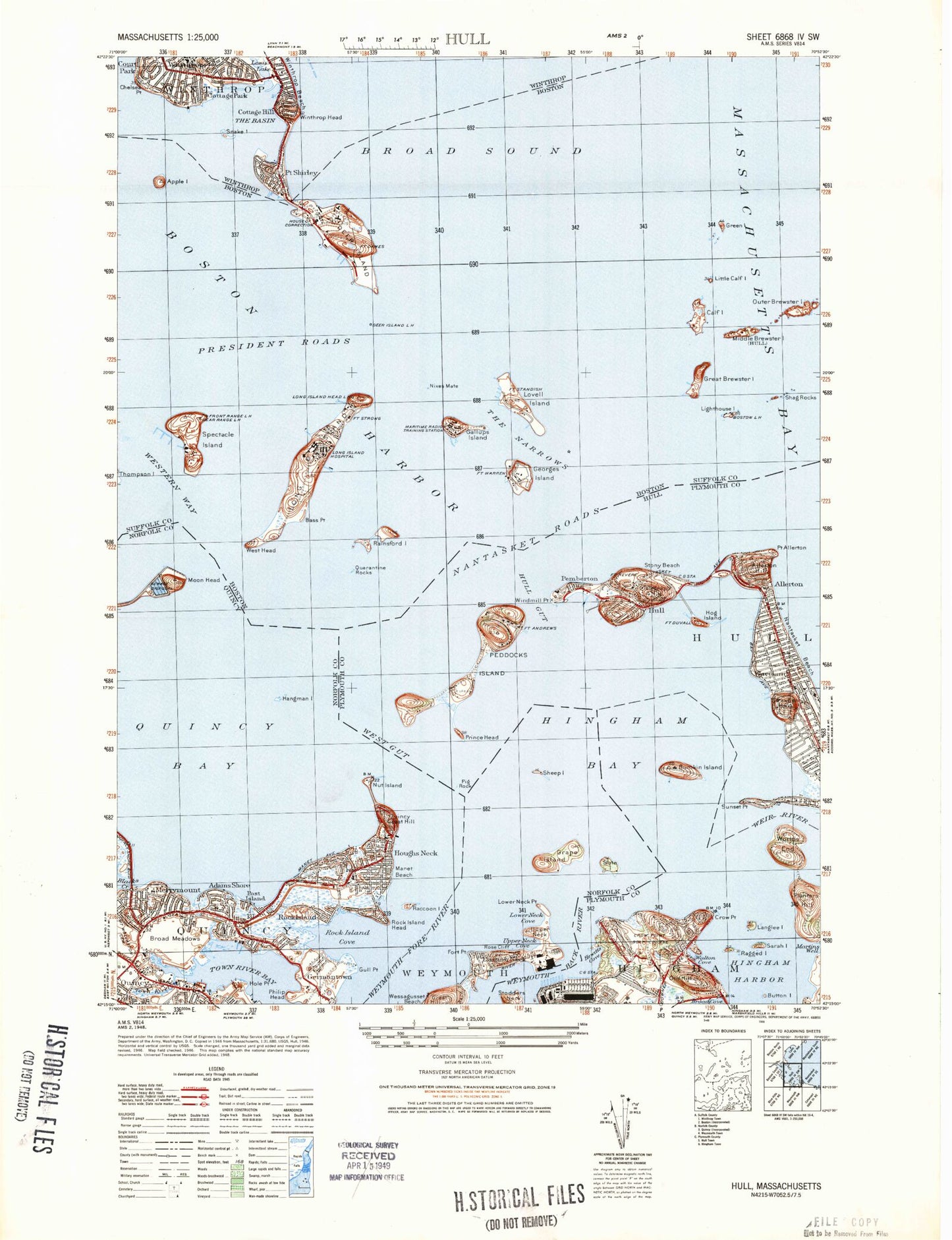
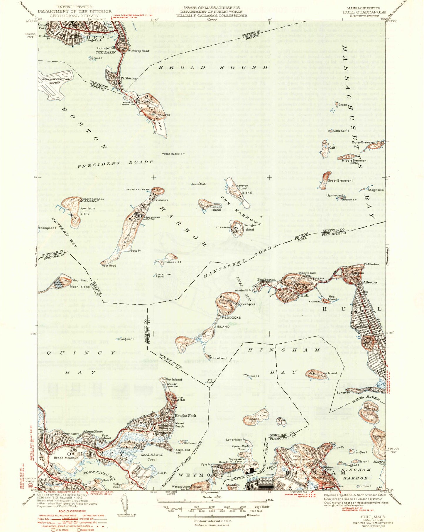
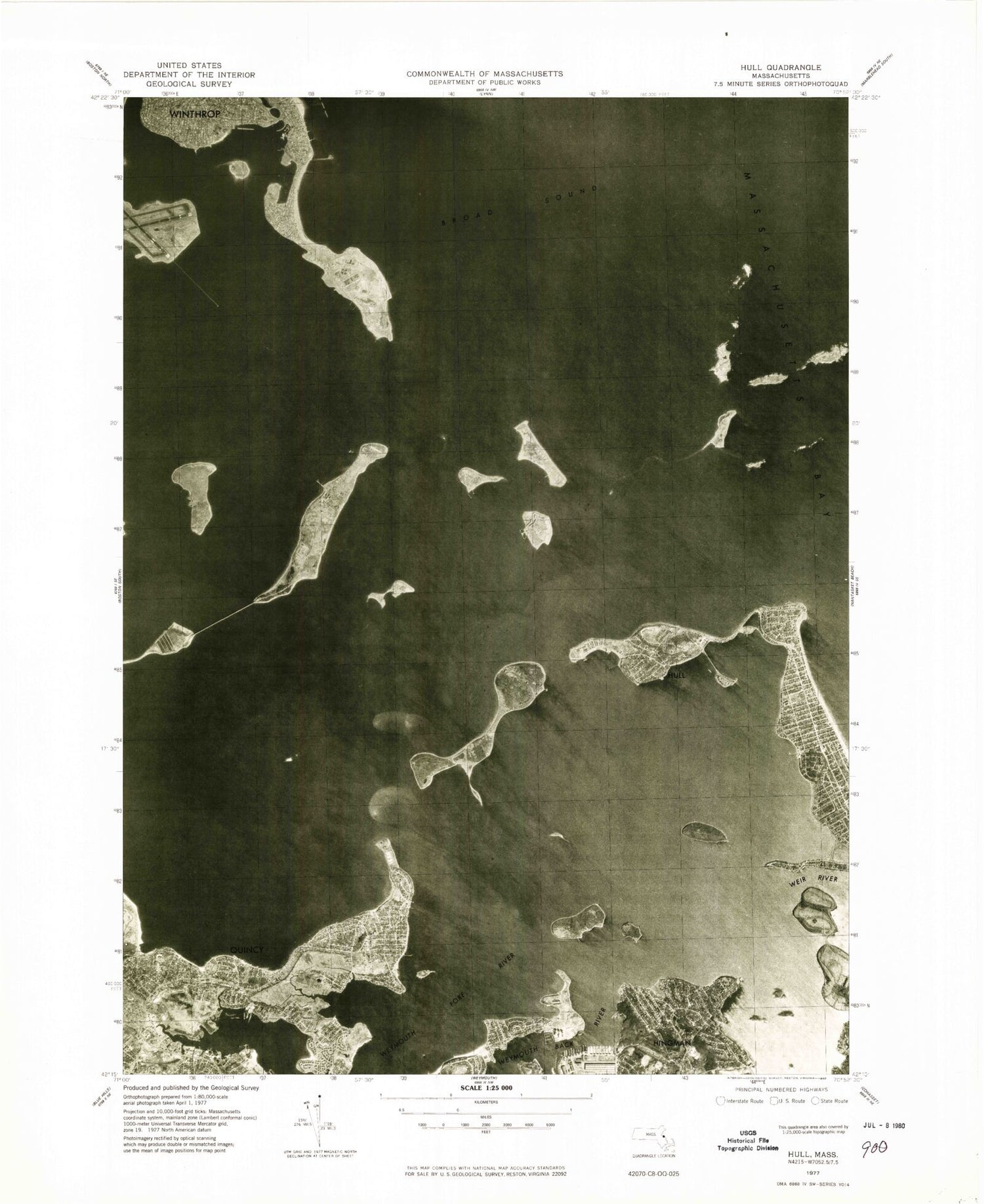
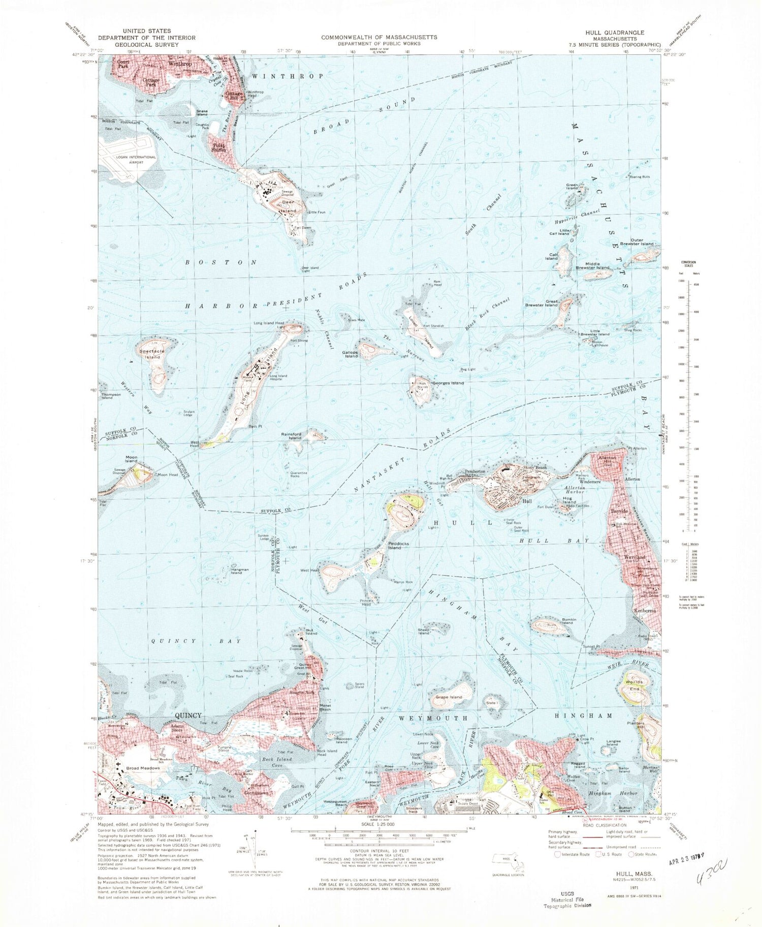
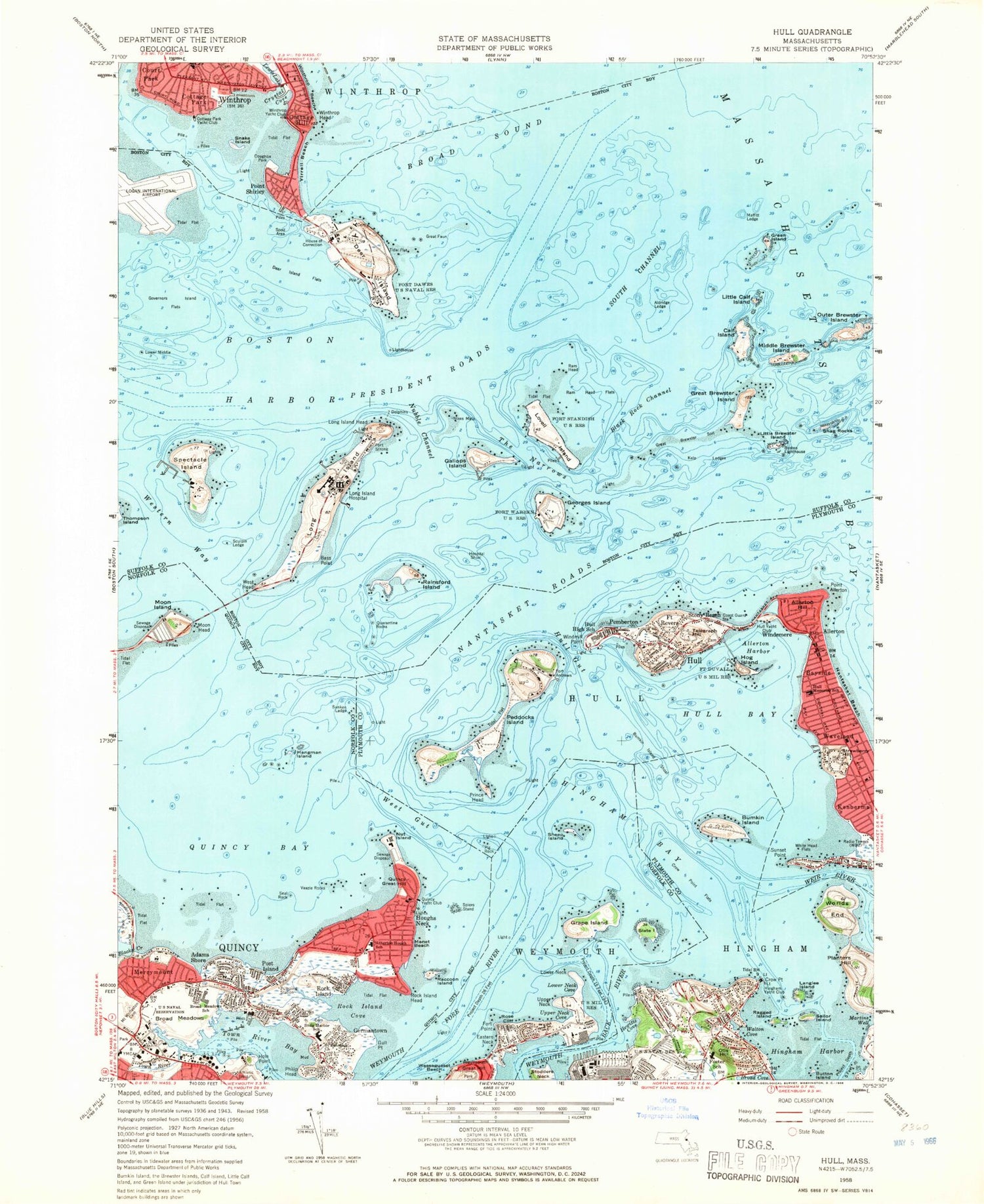
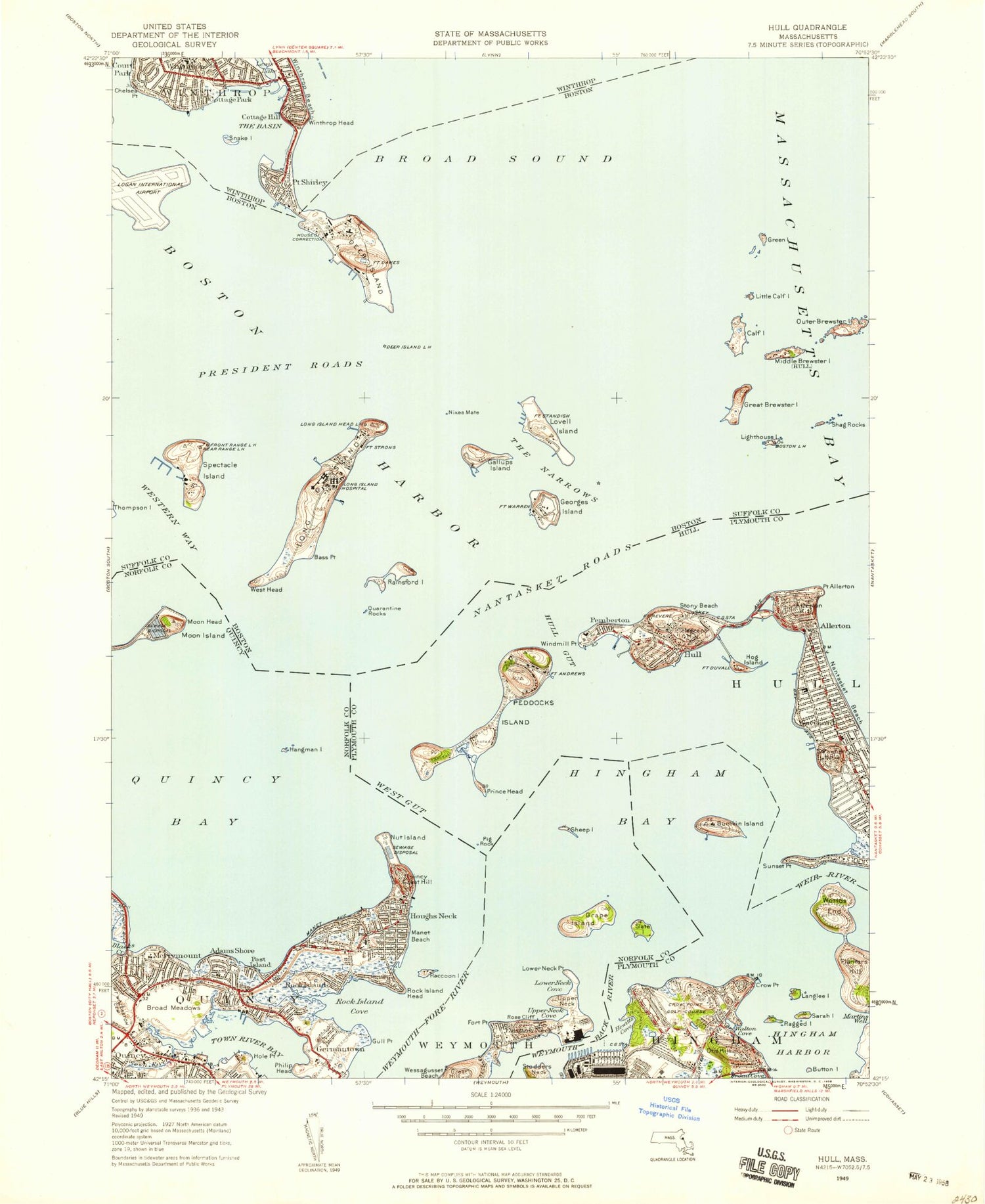
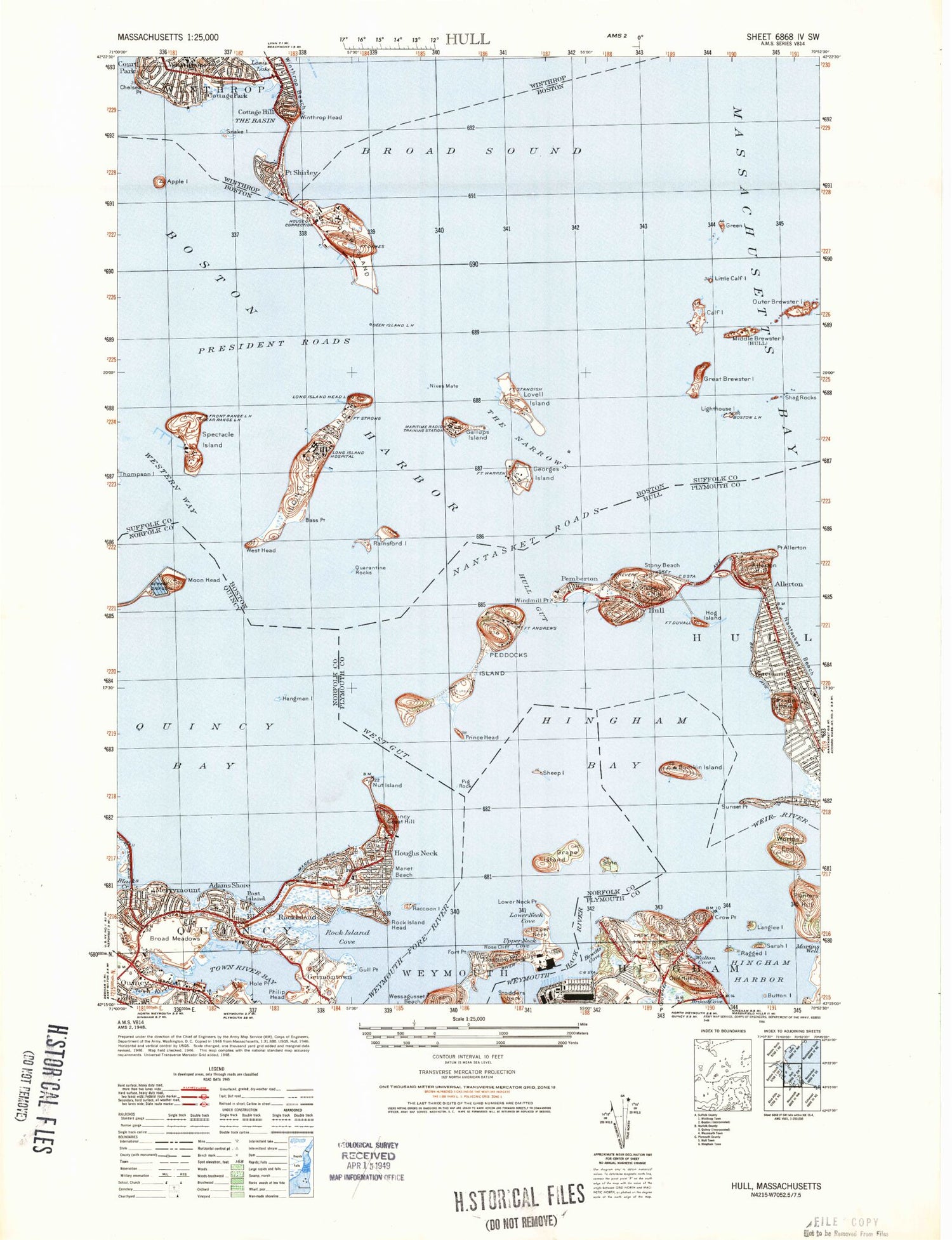
Classic USGS Hull Massachusetts 7.5'x7.5' Topo Map
Couldn't load pickup availability
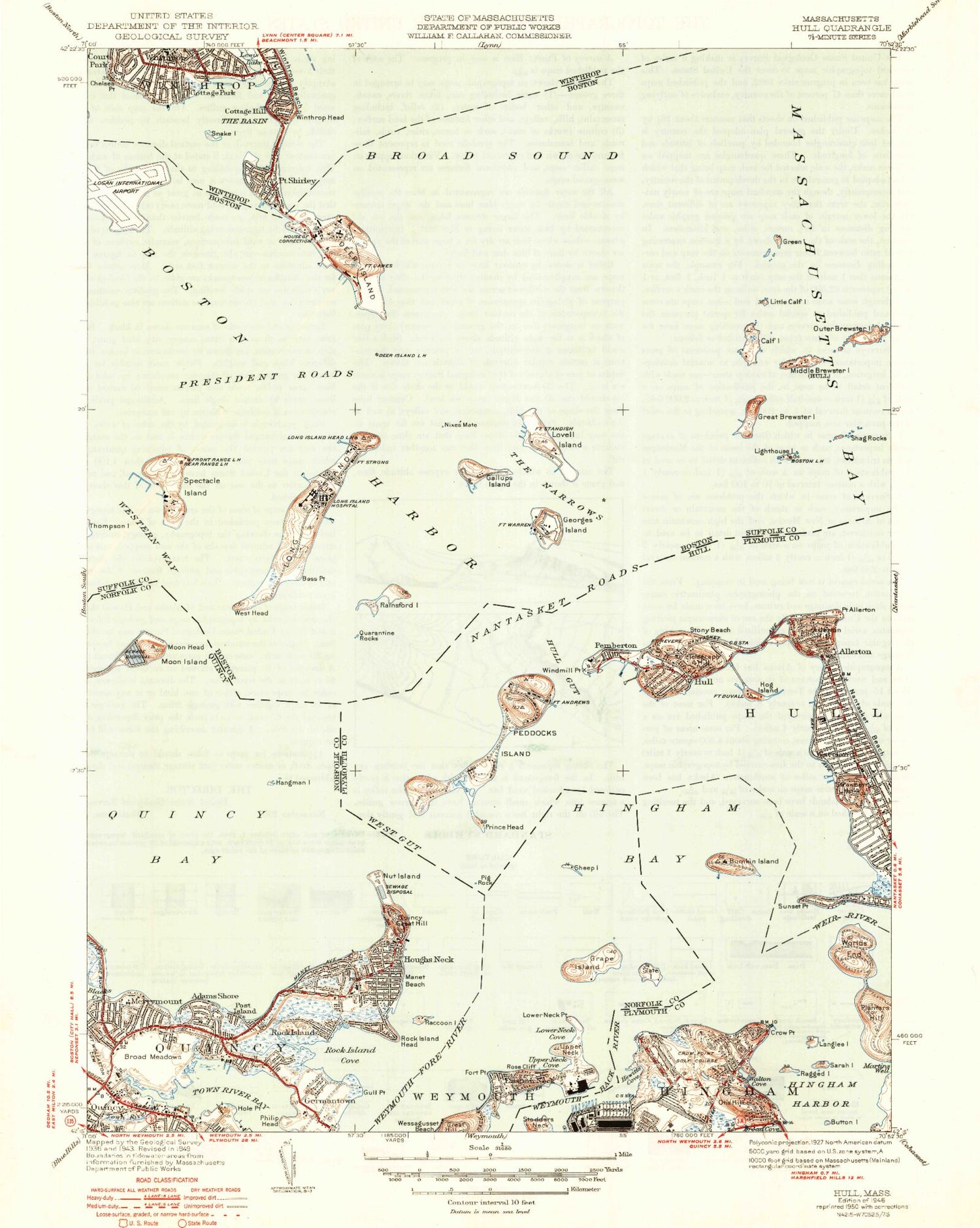
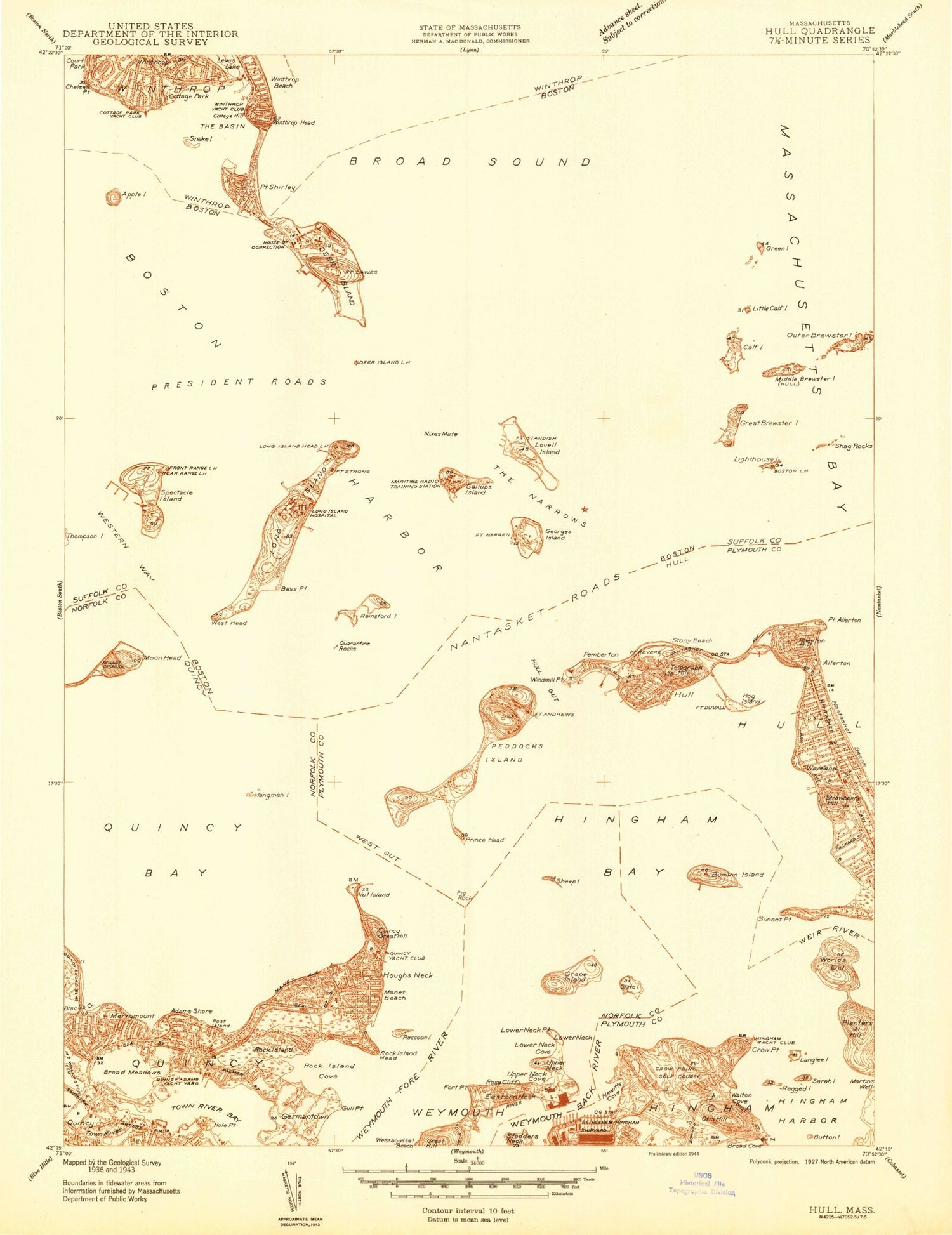
Historical USGS topographic quad map of Hull in the state of Massachusetts. Typical map scale is 1:24,000, but may vary for certain years, if available. Print size: 24" x 27"
This quadrangle is in the following counties: Norfolk, Plymouth, Suffolk.
The map contains contour lines, roads, rivers, towns, and lakes. Printed on high-quality waterproof paper with UV fade-resistant inks, and shipped rolled.
Contains the following named places: Black Rock Channel, Sculpin Ledge Channel, Weymouth Back River, Boston Light, Deer Island Light, Long Island Head Light, Winthrop Light, The Narrows Light, Gallops Island Light, Peddocks Island Channel Light, Pig Rock Light, Quincy Yacht Club Range Light, Windmill Point Light, Nantasket Gut Channel Light, Harrys Rock Light, Crow Point Pier Light, Cottage Park Yacht Club, Winthrop Yacht Club, Long Island Hospital, Hull Memorial School, Hull High School, William L Foster Elementary School, Quincy Yacht Club, Atherton Hough School, Snug Harbor Community School, Saint Boniface Church, Broad Meadows Middle School, Mount Wollaston Cemetery, Pemberton Station (historical), Bay Side Station (historical), Point Allerton Station (historical), Stony Beach Station (historical), Strawberry Hill Station (historical), Thornton Station (historical), Winthrop Beach Station (historical), Rock Island Cove Marshes, Town River Marshes, Southern Artery Shopping Center, Old Ship Church, Hingham Shipyard, Hull Station (historical), Suffolk County, Boston Harbor Islands National Recreation Area, Boston Lighthouse, Portuguese Cove, Adams Shore, Aldridge Ledge, Allerton, Allerton Hill, Point Allerton, Bass Point, Bass Rock, Bayside, Black Rock, Blacks Creek, Boston Harbor, Boston North Channel, Boston South Channel, Broad Meadows, Bumkin Island, Button Island, Calf Island, Calf Islands, Cat Island, Commissioners Ledge, Cottage Hill, Cottage Park, Court Park, Crow Point, Crow Point, Crow Point Flats, Deer Island, Deer Island Flats, Devils Back, Eastern Neck, False Spit, Finns Ledge, Flying Place, Fort Point, Georges Island, Germantown, Governors Island Flats, Grape Island, Great Brewster Island, Great Brewster Spit, Great Faun, Green Island, Gull Point, Halftide Rocks, Hangman Island, Harrys Rock, Hingham Bay, Hingham Harbor, Hole Point, Hospital Shoal, Houghs Neck, Houghs Neck, Hull, Hull Bay, Hull Gut, Hunt Ledge, Hypocrite Channel, Inner Seal Rock, Jacknife Ledge, Kelly Rock, Langlee Island, Lewis Lake, Little Brewster Island, Little Calf Island, Little Faun, Long Island, Long Island Head, Lovell Island, Lower Middle, Maffitt Ledge, Manet Beach, Middle Brewster Island, Moon Head, Moon Island, The Narrows, Nash Rock Shoal, Nixes Mate, Nubble Channel, Nut Island, Otis Hill, Outer Brewster Island, Outer Seal Rock, Peddocks Island, Pemberton, Philip Head, Pig Rock, Planters Hill, Point Shirley, Pope Rock, Post Island, President Roads, Prince Head, Quarantine Rocks, Quarter Ledge, Quincy Great Hill, Raccoon Island, Ragged Island, Rainsford Island, Ram Head, Ram Head Flats, Roaring Bulls, Rock Island, Rock Island Head, Rose Cliff, Sarah Island, Sculpin Ledge, Seal Rock, Shag Rocks, Sheep Island, Shirley Gut, Point Shirley, Slate Island, Snake Island, Spectacle Island, Spiers Stand, Stony Beach, Strawberry Hill, Sunken Ledge, Sunset Point, Telegraph Hill, Toddy Rocks, Town Brook, Town River, Upper Neck, Veazie Rocks, Waveland, Weir River, Western Way, West Gut, West Head, Weymouth Back River, Weymouth Fore River, White Head Flats, Windemere, Winthrop Head, Worlds End, Wreck Rock, Yirrell Beach, Windmill Point, Fort Andrews, Fort Dawes, Fort Duvall, Fort Revere, Cottage Hill, Seal Rock, Mount Wollaston, Fort Warren, Lower Neck, Apple Island, Governors Channel (historical), Half Moon Island (historical), Chelsea Point, Whitings Ledge, Perry Cove, The Piglets, Town of Hull, Allerton Harbor, Crystal Cove, Hewitts Cove, Lower Neck Cove, Martins Well, Quincy Bay, Rock Island Cove, Sailors Snug Harbor (historical), Upper Neck Cove, Walton Cove, Hull Post Office (historical), Brewster Islands, Bumkin Island, Gallops Island, Spinnaker Island, Merrymount, Nantasket Roads, WBZ-AM (Boston), WJDA-AM (Quincy), Adams Shore Branch Thomas Crane Public Library, Bug Light, Deer Island Sewerage Treatment Plant, East Head, Fort Andrews (historical), Fort Warren Visitor Center, Great Hill Park, Hawthorne Gardens, Long Island Light, Merrymount School, Middle Head, Quincy Adams Yacht Club, Suffolk County House of Correction, William K Webb Park, Adams Shore Baptist Church, Bethel Church of the Nazarene