MyTopo
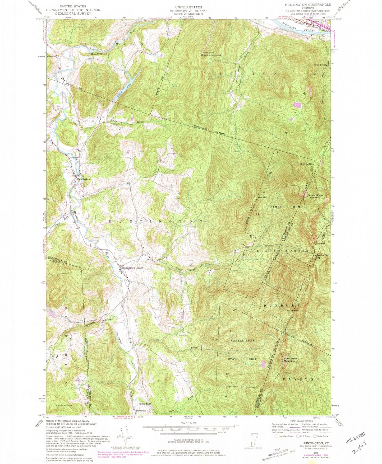
Classic USGS Huntington Vermont 7.5'x7.5' Topo Map
Couldn't load pickup availability
Historical USGS topographic quad map of Huntington in the state of Vermont. Typical map scale is 1:24,000, but may vary for certain years, if available. Print size: 24" x 27"
This quadrangle is in the following counties: Addison, Chittenden, Washington.
The map contains contour lines, roads, rivers, towns, and lakes. Printed on high-quality waterproof paper with UV fade-resistant inks, and shipped rolled.
Contains the following named places: Bald Hill, Bolton, Browns Mountain, Brush Brook, Burnt Rock Mountain, Camels Hump, Carpenter Brook, Cobb Brook, Fiddock School, Gillett Pond, Gleason Brook, Gorham Lodge, Hollow Brook, Honey Hollow, Huntington, Huntington Center, Johns Brook, Joiner Brook, Jones Brook, Montclair Glen Camp, Mount Ira Allen, Robbins Mountain, School Number 12, Towers School, Wiley Lodge, Wind Gap, Camels Hump State Forest, Teal Farm Airport, Town of Huntington, Brewster Pierce Memorial School, Camels Hump Nordic Ski Center, East Bolton Cemetery, Huntington Baptist Church, Huntington Center Cemetery, Huntington Post Office, Huntington Public Library, Maplewood Cemetery, Robbins Mountain Wildlife Management Area, Cowles Cove Shelter, Hump Brook Tent Platforms, Mount Ethan Allen, Montclair Glen Lodge, Huntington Volunteer Fire Department, Bolton Fire Station, Smilie Elementary School, Bolton Census Designated Place, Hanksville Census Designated Place, Huntington Census Designated Place, Huntington Center Census Designated Place