MyTopo
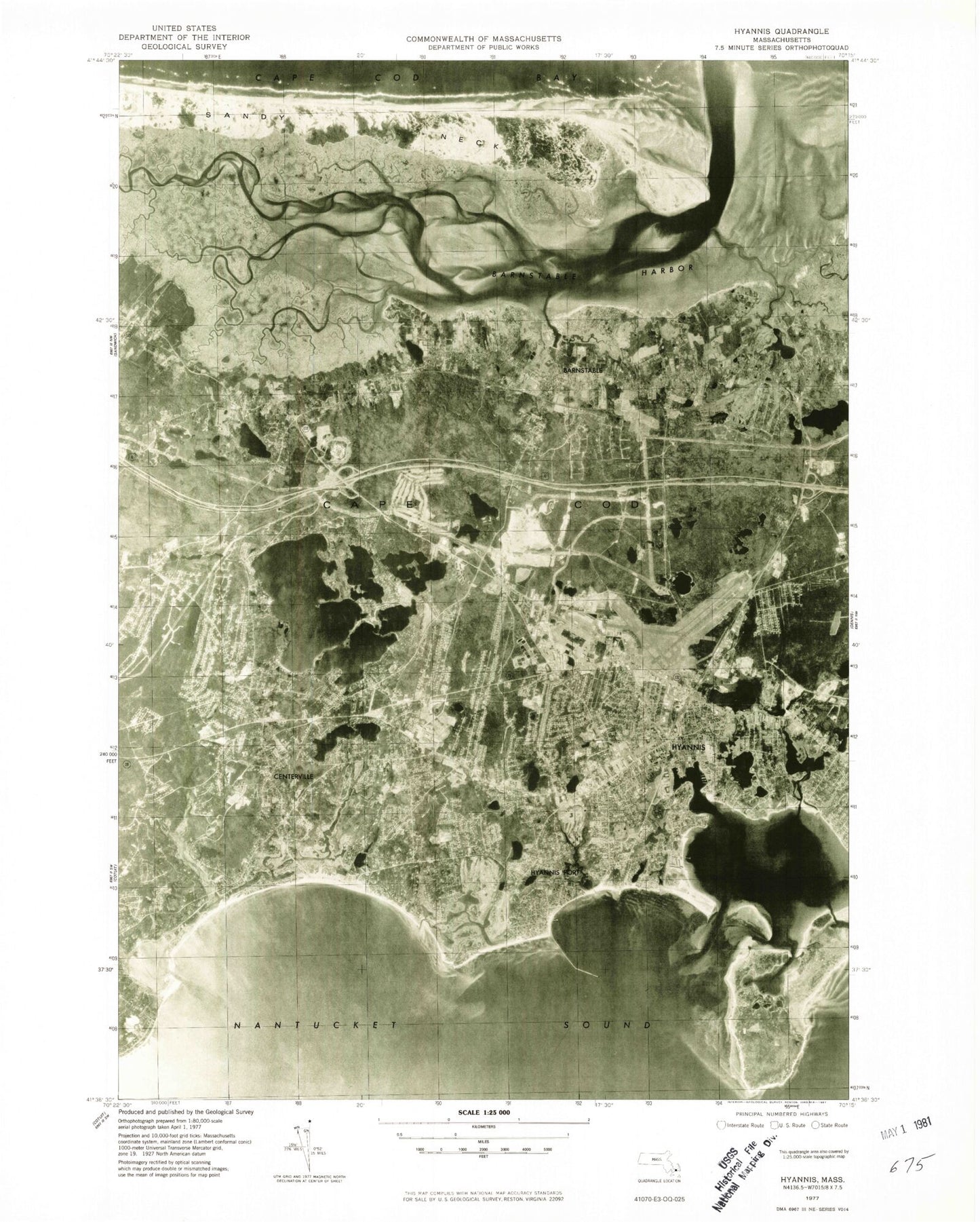
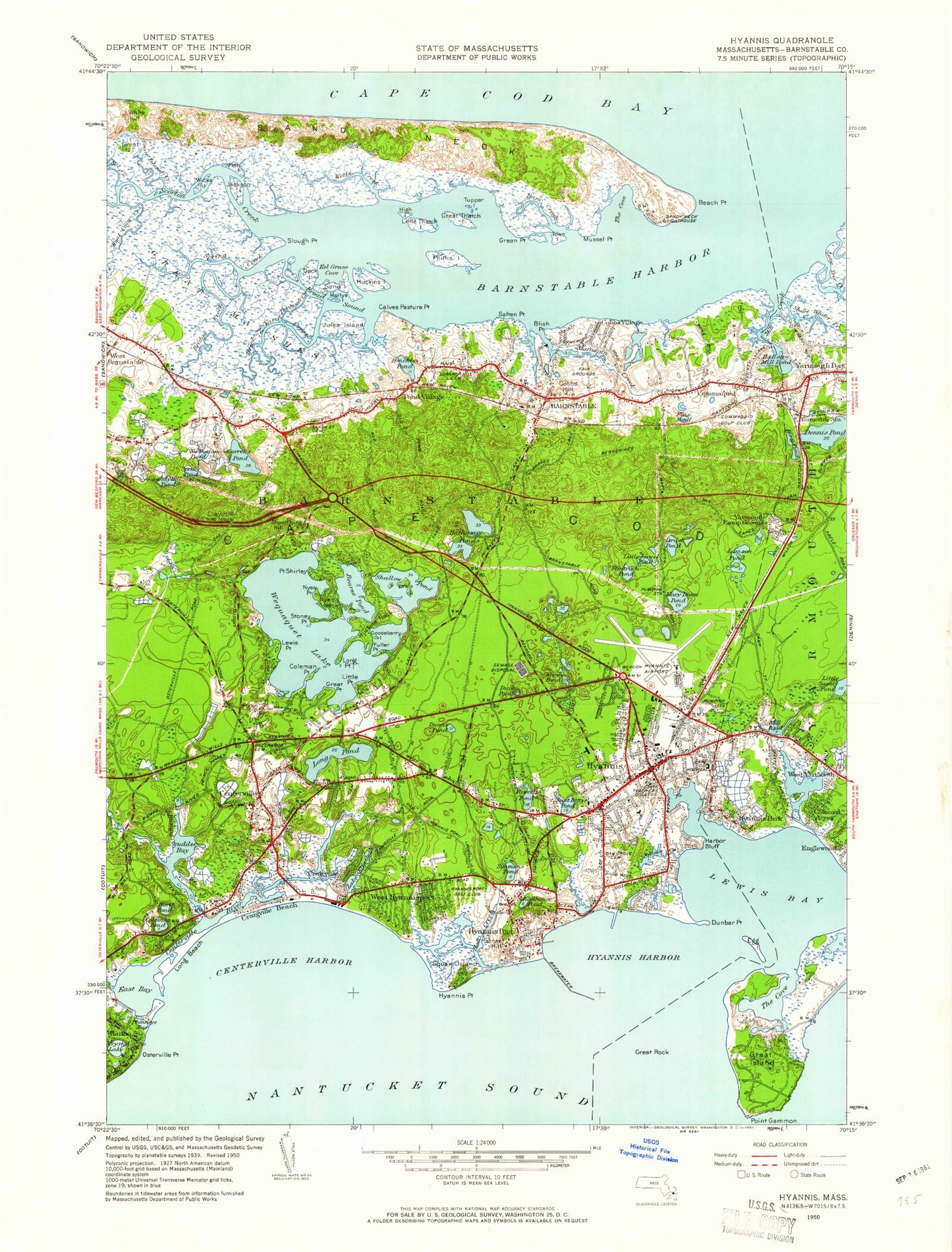
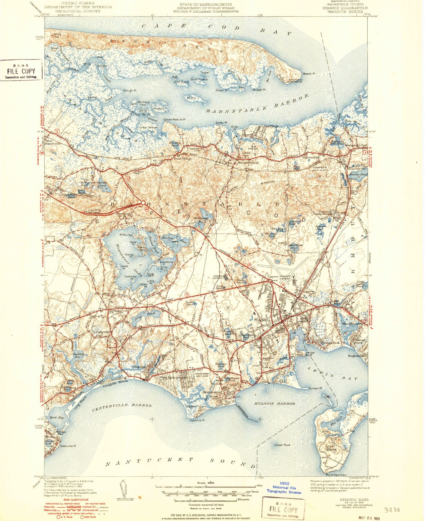
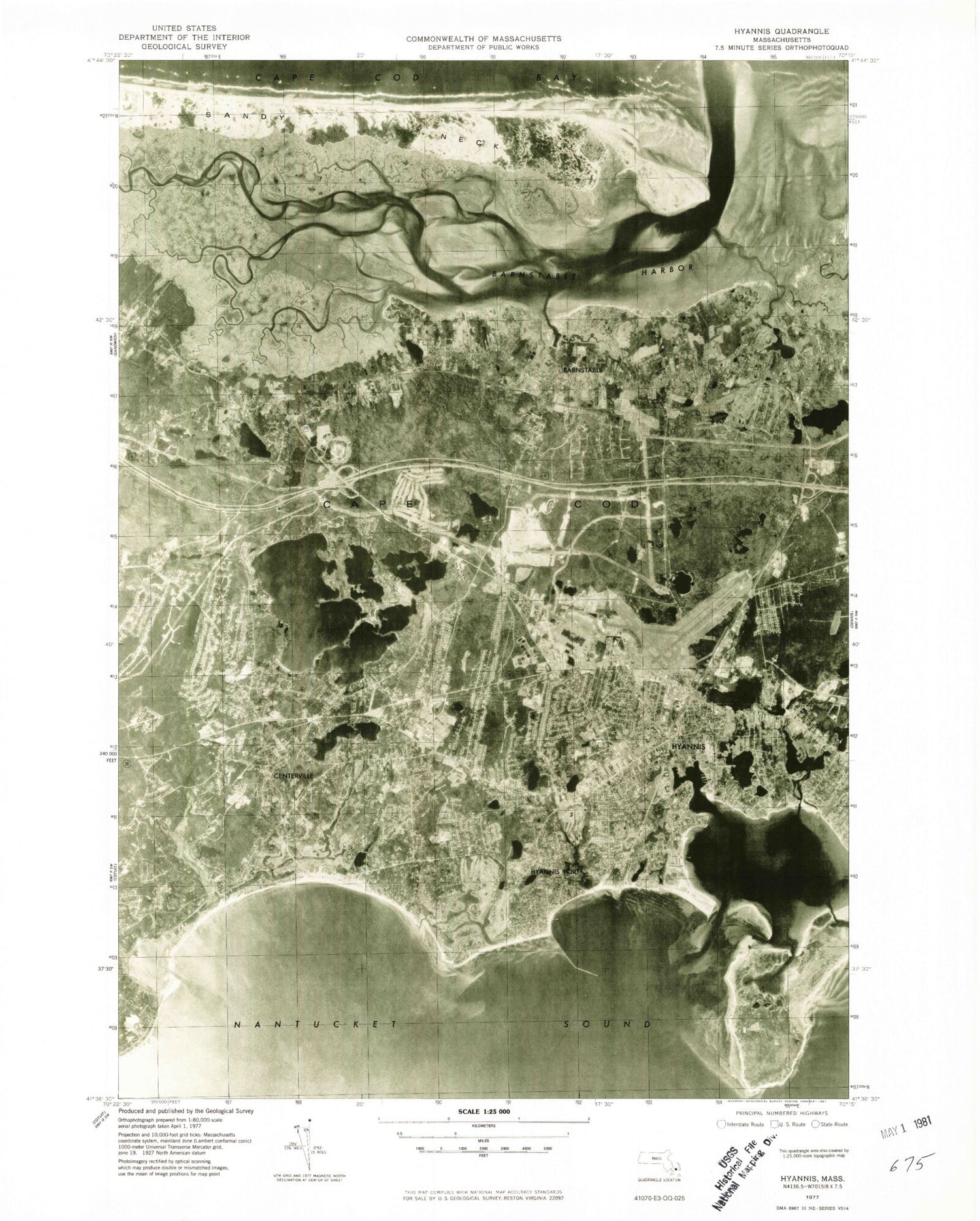
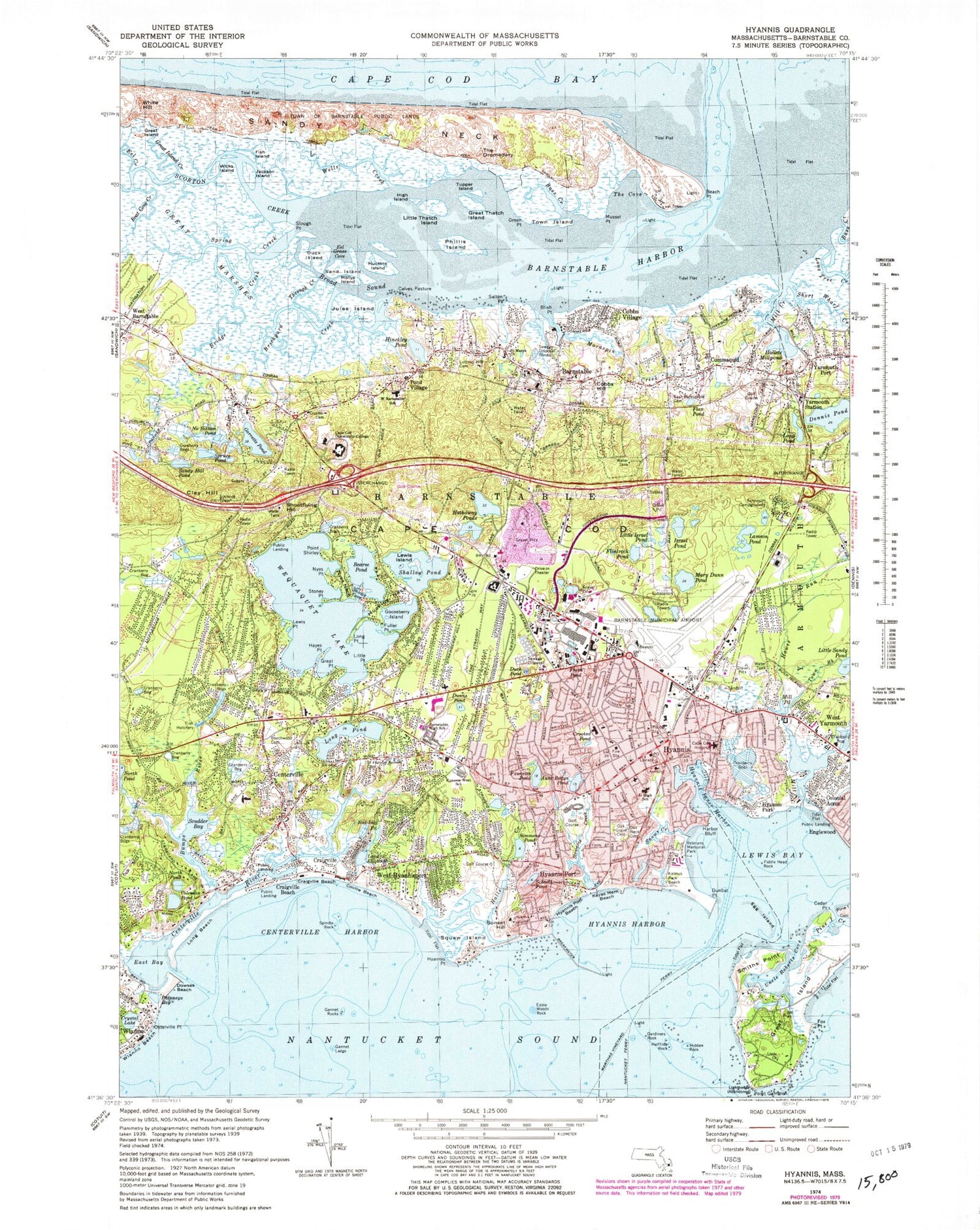
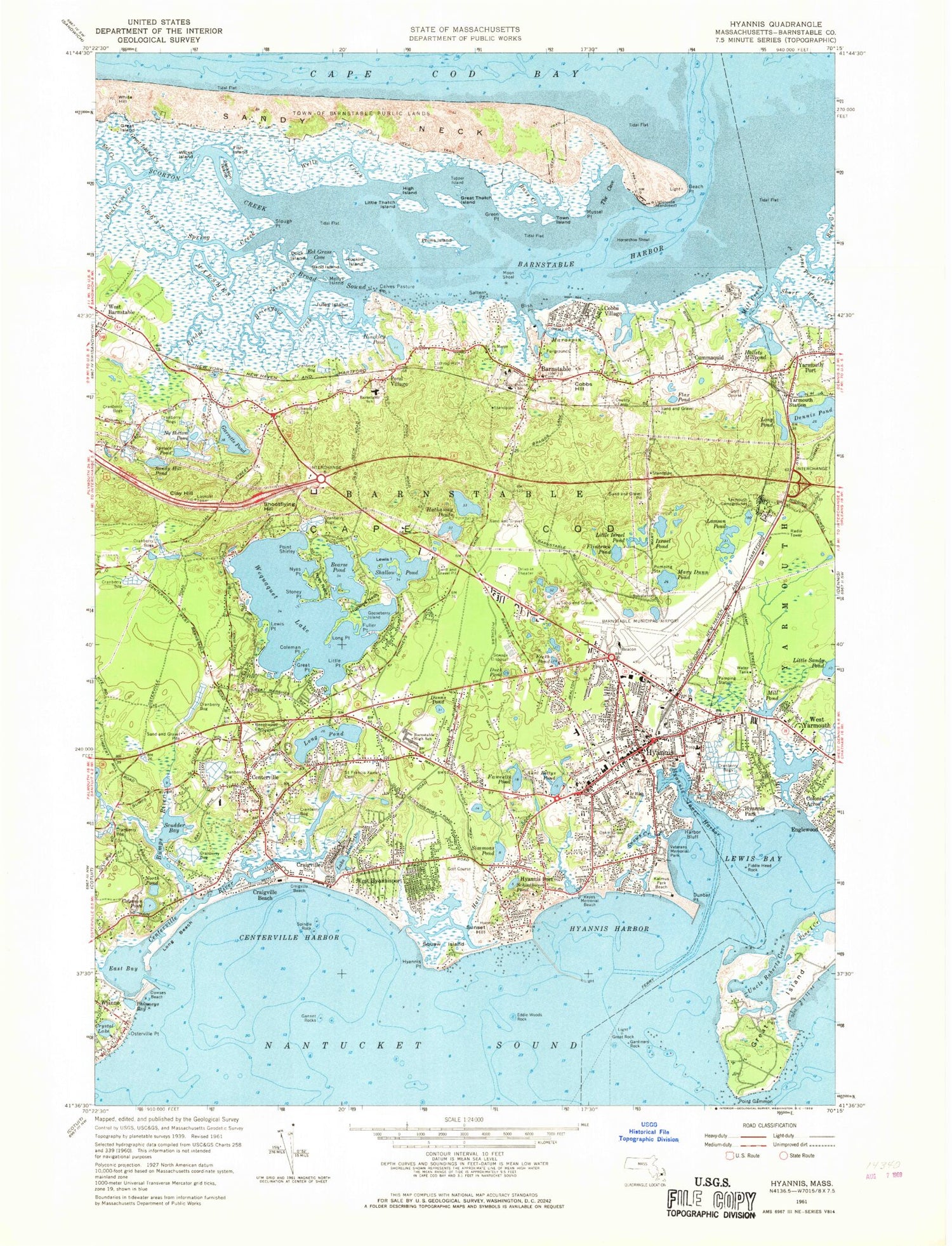
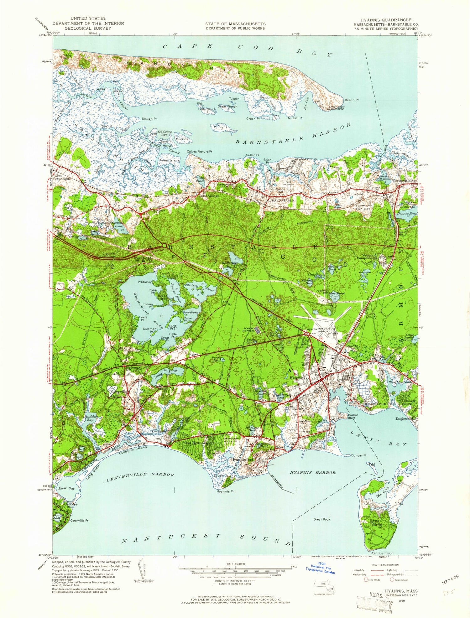
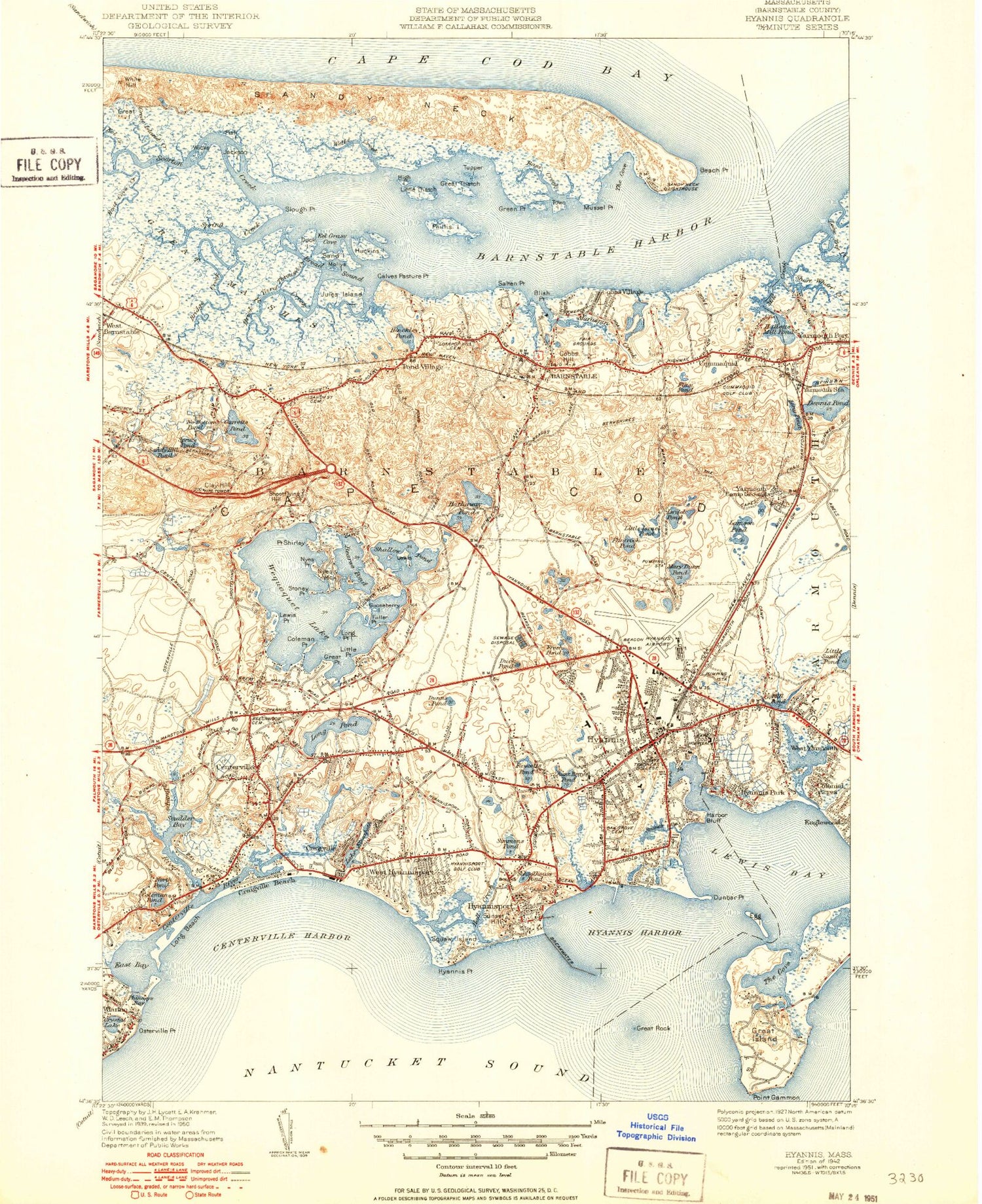
Classic USGS Hyannis Massachusetts 7.5'x7.5' Topo Map
Couldn't load pickup availability
Historical USGS topographic quad map of Hyannis in the state of Massachusetts. Typical map scale is 1:24,000, but may vary for certain years, if available. Print size: 24" x 27"
This quadrangle is in the following counties: Barnstable.
The map contains contour lines, roads, rivers, towns, and lakes. Printed on high-quality waterproof paper with UV fade-resistant inks, and shipped rolled.
Contains the following named places: Rochester Townhall, Beach Point Light, Maraspin Creek Entrance Light, Hyannis Breakwater Light, Sandy Street Cemetery, Cape Cod Community College, West Barnstable Elementary School, Lothrop Hill Cemetery, Saint Marys Church, Cummaquid Cemetery, Yarmouth Campgrounds, Cape Cod Hospital, Beechwood Cemetery, Saint Francis Xaviers Cemetery, Barnstable High School, Hyannis West Elementary School, Oak Grove Cemetery, Oak Neck Cemetery, Veterans Memorial Park, Kalmus Park Beach, Hyannis Junior High School, Squaw Island Marshes, Craigville Marshes, Mill Pond Marshes, Airport Shopping Center, Capetown Shopping Center, Capetown Plaza, Centerville Shopping Center, All Cape Shopping Center Picture Pond Plaza, Cape Cod Mall, Town of Barnstable Public Lands, Sturgis Library, Barnstable County Court House, Crocker Tavern, Baxters Mill, Mary Lincoln House, South Congregational Church, Baxter Grist Mill Dam, Kennedy Compound, West Barnstable Station, Sandy Neck Light, Barnstable Municipal Airport Aero Light, North Pond, Donald G Trayer Museum, John F Kennedy Memorial, Sandy Neck Dunes, Weequakut (historical), Barnstable Municipal Airport-Boardman/Polando Field, Aunt Bettys Pond, Barnstable, Bass Creek, Bass Creek, Beach Point, Bearse Pond, Blish Point, Boat Cove Creek, Brickyard Creek, Bridge Creek, Broad Sound, Calves Pasture Point, Centerville, Centerville Harbor, Centerville River, Channel Rock, Barnstable Harbor, Clay Hill, Cobbs Hill, Cobbs Village, Hayes Point, Coleman Pond, Colonial Acres, Craigville, Craigville Beach, Craigville Beach, Crystal Lake, Cummaquid, Dennis Pond, Dowses Beach, Duck Island, Duck Pond, Dunbar Point, Dunns Pond, Eddie Woods Rock, Eel Creek, Fuller Point, Lake Elizabeth, Fawcetts Pond, Fiddle Head Rock, Fish Island, Flax Pond, Flintrock Pond, Fresh Pond, Point Gammon, Gannet Ledge, Gannet Rocks, Gardiners Rock, Garretts Pond, Gooseberry Island, Great Island, Great Island, Great Island Creek, Great Marshes, Great Point, Great Rock, Great Thatch Island (historical), Green Point, Halftide Rock, Hallets Millpond, Harbor Bluff, Hathaway Ponds, High Island, Hinckley Pond, Horseshoe Shoal, Huckins Island, Huckins Neck, Hyannis Harbor, Hyannis Park, Hyannis Point, Hyannis Port, Israel Pond, Jackson Island, Jules Island, Kalmus Park Beach, Keyes Memorial Beach, Lamson Pond, Lewis Bay, Lewis Island, Lewis Point, Little Israel Pond, Little Point, Little Thatch Island (historical), Lone Tree Creek, Long Beach, Long Point, Long Pond, Long Pond, Maraspin Creek, Mary Dunn Pond, Mill Creek, Mill Creek, Mill Pond, Mollys Island, Moon Shoal, Mussel Point, No Bottom Pond, North Pond, Nyes Neck, Nyes Point, Osterville Point, Phillis Island (historical), Phinneys Bay, Pond Village, Rendezvous Creek, Salten Point, Sand Island (historical), Sandy Hill Pond, Sandy Neck, Schoolhouse Pond, Scorton Creek, Shallow Pond, Point Shirley, Simmons Pond, Slough Point, Stoney Point, Sunset Hill, Shootflying Hill, Spindle Rock, Spring Creek, Short Wharf Creek, Snows Creek, Spruce Pond, Squaw Island, Through Creek, Town Island (historical), Tupper Island (historical), Wells Creek, Wequaquet Lake, West Barnstable, West Hyannisport, White Hill, Wianno Beach, Wicks Island, Yarmouth Station, Halls Creek, Hinckley Rock, Scudder Bay, Dead Neck Rock (historical), Middle Ledge (historical), Bench Rock, Black Bank Channel, Blind Rock, Bumps River, Church Rock, Cone Rock, Egg Island, Flying Fish Rock, Lobster Rock, Red Rock, Salten Rock, Scudders Rock, Small Pond, Tongue Rock, White Rock, Upper Gate Pond (historical), The Spindle, City of Barnstable Town, The Cove, East Bay, Eel Grass Cove, Hyannis Inner Harbor, Uncle Roberts Cove, WQRC-FM (Barnstable), WPXC-FM (Hyannis), WKKL-FM (West Barnstable), WCVX-TV (Vineyard Haven), Hyannis, Assembleia De Deus, West Barnstable Post Office, Hyannis Port Beach, Veterans Park Beach, Lewis Bay Beach, Bay View Street Beach, Saint Francis Xavier Church, Saint Francis Xavier Preparatory School, Academy of Early Learning, Covenant On The Rock Family Church, Red Lily Pond, Barnstable Fire Department, Centerville - Osterville - Marstons Mills Fire District Station 1, Hyannis Fire Department, Yarmouth Fire Department Station 3, Barnstable Police Department, Barnstable County Sheriff's Office, Barnstable Post Office, Centerville Post Office, Cummaquid Post Office