MyTopo
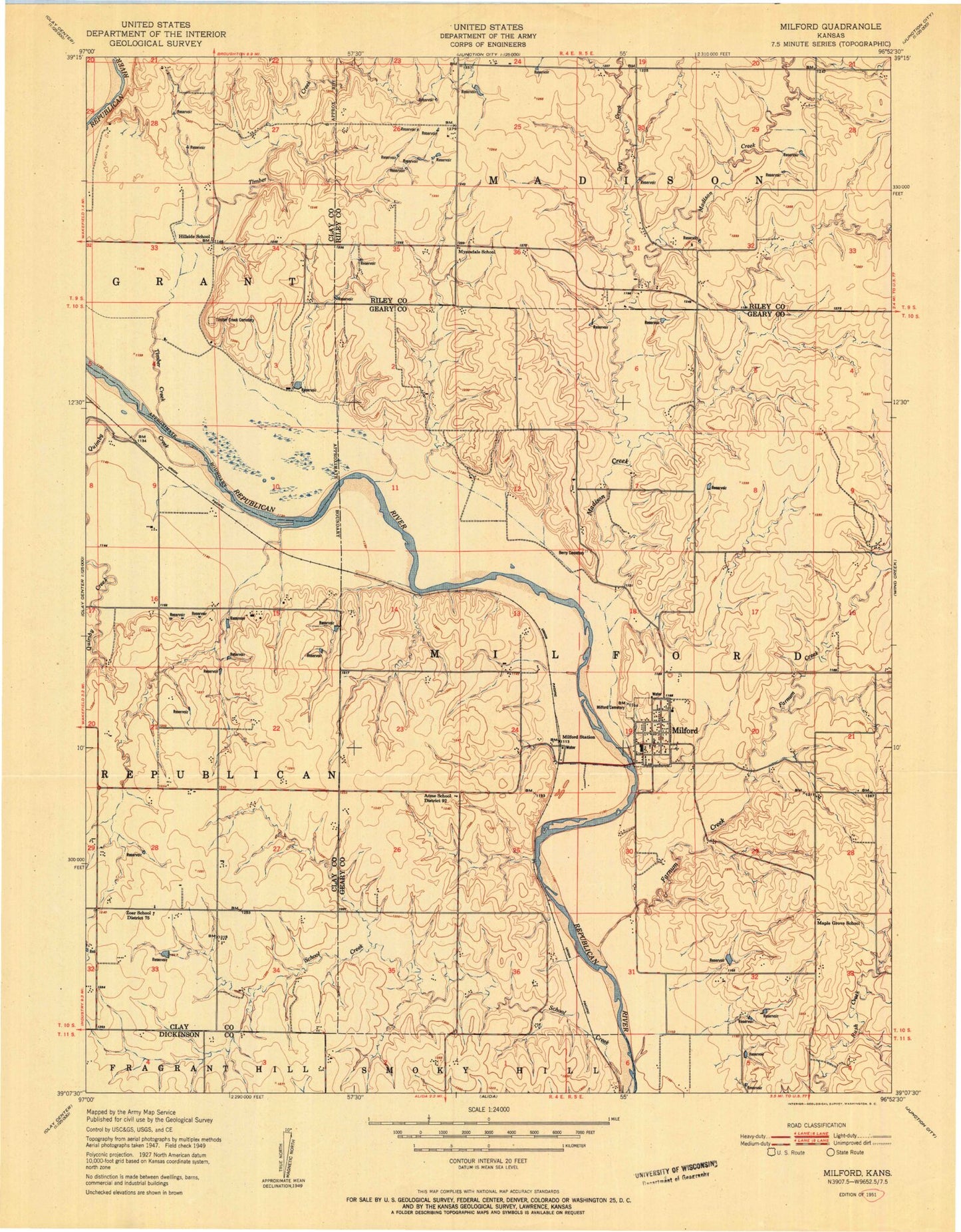
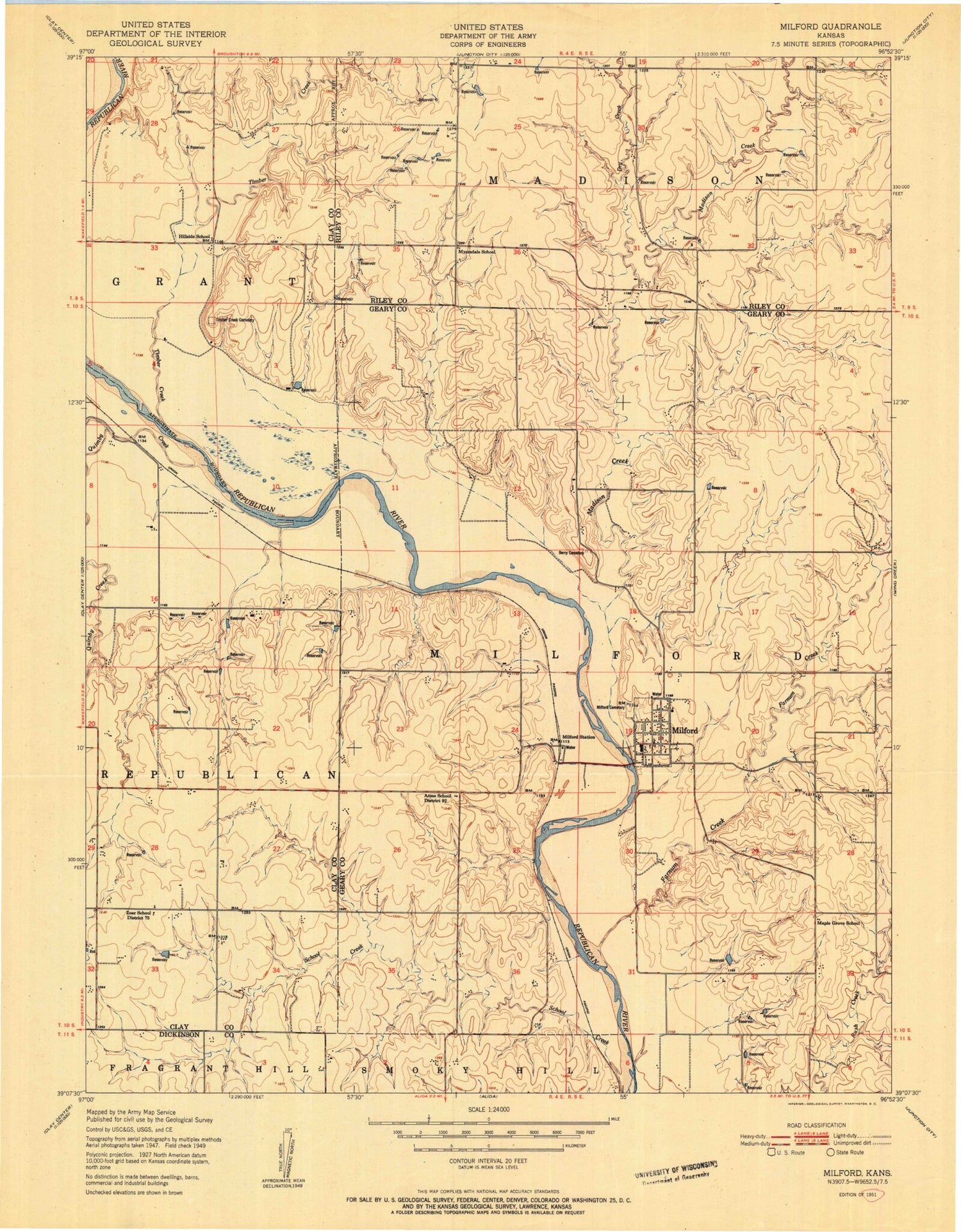
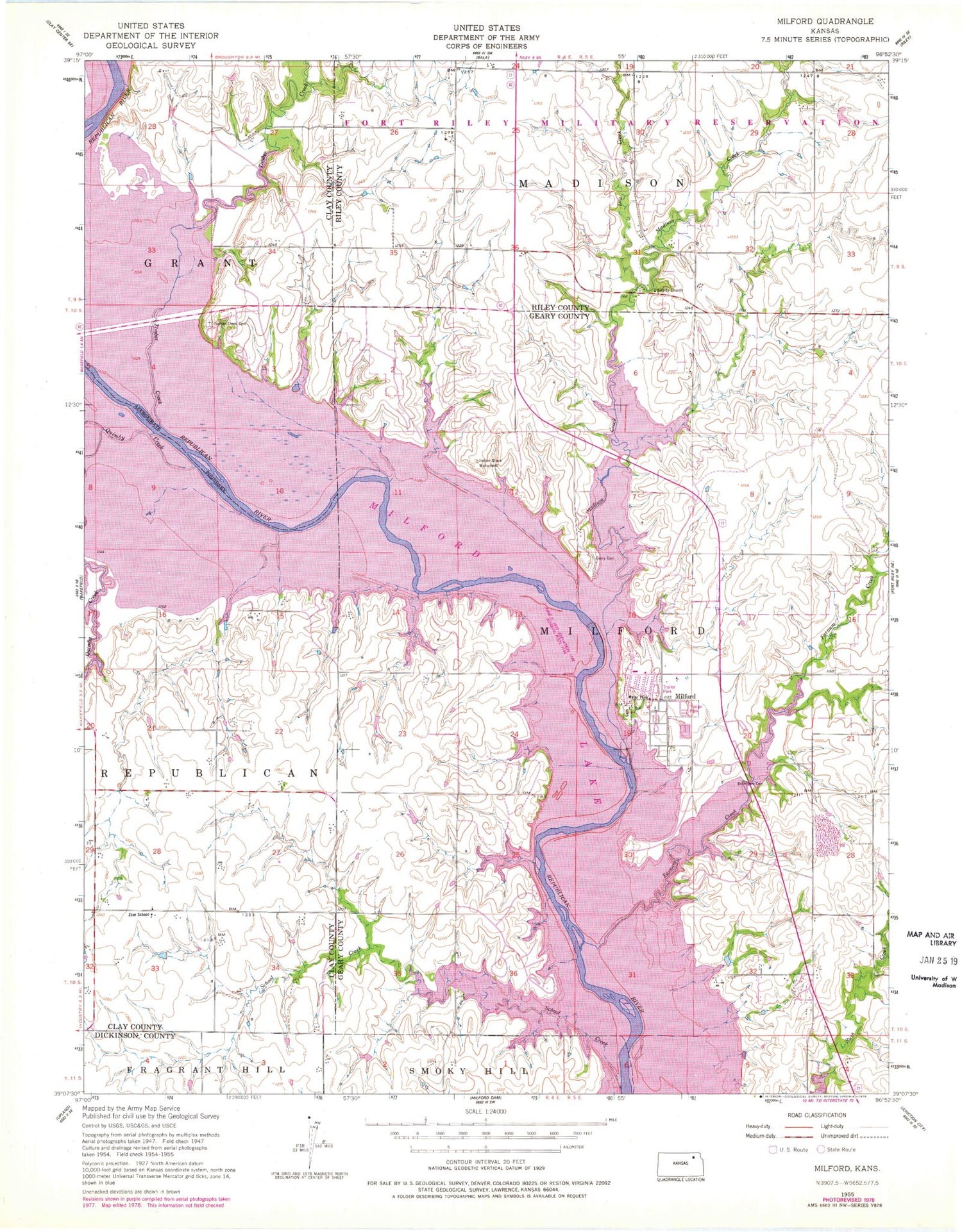
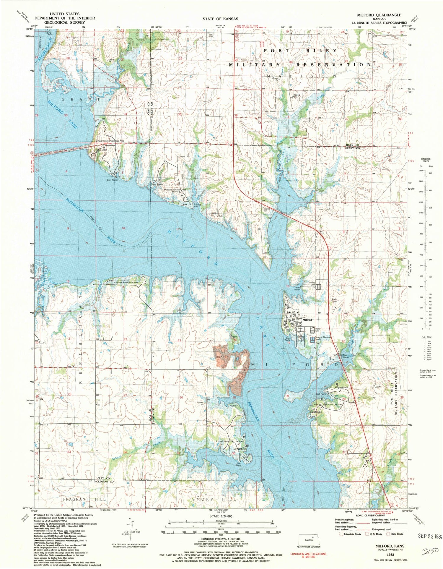
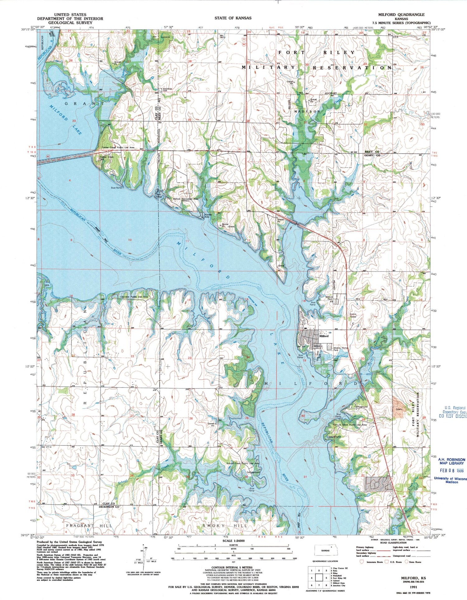
USGS Classic Milford Kansas 7.5'x7.5' Topo Map
Couldn't load pickup availability
Historical USGS topographic quad map of Milford in the state of Kansas. Scale: 1:24000. Print size: 24" x 27"
This quadrangle is in the following counties: Clay, Dickinson, Geary, Riley.
The map contains contour lines, roads, rivers, towns, lakes, and grids including latitude / longitude and UTM / MGRS. Printed on high-quality waterproof paper with UV fade-resistant inks.
Contains the following named places: Milford Lake, Timber Creek, Dry Creek, Madison Creek, Quimby Creek, Township of Milford, Timber Creek Cemetery, Myersdale School, Hillside Church, Indian Grave Monument, Barry Cemetery, Milford Station, Milford, Branscom Cemetery, Farnum Creek, Zoar School, School Creek, Acme (historical), Clayview Public Use Area, Hillside School (historical), Timber Creek Public Use Area, Zoar Church (historical), Acme School (historical), Farnam Creek Public Use Area, Flag Stop Park, Maple Grove School (historical), Milford Cemetery, Milford Recreation Area, School Creek Public Use Area, Milford Volunteer Fire Department, City of Milford, Milford Elementary School, Milford Congregational Church, Milford Wastewater Treatment Facility, Milford Post Office, Lakeside Mobile Home Court, Flagstop Resort and Recreational Vehicle Park