
MyTopo
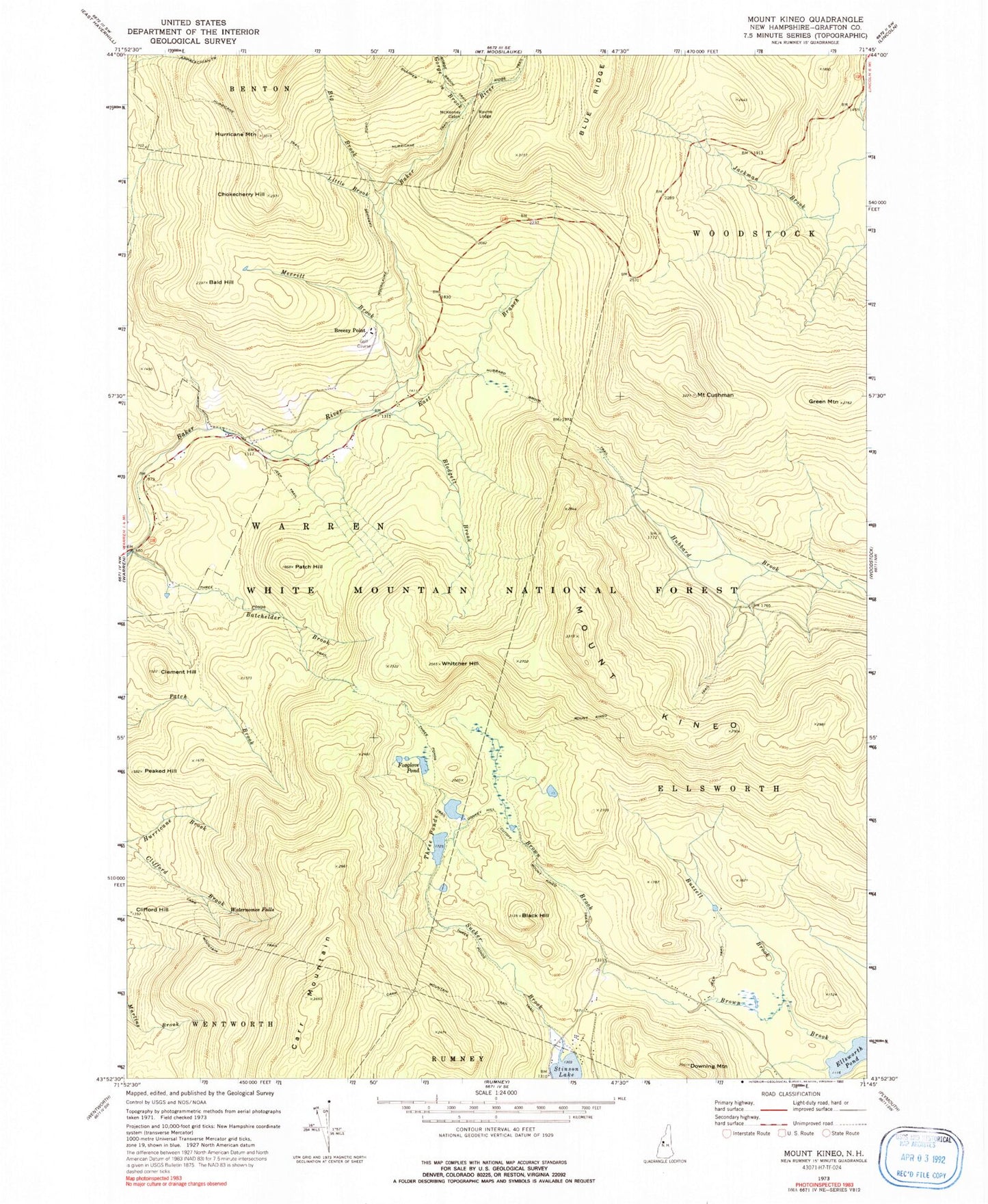
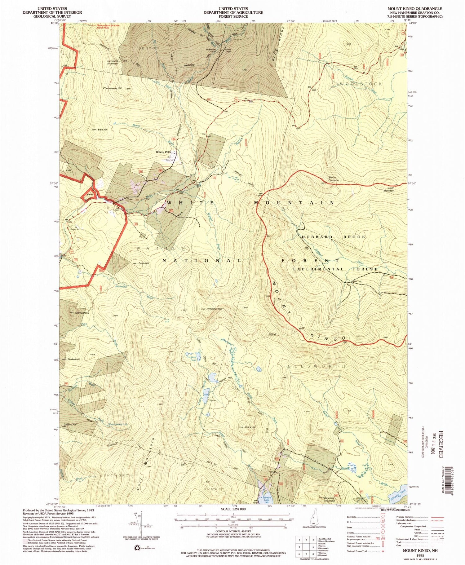
Classic USGS Mount Kineo New Hampshire 7.5'x7.5' Topo Map
Couldn't load pickup availability
Historical USGS topographic quad map of Mount Kineo in the state of New Hampshire. Typical map scale is 1:24,000, but may vary for certain years, if available. Print size: 24" x 27"
This quadrangle is in the following counties: Grafton.
The map contains contour lines, roads, rivers, towns, and lakes. Printed on high-quality waterproof paper with UV fade-resistant inks, and shipped rolled.
Contains the following named places: Bald Hill, Batchelder Brook, Big Brook, Black Hill, Blodgett Brook, Breezy Point, Buzzell Brook, Carr Mountain, Carr Mountain Trail, Chokecherry Hill, Clement Hill, Clifford Hill, Mount Cushman, Donkey Hill Cutoff, Downing Mountain, East Branch Baker River, Ellsworth Pond, Foxglove Pond, Gorge Brook, Green Mountain, Hurricane Mountain, Hurricane Trail, Little Brook, McKenney Cabin, Merrill Brook, Mount Kineo, Mount Kineo Trail, Patch Hill, Peaked Hill, Ravine Lodge, Ridge Trail, Snapper Ski Trail, Sucker Brook, Three Ponds, Three Ponds Trail, Three Ponds Trail, Waternomee Falls, Whitcher Hill, Jackman Brook Overlook, Grafton County, Town of Ellsworth, Camp Number 2 (historical), Camp Number 4 (historical), Camp Number 5 (historical), East Warren School (historical), Jackman Camp (historical), Moosilauke Golf Club