MyTopo
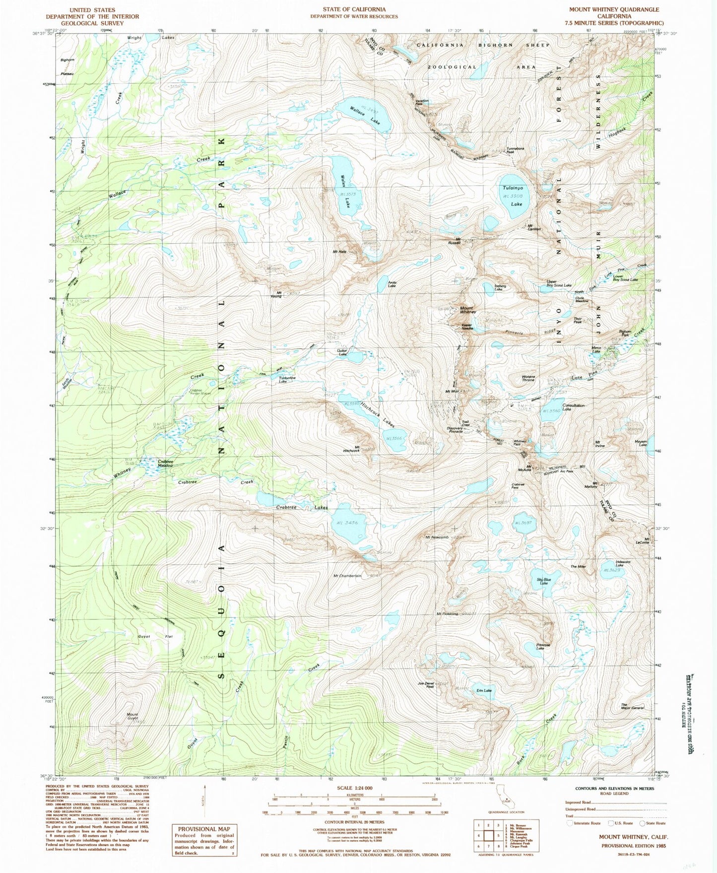
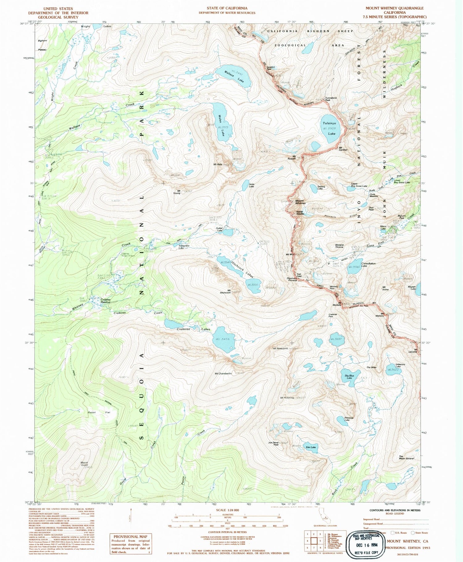
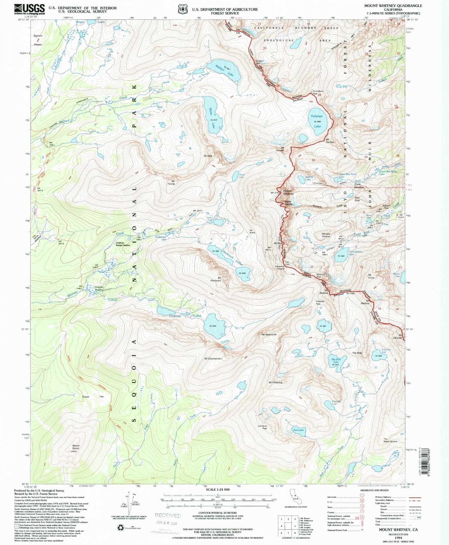
USGS Classic Mount Whitney California 7.5'x7.5' Topo Map
Couldn't load pickup availability
Historical USGS topographic quad map of Mount Whitneyin the states of California, Nevada. Scale: 1:24000. Print size: 24" x 27"
This quadrangle is in the following counties: Inyo, Tulare.
The map contains contour lines, roads, rivers, towns, lakes, and grids including latitude / longitude and UTM / MGRS. Printed on high-quality waterproof paper with UV fade-resistant inks.
Contains the following named places: Sierra Nevada, Arc Pass, Arctic Lake, Bighorn Park, Mount Carillon, Mount Chamberlin, Clyde Meadow, Consultation Lake, Mount Corcoran, Crabtree Creek, Crabtree Lakes, Crabtree Meadow, Crabtree Ranger Station, Erin Lake, Guyot Flat, Mount Guyot, Hitchcock Lakes, Mount Hitchcock, Iridescent Lake, Mount Irvine, Joe Devel Peak, Keeler Needle, Mount Le Conte, Lower Boy Scout Lake, Mount Mallory, Meysan Lake, Mirror Lake, Mount Newcomb, Mount Pickering, Pinnacle Ridge, Primrose Lake, Mount Russell, Sandy Meadow, Sky Blue Lake, Mount Whitney Trail, The Major General, The Miter, Thor Peak, Trail Crest, Tulainyo Lake, Tunnabora Peak, Upper Boy Scout Lake, Vacation Pass, Wales Lake, Wallace Lake, Whitney Pass, Mount Whitney, Mount Young, Crooks Peak, Mount Muir, Discovery Pinnacle, Mount Hale, Mount McAdie, Wotans Throne, Crabtree Pass, Guitar Lake, Timberline Lake, Frog Pond, Mount Marsh, Sheep Pass (historical), Sierra Nevada