MyTopo
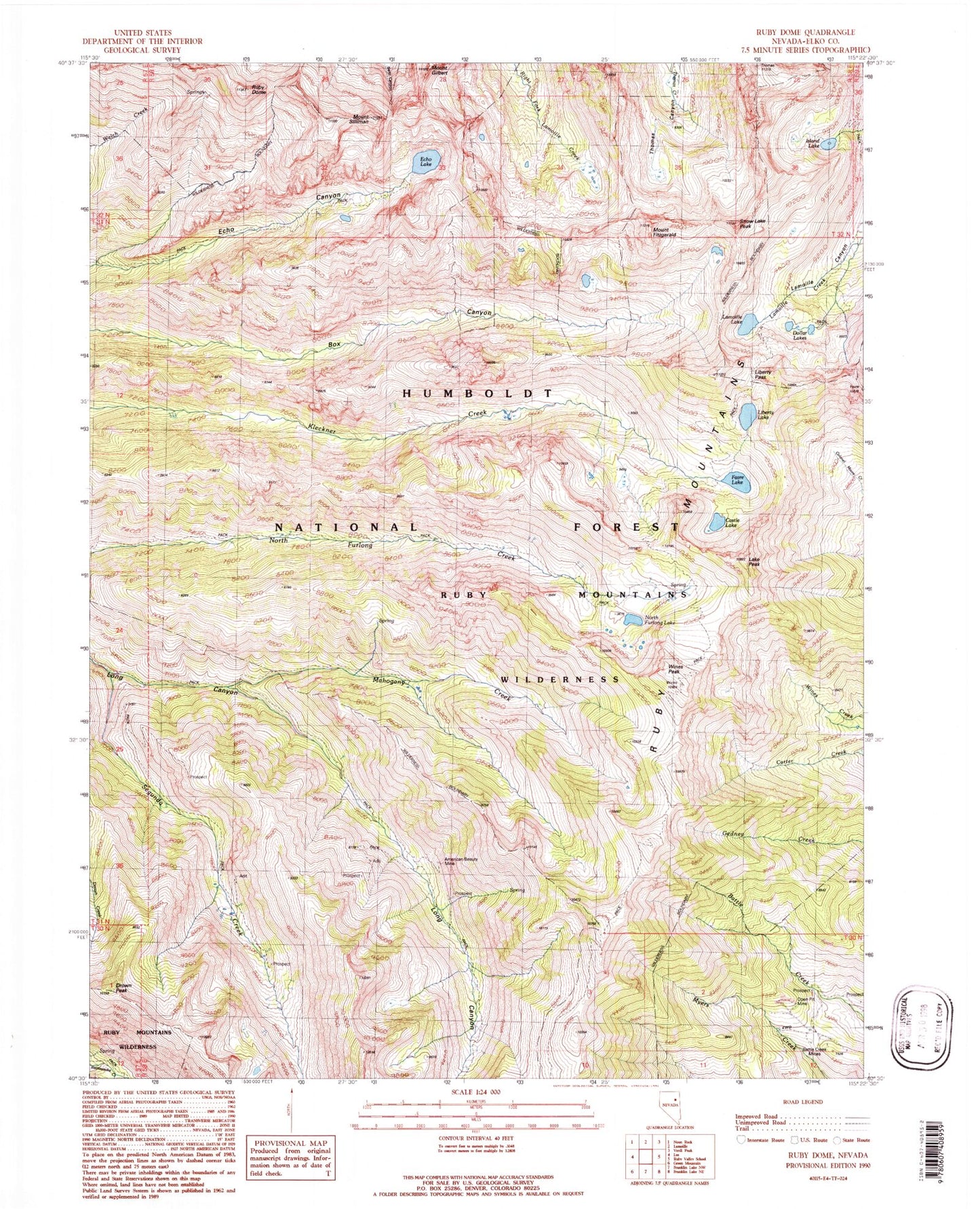
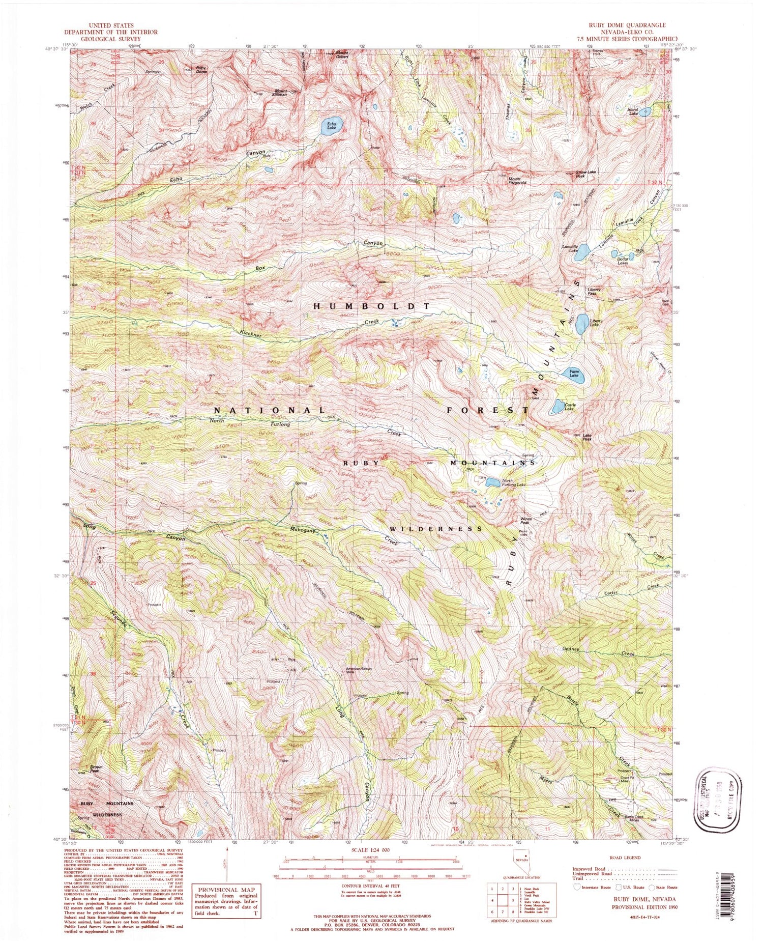
USGS Classic Ruby Dome Nevada 7.5'x7.5' Topo Map
Couldn't load pickup availability
Historical USGS topographic quad map of Ruby Dome in the state of Nevada. Scale: 1:24000. Print size: 24" x 27"
This quadrangle is in the following counties: Elko.
The map contains contour lines, roads, rivers, towns, lakes, and grids including latitude / longitude and UTM / MGRS. Printed on high-quality waterproof paper with UV fade-resistant inks.
Contains the following named places: Michigan Mine, Ruby Valley Mining District, American Beauty Mine, Battle Creek Mines, Castle Lake, Dollar Lakes, Drown Peak, Echo Lake, Favre Lake, Island Lake, Lake Peak, Lamoille Lake, Liberty Lake, Liberty Pass, Mahogany Creek, North Furlong Lake, Ruby Dome, Segunda Creek, Wines Peak, Mount Gilbert, Mount Fitzgerald, Snow Lake Peak, Ruby Mountains Scenic Area (historical), Hargrove Mine, Ruby Mountain Ranger District, Ruby Crest National Recreation Trail Head, Roads End Picnicking Site, Mount Silliman, Ruby Mountains Wilderness, Goat Lake