MyTopo
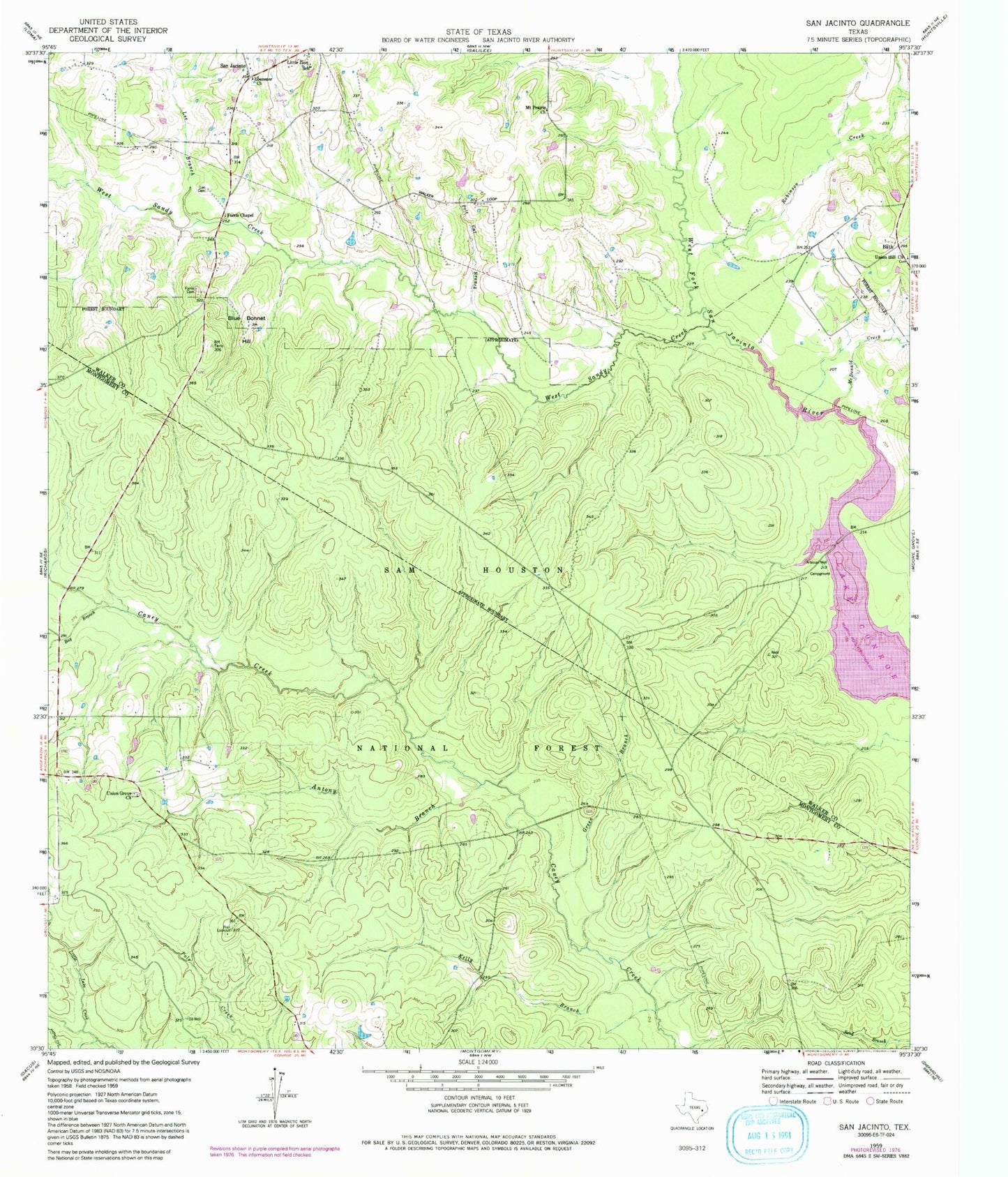
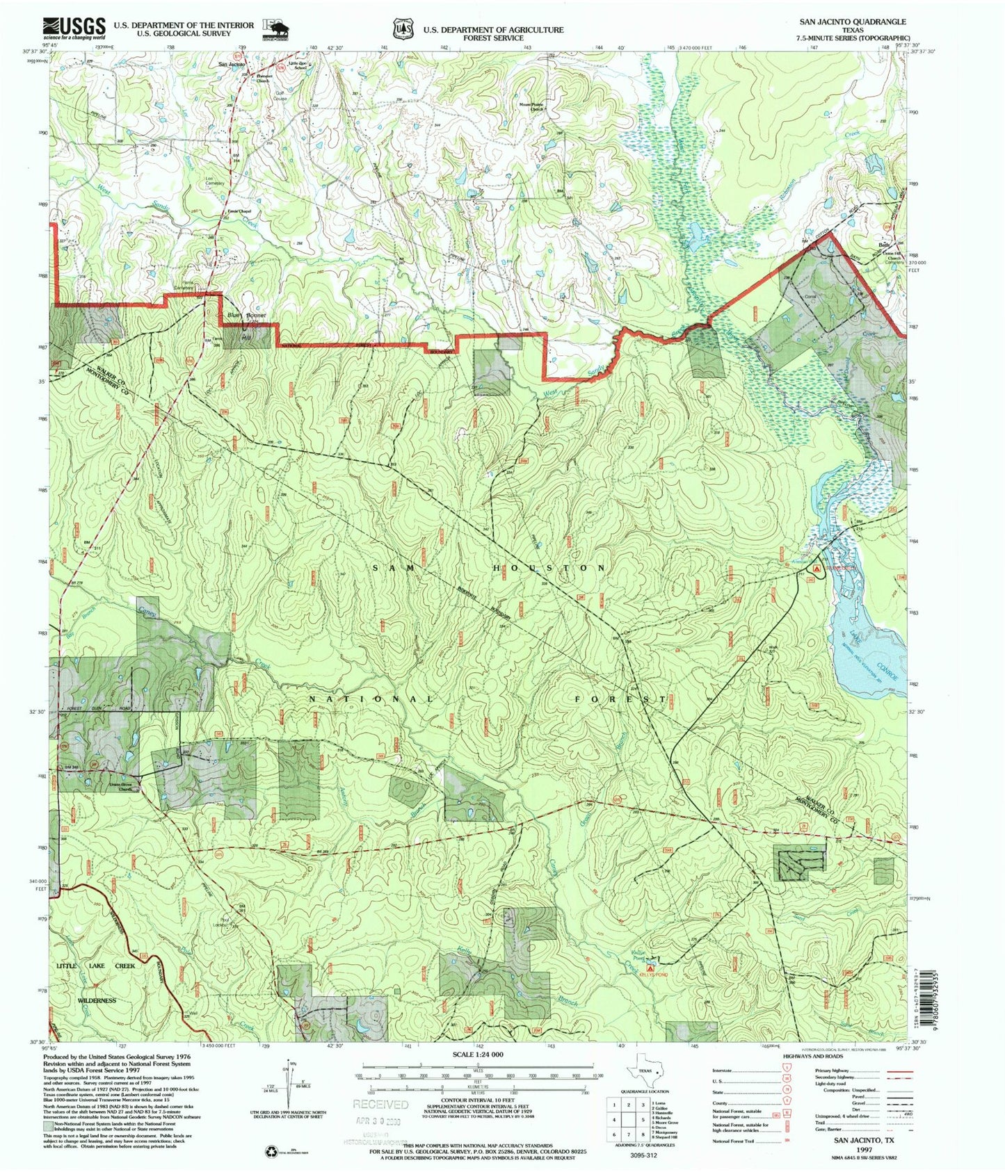
USGS Classic San Jacinto Texas 7.5'x7.5' Topo Map
Couldn't load pickup availability
Historical USGS topographic quad map of San Jacinto in the state of Texas. Scale: 1:24000. Print size: 24" x 27"
This quadrangle is in the following counties: Montgomery, Walker.
The map contains contour lines, roads, rivers, towns, lakes, and grids including latitude / longitude and UTM / MGRS. Printed on high-quality waterproof paper with UV fade-resistant inks.
Contains the following named places: Kelly Branch, Antony Branch, Bay Branch, Blue Bonnet Hill, Ebenezer Church, Farris Cemetery, Farris Chapel, Green Branch, Lee Branch, Lee Cemetery, Little Zion School, McDonald Creek, Mount Prairie Church, Pole Cat Branch, Pool Lookout, Robinson Creek, San Jacinto, Union Grove Church, Union Hill Church, West Sandy Creek, Kellys Pond Recreation Site, Stubblefield Recreation Site, Union Grove Cemetery, Stubblefield Lake Trail, Goshen