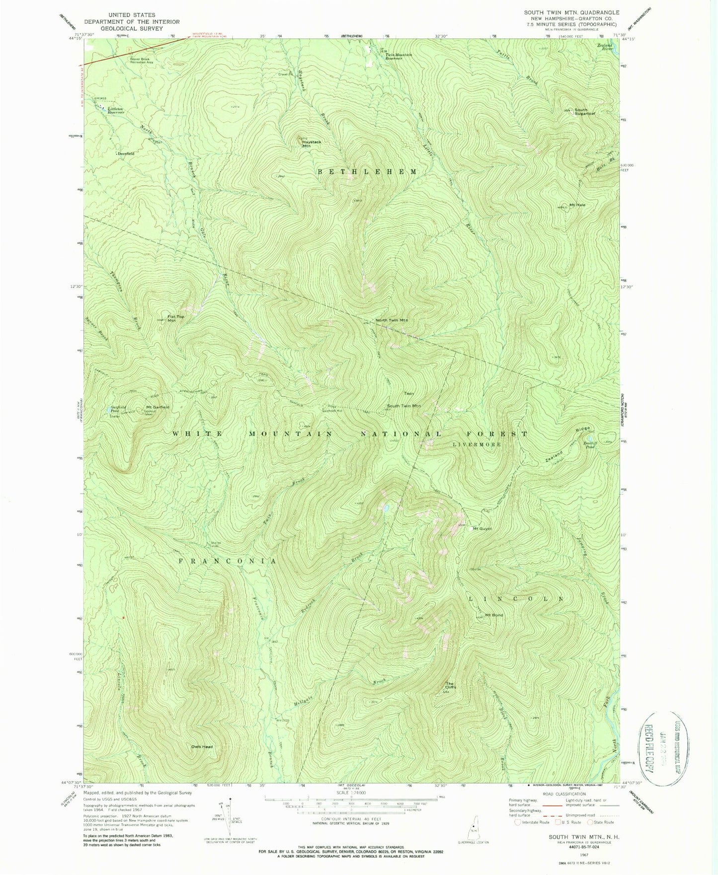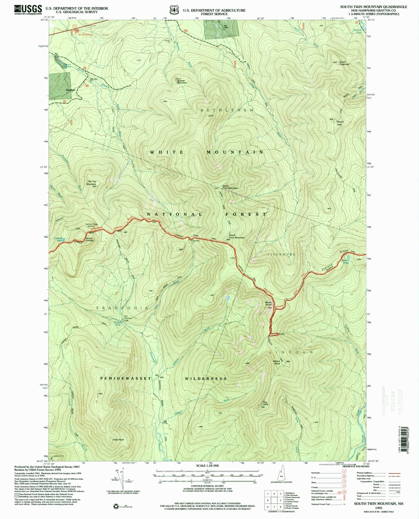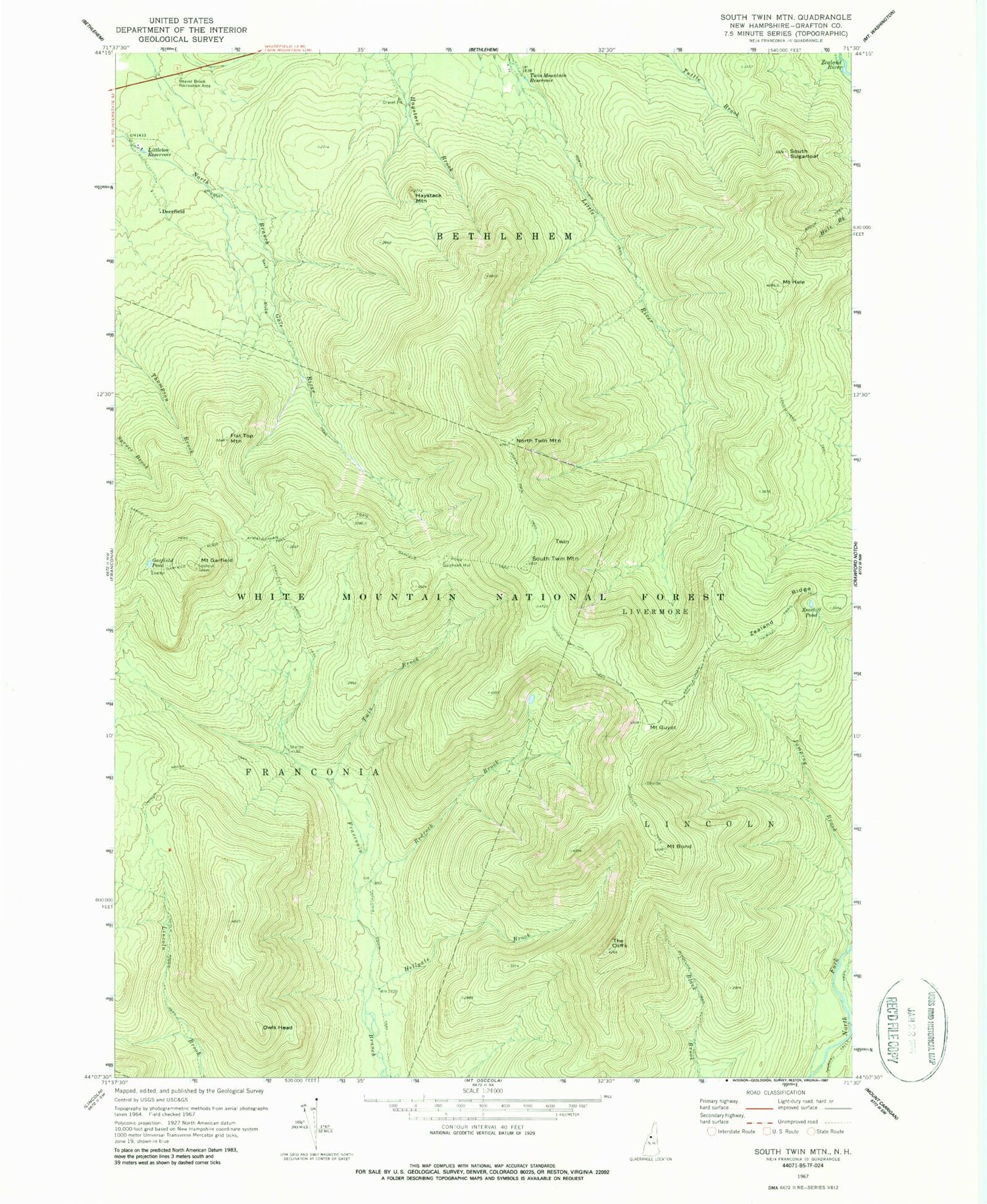
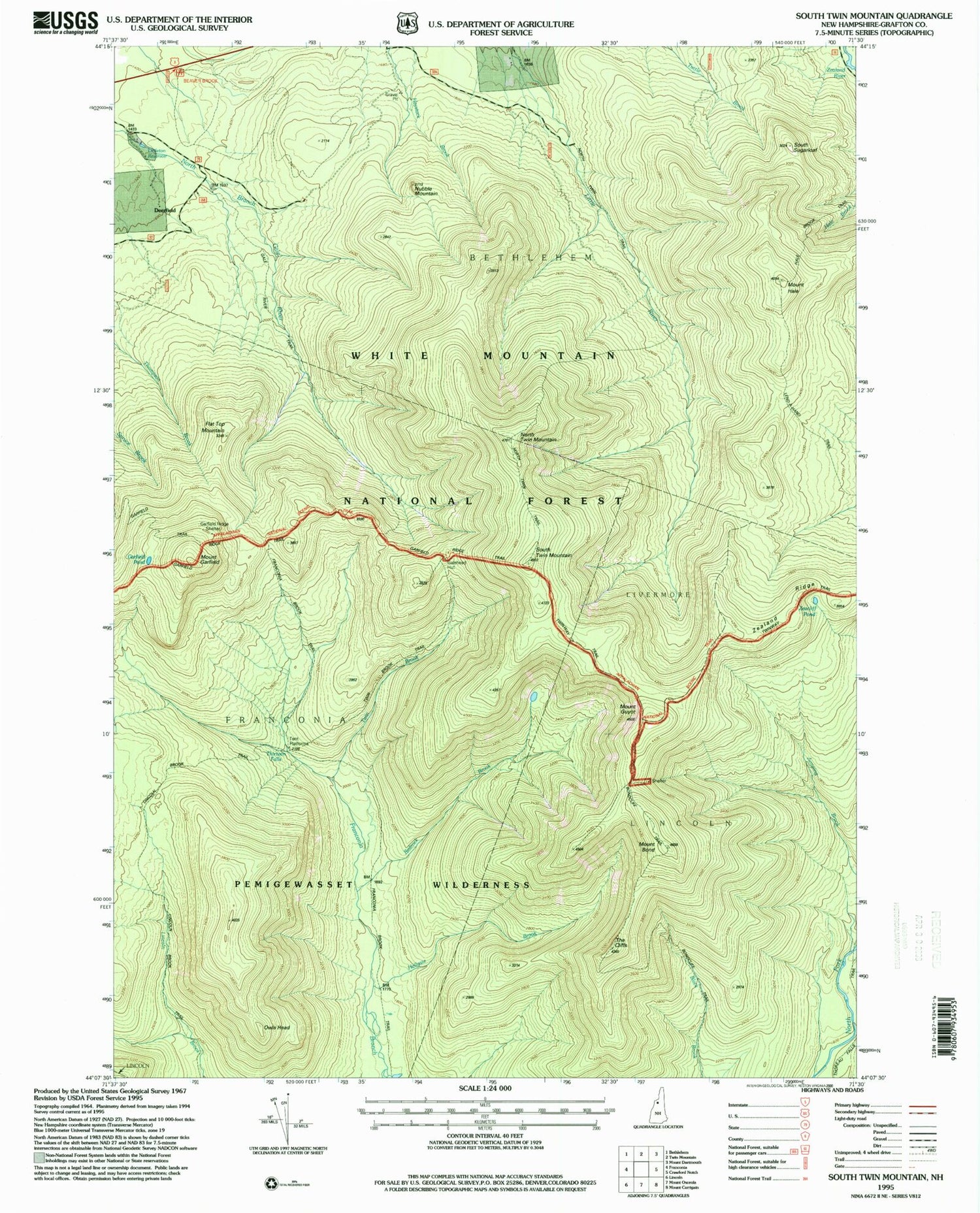
MyTopo
USGS Classic South Twin Mountain New Hampshire 7.5'x7.5' Topo Map
Couldn't load pickup availability
Historical USGS topographic quad map of South Twin Mountain in the state of New Hampshire. Scale: 1:24000. Print size: 24" x 27"
This quadrangle is in the following counties: Grafton.
The map contains contour lines, roads, rivers, towns, lakes, and grids including latitude / longitude and UTM / MGRS. Printed on high-quality waterproof paper with UV fade-resistant inks.
Contains the following named places: Beaver Brook Recreation Area, Mount Bond, Bondcliff Trail, Deerfield, Flat Top Mountain, Franconia Brook Trail, Gale River Trail, Galehead Hut, Garfield Pond, Garfield Ridge Trail, Mount Garfield, Mount Guyot, Hale Brook Trail, Mount Hale, Haystack Mountain, Hellgate Brook, Lend-A-Hand Trail, Lincoln Brook Trail, Littleton Reservoir, North Twin Mountain, North Twin Trail, North Twin Trail, Owls Head, Redrock Brook, South Sugarloaf, South Twin Mountain, The Cliffs, Twin Brook, Twin Mountain Reservoir, Twinway Trail, Zeacliff Pond, Zealand Ridge, Galehead Mountain, Thirteen Falls, Hawthorne Falls, Mount Guyot Shelter, Thirteen Falls Campsite, Pemigewasset Wilderness