MyTopo
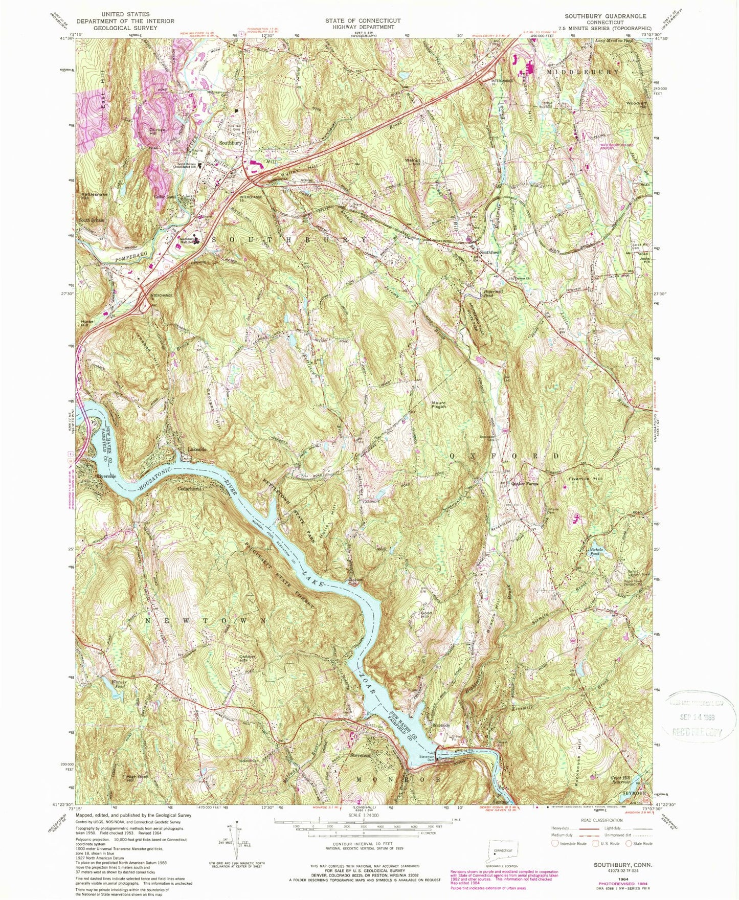
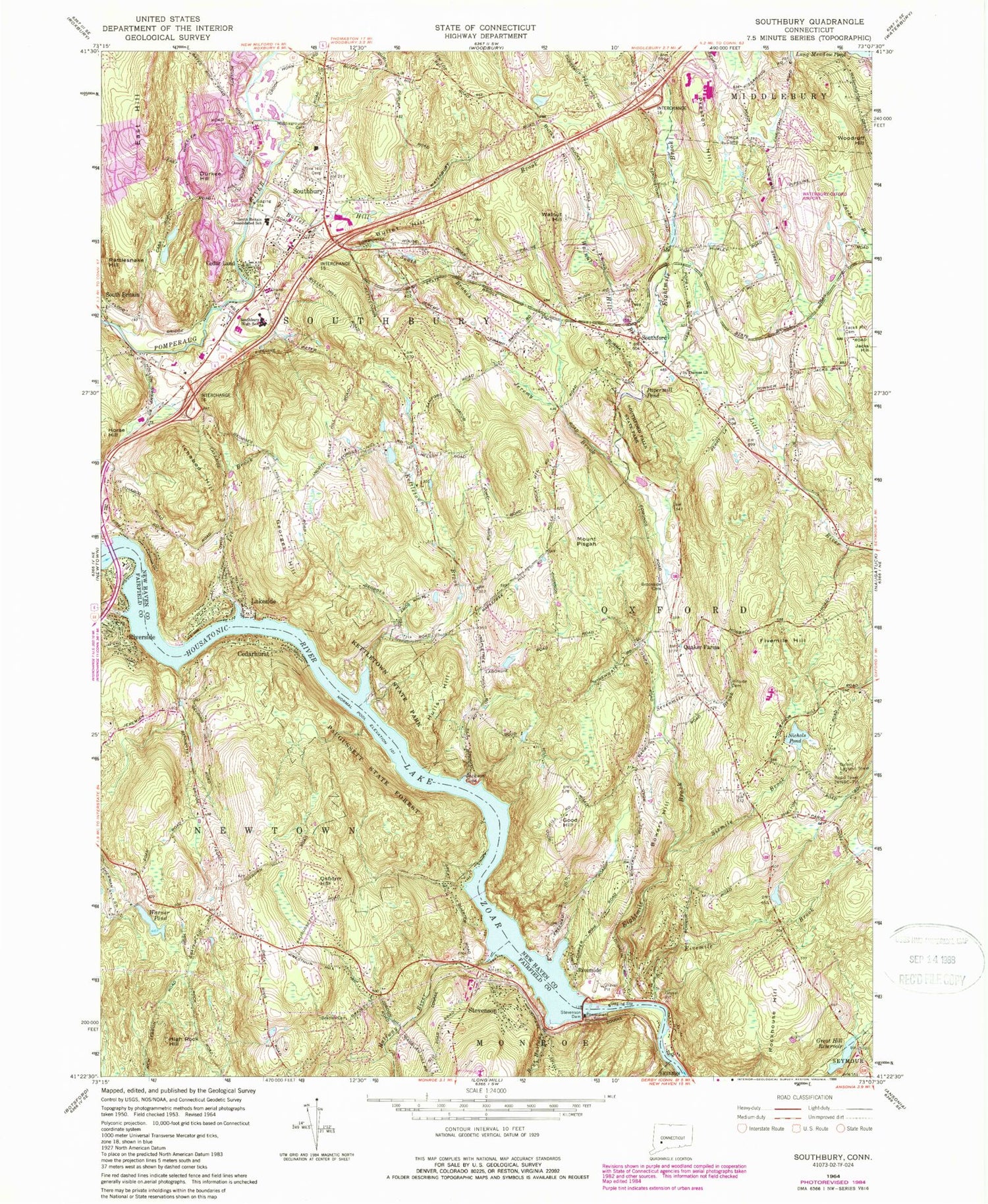
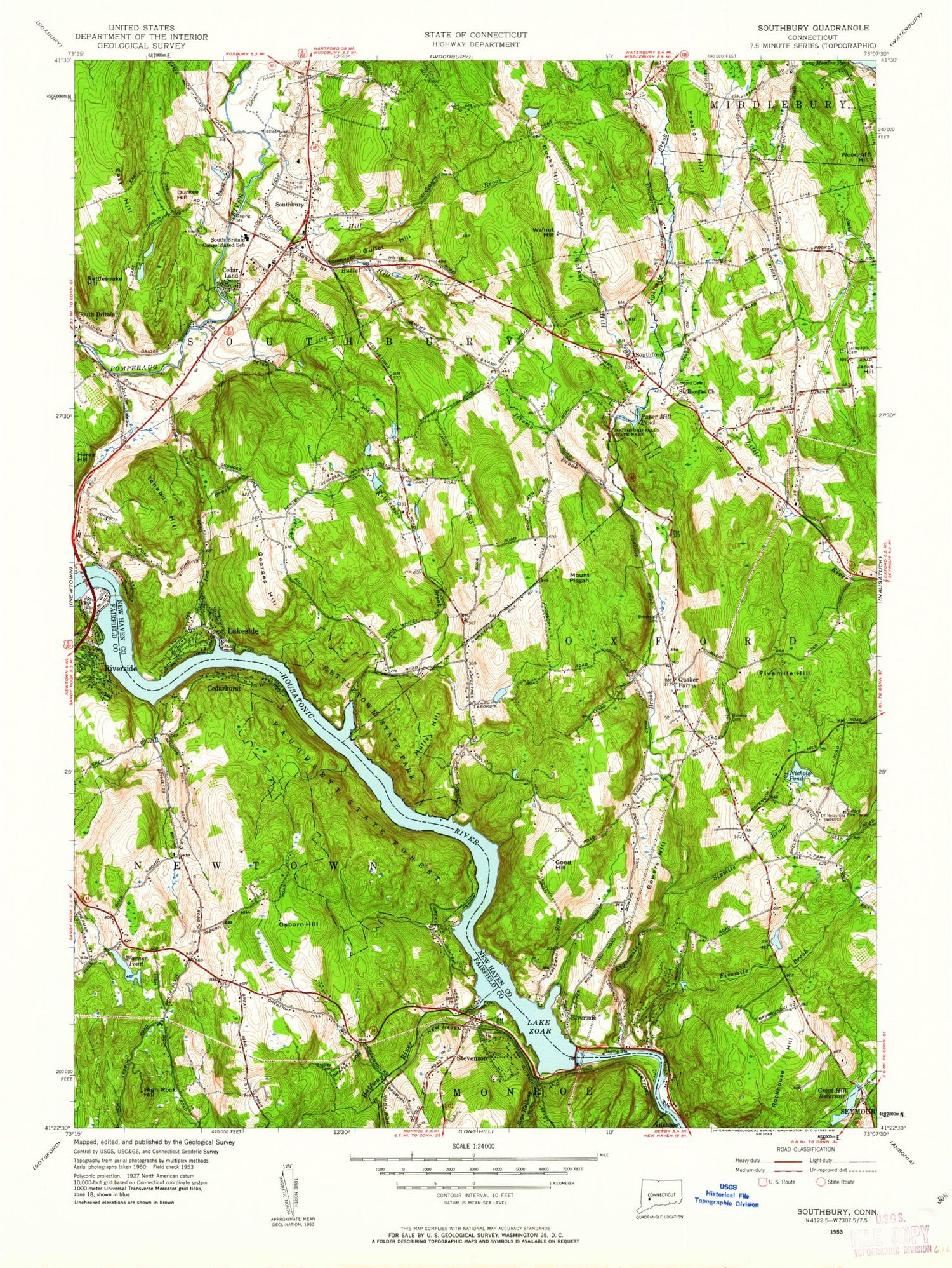
Classic USGS Southbury Connecticut 7.5'x7.5' Topo Map
Couldn't load pickup availability
Historical USGS topographic quad map of Southbury in the states of Connecticut, Massachusetts. Typical map scale is 1:24,000, but may vary for certain years, if available. Print size: 24" x 27"
This quadrangle is in the following counties: Fairfield, New Haven.
The map contains contour lines, roads, rivers, towns, and lakes. Printed on high-quality waterproof paper with UV fade-resistant inks, and shipped rolled.
Contains the following named places: Rockhouse Hill, Boys Halfway River, Bradley Cemetery, Brookside Cemetery, Bucks Hill, Bullet Hill, Bullet Hill Brook, Cedar Land, Cedarhurst, Durkee Hill, Eightmile Brook, Fivemile Brook, Fivemile Hill, Georges Hill, Good Hill, Great Hill Reservoir, High Rock Hill, Hillside Cemetery, Hulls Hill, Ichabod Hill, Jacks Hill Cemetery, Jackson Cove, Jeremy Brook, Kettletown Brook, Kettletown State Park, Lakeside, Lee Brook, Middleground Cemetery, Nichols Pond, Osborn Hill, Papermill Pond, Paugussett State Forest, Pine Hill Cemetery, Mount Pisgah, Pole Bridge Brook, Preston Hill, Quaker Farms, Rattlesnake Hill, Riverside, Riverside, Round Hill Brook, Saint Thomas Church, Sevenmile Brook, Sixmile Brook, South Branch Bullet Hill Brook, South Britain Consolidated School, Southbury, Southbury High School, Southford, Southford Falls State Park, Stevenson, Stevenson Dam, Walnut Hill, Walnut Hill Brook, Warner Pond, Lake Zoar, Oxford Lookout Tower, Waterbury-Oxford Airport, Town of Oxford, Town of Southbury, Great Hill Reservoir Dam, Warner Pond Dam, Heritage Village, Platt Park, Pomperaug Golf Club, Quaker Farms School, Sacred Heart Church, Southbury Historic District Number 1, Southbury Playhouse, Southbury Post Office, Southbury Public Library, Southbury Shopping Plaza, Southford Cemetery, Union Square, United Church of Christ, Bowers Hill, Bowers Hill, Bullet Hill School House, Christ Church, Church of the Epiphany, Edward Park, Great Oak School, Heritage Country Club, Jackson Cove Park, Kettletown, Lake Zoar Wildlife Area, Stevenson Station, Heritage Village Census Designated Place, Southbury Fire Marshal's Office, Southbury Volunteer Fire Department, Oxford Volunteer Fire Department Quaker Farms Company, Oxford Volunteer Fire Department Riverside Company, Southbury Volunteer Fire Department South Britain Fire House, Stevenson Volunteer Fire Company Station 1 Headquarters, Sandy Hook Fire Rescue Company Station 2, Southbury Volunteer Fire Department Southford Fire House, Heritage Village Ambulance Association, Southbury Ambulance Association, Southbury Police Department, Connecticut State Police Troop A - Southbury, Sandy Hook Census Designated Place, Tyringham Cobble Park