MyTopo
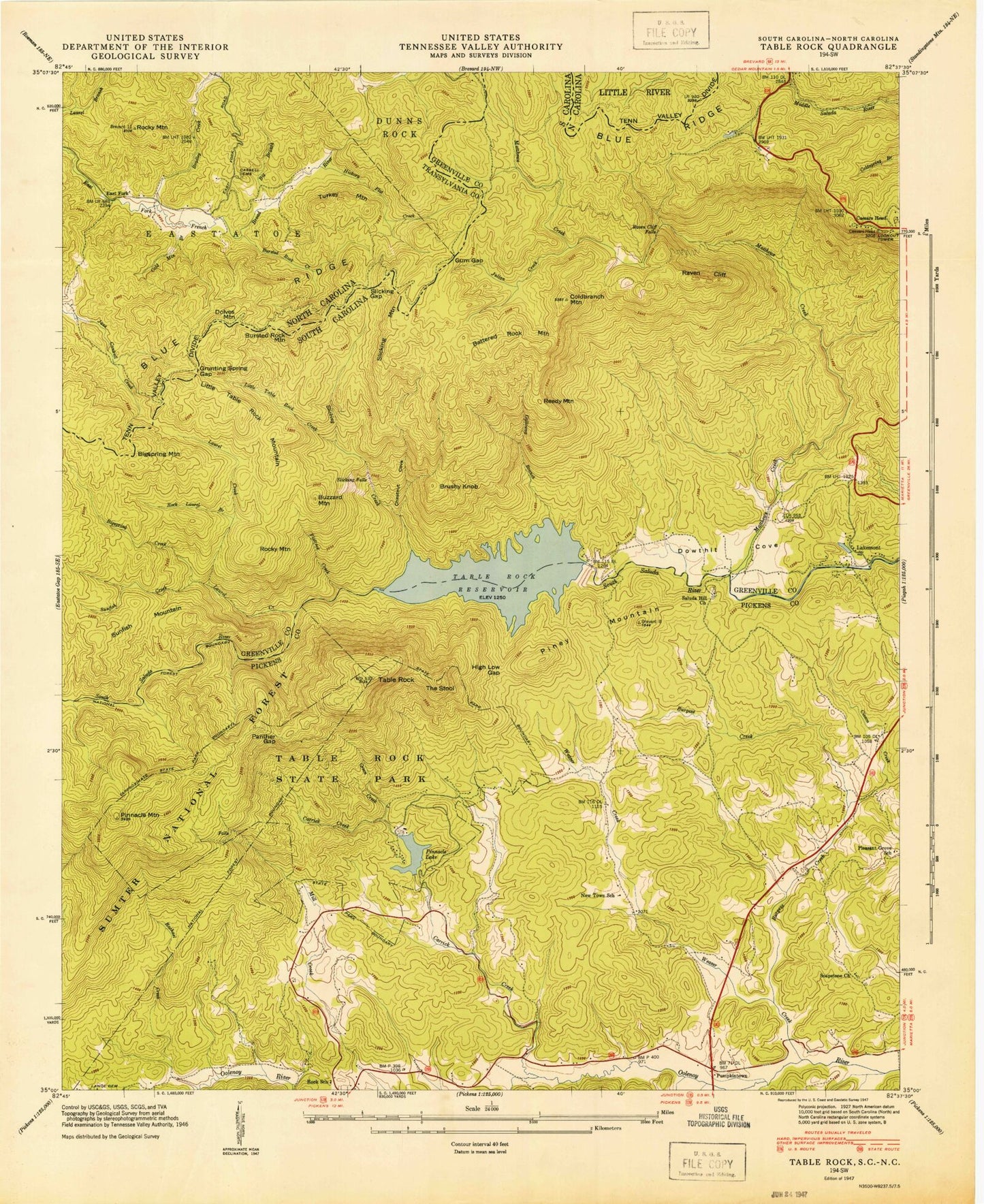
USGS Classic Table Rock South Carolina 7.5'x7.5' Topo Map
Couldn't load pickup availability
Historical USGS topographic quad map of Table Rockin the states of South Carolina, North Carolina. Scale: 1:24000. Print size: 24" x 27"
This quadrangle is in the following counties: Greenville, Pickens, Transylvania.
The map contains contour lines, roads, rivers, towns, lakes, and grids including latitude / longitude and UTM / MGRS. Printed on high-quality waterproof paper with UV fade-resistant inks.
Contains the following named places: Grunting Spring Gap, Gum Gap, Slicking Gap, Bursted Rock Mountain, Dolves Mountain, Little Table Rock Mountain, Adams Creek, Bigspring Creek, Burgess Creek, Chestnut Cove, Cissom Creek, Dowthit Cove, Flatrock Creek, Galloway Branch, Green Creek, High Low Gap, Julian Creek, Lynch Cemetery, Little Table Rock Creek, New Town School, Panther Gap, Pinnacle Lake, Pinnacle Mountain, Raven Cliff, Raven Cliff Falls, Rock Laurel Branch, Rock School, Slicking Creek, Sunfish Creek, Table Rock, Table Rock State Park, Weaver Creek, Battered Rock Mountain, Bigspring Mountain, Brushy Knob, Buzzard Mountain, Little Table Rock Mountain, Piney Mountain, Reedy Mountain, Rocky Mountain, Slicking Mountain, Sunfish Mountain, The Stool, South Carolina Noname 23026 Dam, Table Rock Cove, South Carolina Noname 39006 D-1946 Dam, Pinnacle Lake, Burgess Creek Dam D-1945, Methodist Pond Dam D-0044, Methodist Pond, Lawton Lake Dam D-2825, Lawton Lake, Knob (historical), Liberia, Miracle Hill School, Soapstone School (historical), Table Rock State Park Historic District, Saluda Hill Baptist Church Graveyard, Caesars Head Mountain, Douthetts Cove School (historical), Table Rock Bridge, Bensons Mill (historical), Lakemont, Laurel Creek, Matthews Creek, Carrick Creek, Coldbranch Mountain, New Hope Baptist Church, Pumpkintown, Saluda Hill Church, Slicking Falls, Soapstone Church, Table Rock Reservoir, Douthels Ford, Reeds Run, Pumpkintown Fire Department, River Falls Fire Department Station 2, Big Branch, Bursted Rock Creek, Big Hill Cemetery, Cold Mountain Branch, Grunting Spring Gap, Gum Gap, Hickory Flat Creek, Rocky Mountain, Slicking Gap, East Fork, Pine Shore Lakes, Bradley Creek, Bursted Rock Mountain, Dolves Mountain, Little Table Rock Mountain, Turkey Mountain, Bigspring Mountain, Slicking Mountain