MyTopo
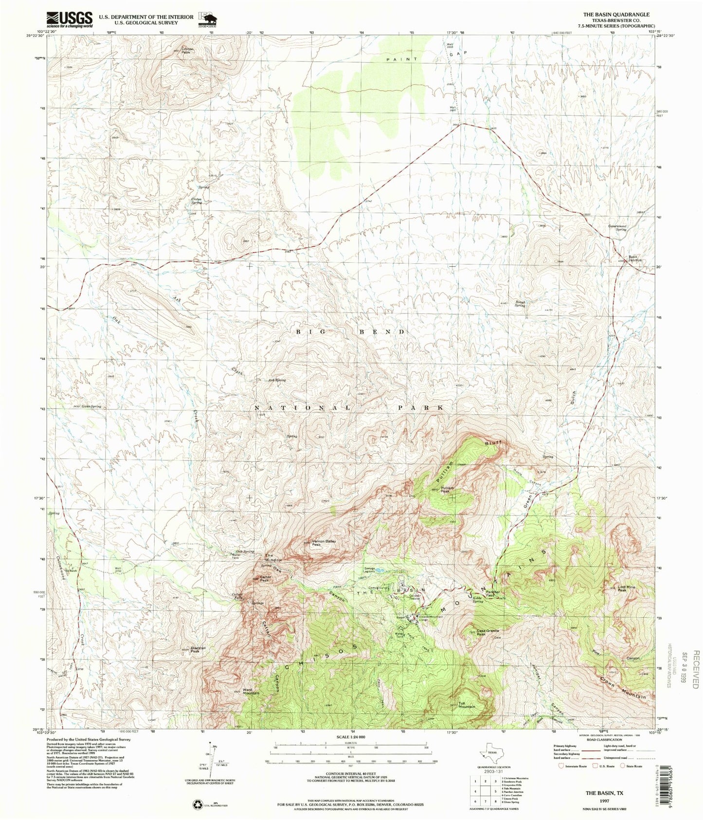
USGS Classic The Basin Texas 7.5'x7.5' Topo Map
Couldn't load pickup availability
Historical USGS topographic quad map of The Basin in the state of Texas. Scale: 1:24000. Print size: 24" x 27"
This quadrangle is in the following counties: Brewster.
The map contains contour lines, roads, rivers, towns, lakes, and grids including latitude / longitude and UTM / MGRS. Printed on high-quality waterproof paper with UV fade-resistant inks.
Contains the following named places: Ash Creek, Ash Spring, Blacktail Peak, Casa Grande Peak, Chisos Mountain Lodge, Croton Peak, Croton Spring, Crown Mountain, Kibbe Spring, Lost Mine Peak, Oak Canyon, Panther Pass, Pulliam Bluff, Rough Spring, The Window, Toll Mountain, Ward Mountain, Boot Canyon, Cattail Canyon, Cattail Falls, Carter Peak, Gano Spring, Government Spring, Maple Canyon, Oak Spring, Old Ranch, Paint Gap, Pulliam Peak, The Basin, Vernon Bailey Peak, Rough Mountain, Basin Junction, Mount Huffman, Cattail Falls Spring, Window Springs, Basin Loop, The Window Trail, Lost Mine Trail, Juniper Canyon Trail