MyTopo
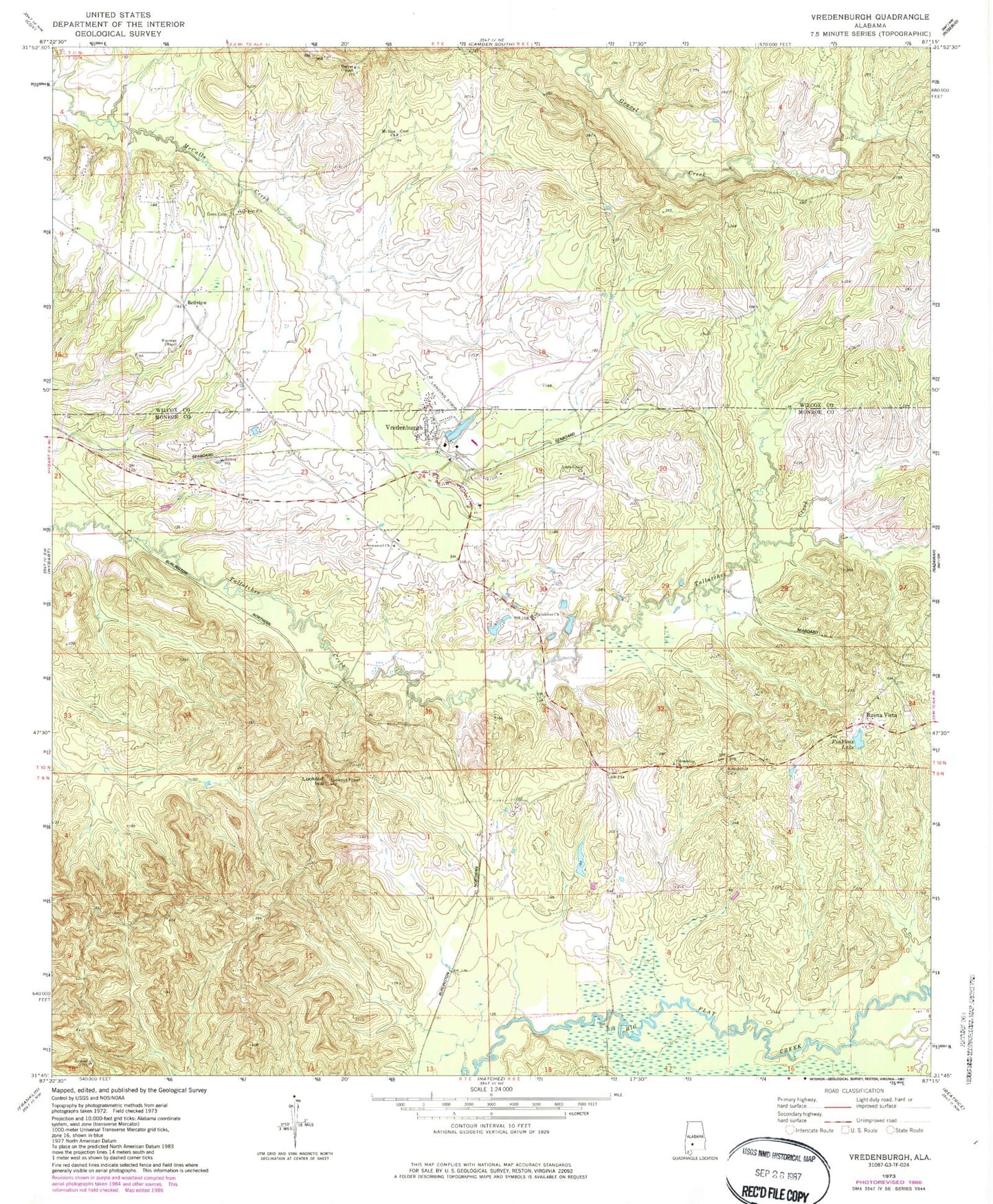
Classic USGS Vredenburgh Alabama 7.5'x7.5' Topo Map
Couldn't load pickup availability
Historical USGS topographic quad map of Vredenburgh in the state of Alabama. Map scale may vary for some years, but is generally around 1:24,000. Print size is approximately 24" x 27"
This quadrangle is in the following counties: Monroe, Wilcox.
The map contains contour lines, roads, rivers, towns, and lakes. Printed on high-quality waterproof paper with UV fade-resistant inks, and shipped rolled.
Contains the following named places: Apple Grove Baptist Church, Apple Grove Cemetery, Basidonia Cemetery, Bellview, Buena Vista Cemetery, Concord Baptist Church, Dees Cemetery, Dry Creek, Finkleas Lake, Friendship Church, Friendship School, Glorious Holy Church, Immanuel Church, Lookout Hill, Lookout Hill Fire Tower, Macedonia Church, Magdalene Church, Mount Zion Baptist Church, Oak Grove School, Pine Lake Dam, Reeves Chapel, Shannon Lake, Shannon Lake Dam, Tallatchee Church, Town of Vredenburgh, Vredenburgh, Vredenburgh Junior High School, Vredenburgh Post Office, Vredenburgh Volunteer Fire Department, Waymon Chapel African Methodist Episcopal Church