MyTopo
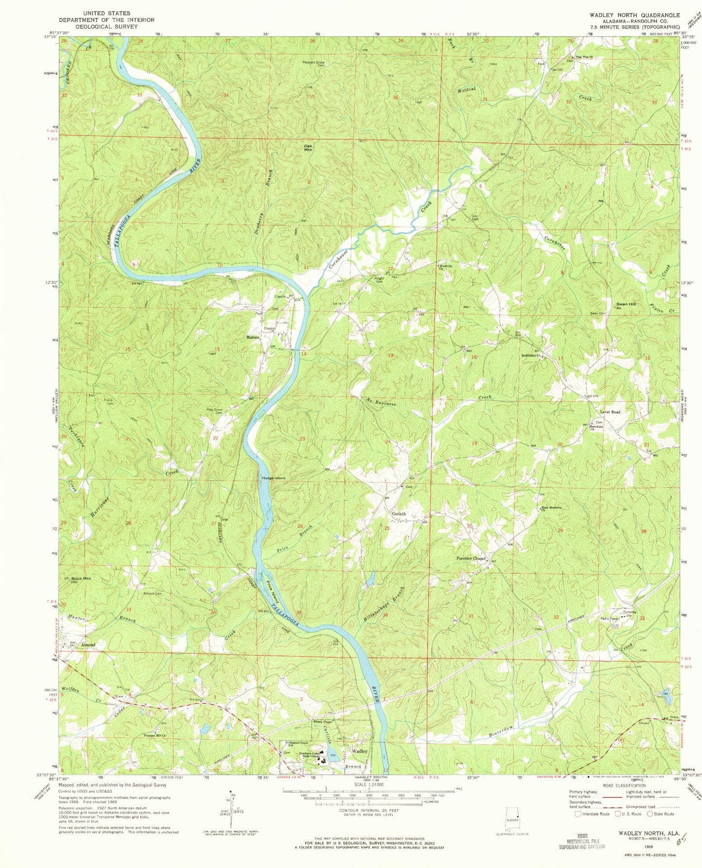
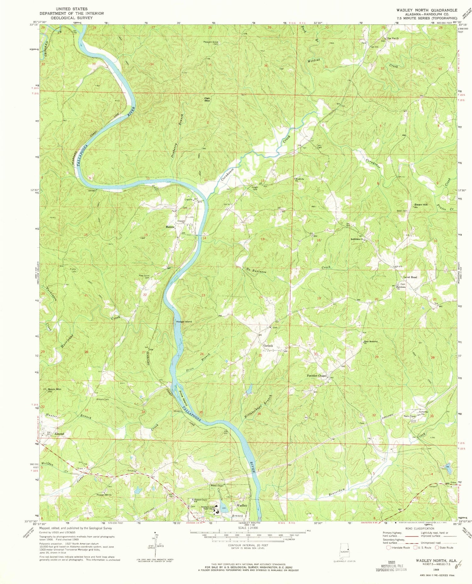
Classic USGS Wadley North Alabama 7.5'x7.5' Topo Map
Couldn't load pickup availability
Historical USGS topographic quad map of Wadley North in the state of Alabama. Map scale may vary for some years, but is generally around 1:24,000. Print size is approximately 24" x 27"
This quadrangle is in the following counties: Randolph.
The map contains contour lines, roads, rivers, towns, and lakes. Printed on high-quality waterproof paper with UV fade-resistant inks, and shipped rolled.
Contains the following named places: Almond, Almond Church, Antioch Cemetery, Atchinalgi, Beaverdam Creek, Bethlehem Church, Big Hunting Club, Buck Branch, Buck Mountain, Cedar Creek, College Lake, College Lake Dam, Concord, Concord Cemetery, Concord Church, Corinth, Corinth Church, Corinth Volunteer Fire Department, Cornhouse Creek, Crooked Creek, Dewberry Branch, Fisher Cemetery, Fixico Creek, Forester Chapel, Forester Chapel Church, Frost Dam, Frost Lake, Gay Cemetery, Hillabeehago Branch, Hodge Island, Hope Memorial Church, Hunter Branch, Hurricane Creek, Knight Cemetery, Knight Dam, Level Road, Macedonia Church, Malone, Malone Cemetery, Malone Church, Malone Ferry, No Business Creek, Oak Mountain, Pine Flat Church, Pine Grove Cemetery, Pleasant Grove Cemetery, Pleasant Grove School, Pleasant Hill Cemetery, Pleasant Hill Church, Price Branch, Price Island, Southern Union State College, Stephens Mill, Swan Cemetery, Swan Hill, Transco Dam, Turkeypen Creek, Wadley Division, Wellborne Ferry, Whites Chapel, Wildcat Creek, Wolfpen Creek, Woodville Church, ZIP Code: 36276