
MyTopo
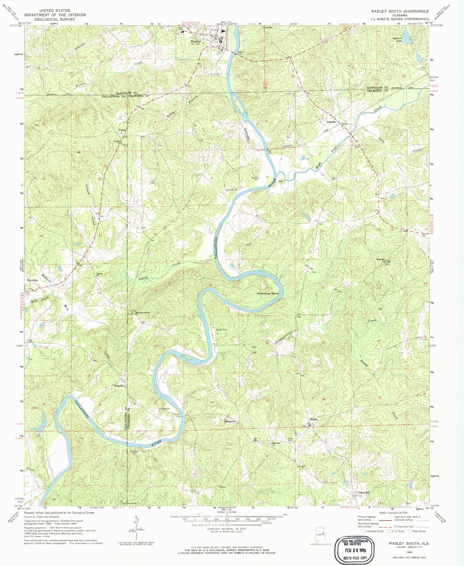
Classic USGS Wadley South Alabama 7.5'x7.5' Topo Map
Couldn't load pickup availability
Historical USGS topographic quad map of Wadley South in the state of Alabama. Map scale may vary for some years, but is generally around 1:24,000. Print size is approximately 24" x 27"
This quadrangle is in the following counties: Chambers, Randolph, Tallapoosa.
The map contains contour lines, roads, rivers, towns, and lakes. Printed on high-quality waterproof paper with UV fade-resistant inks, and shipped rolled.
Contains the following named places: Abanda, Abanda Baptist Church, Abanda Cemetery, Abanda Census Designated Place, Abanda Fire and Rescue, Antioch Church, Bailey Cemetery, Beulah Cemetery, Beulah Church, Bibby Family Cemetery, Bibbys Ferry, Bishop Ferry, Blake, Bosworth, Carlisle Branch, Caty Creek, Chesnut Fork Church, Chikasanoxee Creek, Clegg and Pearson Dam, Clegg and Pearson Lake, Concord Dam, Concord Lake, Darian Cemetery, Darian Primitive Baptist Church, Denny Ferry, Denver Church, Ebenezer Cemetery, Ebenezer Church, Fredrick Ferry, Frog Eye, Greasy Creek, High Pine Creek, Hodnett Mill Creek, Hopewell Cemetery, Hopewell Church, Hutton Creek, Johnson Ferry, Laney Creek, Louina, Mill Creek, Milltown Division, Monaghan Dam, Monaghan Lake, Mountain Spring Church, Mountain Springs Cemetery, Muleshoe Bend, Pleasant Grove Church, Rocky Branch, Sandy Creek, Shiloh, Shiloh Baptist Church, Shiloh Cemetery, Sims Cemetery, Sparkling Springs, Town of Wadley, Truett, Union Hill, Wadley, Wadley Cemetery, Wadley High School, Wadley Police Department, Wadley Post Office, Wadley Volunteer Fire Department, Wait Ferry


