MyTopo
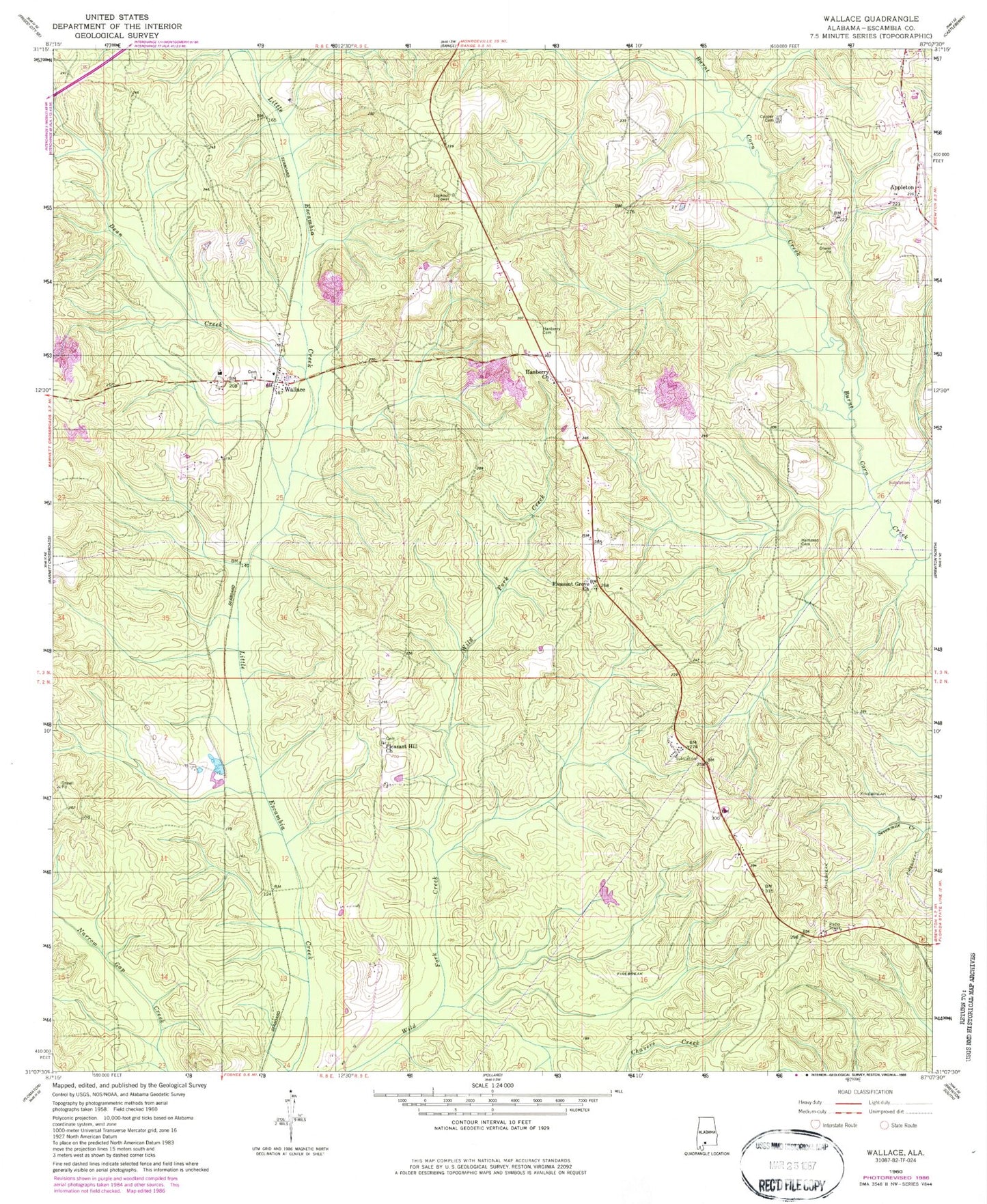
Classic USGS Wallace Alabama 7.5'x7.5' Topo Map
Couldn't load pickup availability
Historical USGS topographic quad map of Wallace in the state of Alabama. Map scale may vary for some years, but is generally around 1:24,000. Print size is approximately 24" x 27"
This quadrangle is in the following counties: Escambia.
The map contains contour lines, roads, rivers, towns, and lakes. Printed on high-quality waterproof paper with UV fade-resistant inks, and shipped rolled.
Contains the following named places: Appleton Church, Appleton Oil Field, Brewton Division, Cooper Cemetery, Dean Creek, Escambia County, Hammac Cemetery, Hammac Church, Hanberry Cemetery, Hanberry Church, Hanberry Church Oil Field, Huxford Still, Old Town Post Office, Pleasant Grove Church, Pleasant Hill Cemetery, Pleasant Hill Church, South Burnt Corn Creek Oil Field, Turpentine Camp, Wallace, Wallace Baptist Church, Wallace Church Cemetery, Wallace Oil Field, Wallace School, Wallace United Methodist Church, Wallace Volunteer Fire Department