MyTopo
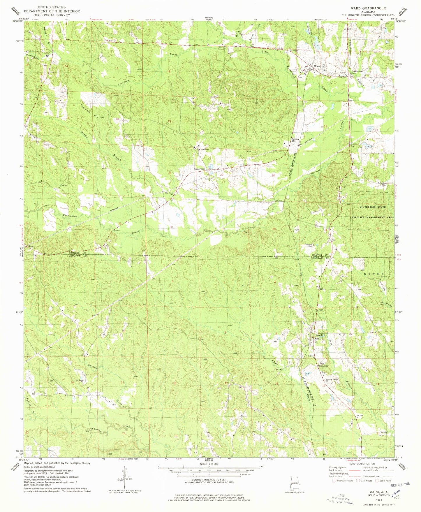
Classic USGS Ward Alabama 7.5'x7.5' Topo Map
Couldn't load pickup availability
Historical USGS topographic quad map of Ward in the state of Alabama. Map scale may vary for some years, but is generally around 1:24,000. Print size is approximately 24" x 27"
This quadrangle is in the following counties: Choctaw, Sumter.
The map contains contour lines, roads, rivers, towns, and lakes. Printed on high-quality waterproof paper with UV fade-resistant inks, and shipped rolled.
Contains the following named places: Beulah Baptist Church, Beulah Cemetery, Big Rack Club, Bogan Branch, Boone Branch, Chapel Branch, Charles, Cokes Chapel, Cokes Chapel Cemetery, Cokes Chapel Methodist Church, Cuba Head Start School, Fairfield Cemetery, Fairfield Christian Methodist Episcopal Church, Halsell, Halsell Church, Halsell United Methodist Church, Holiness Church, Hyndes Branch, John the Baptist Church, Johnson Creek, Kinterbish, Kinterbish State Wildlife Management Area, Little Kinterbish Creek, Means, Mount Moriah Baptist Church, Mundy Branch, Phelps Branch, Pine Grove Baptist Church, Pine Grove Cemetery, Shearon Cemetery, Silver Creek, Thomas E Huckabee Lake, Thomas E Huckabee Lake Dam, Thompson Branch, Thornton Creek, Thornton Hill, Ward, Ward Church, Ward Post Office, Ward Volunteer Fire Department