

MyTopo
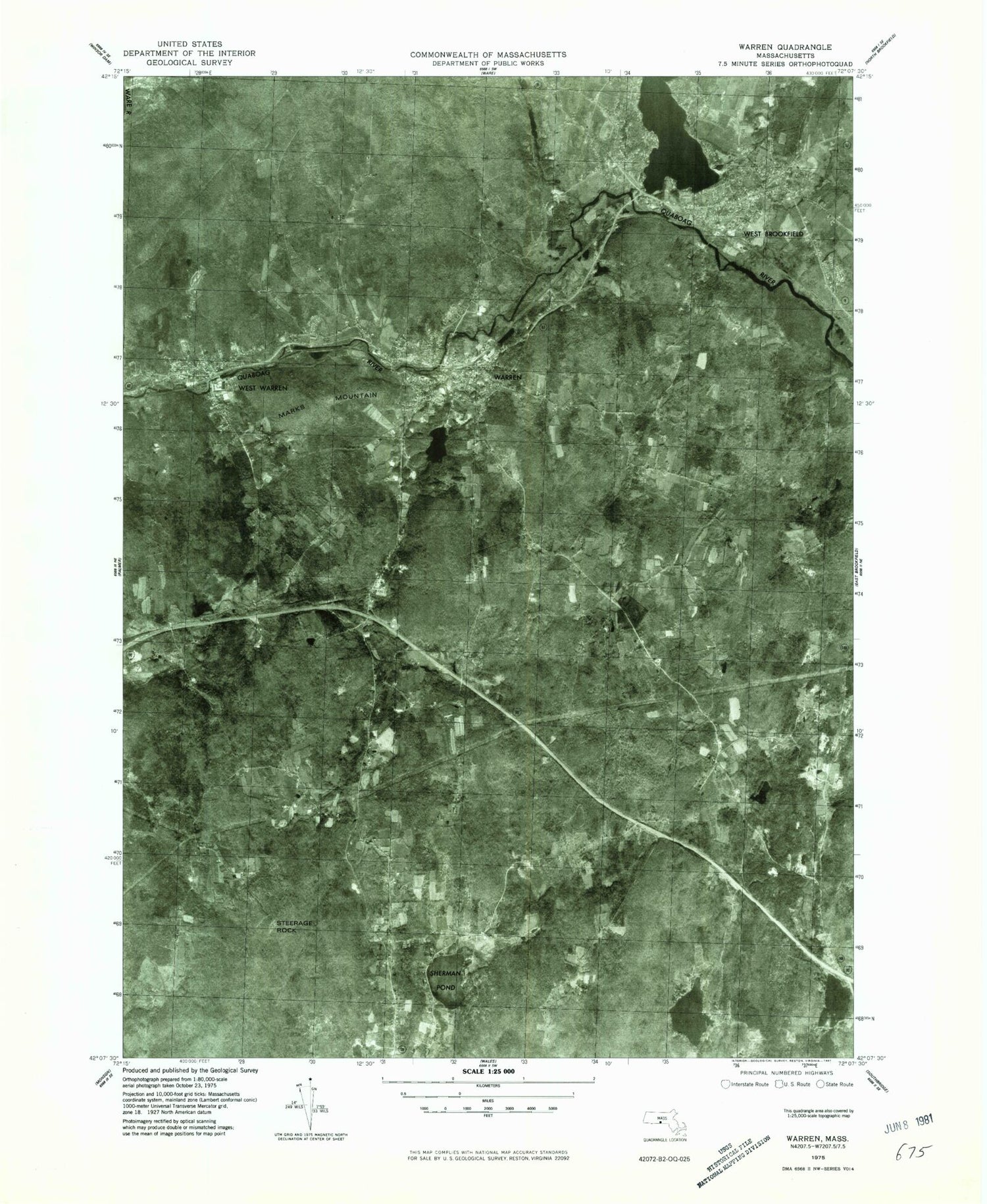
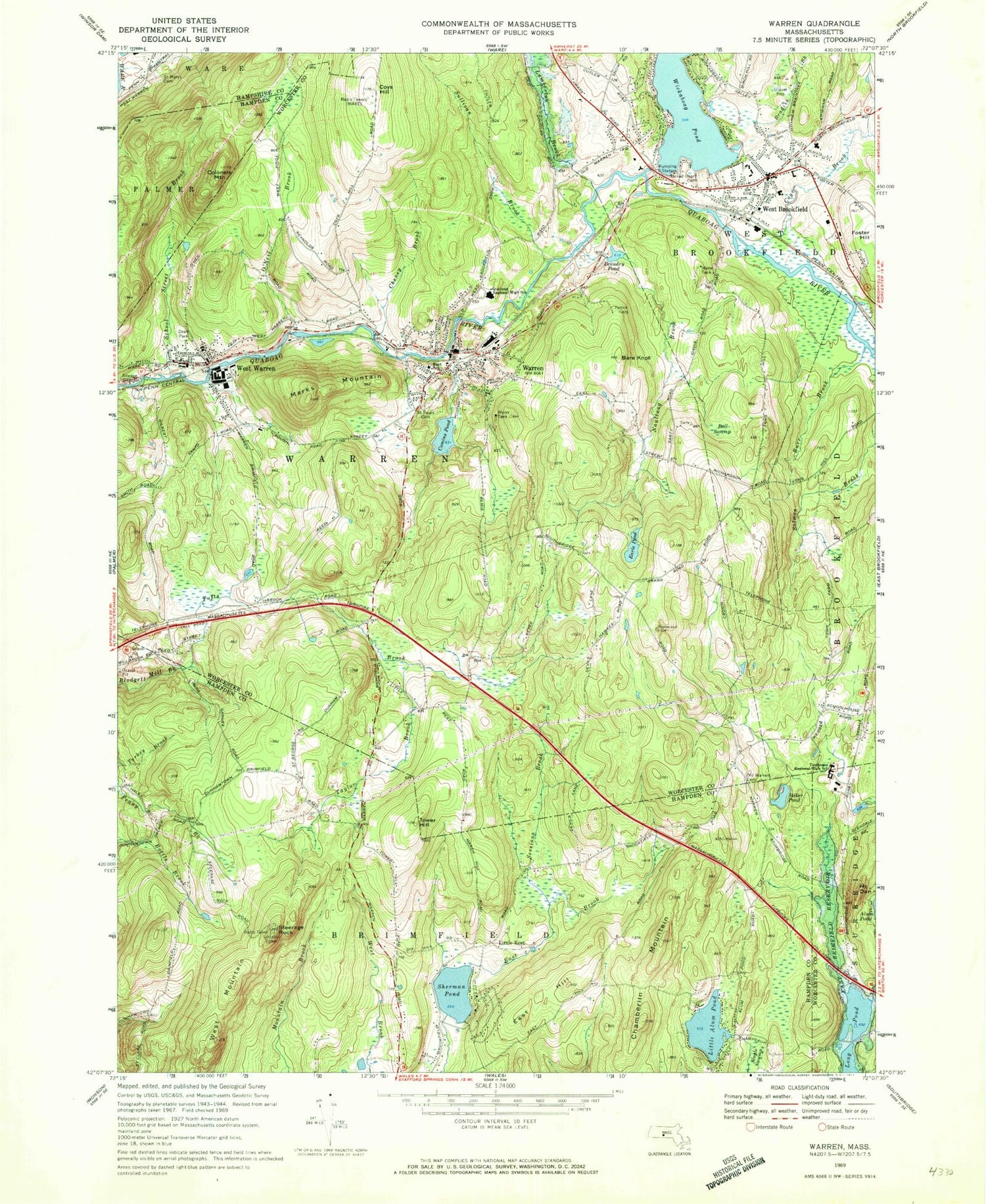
Classic USGS Warren Massachusetts 7.5'x7.5' Topo Map
Couldn't load pickup availability
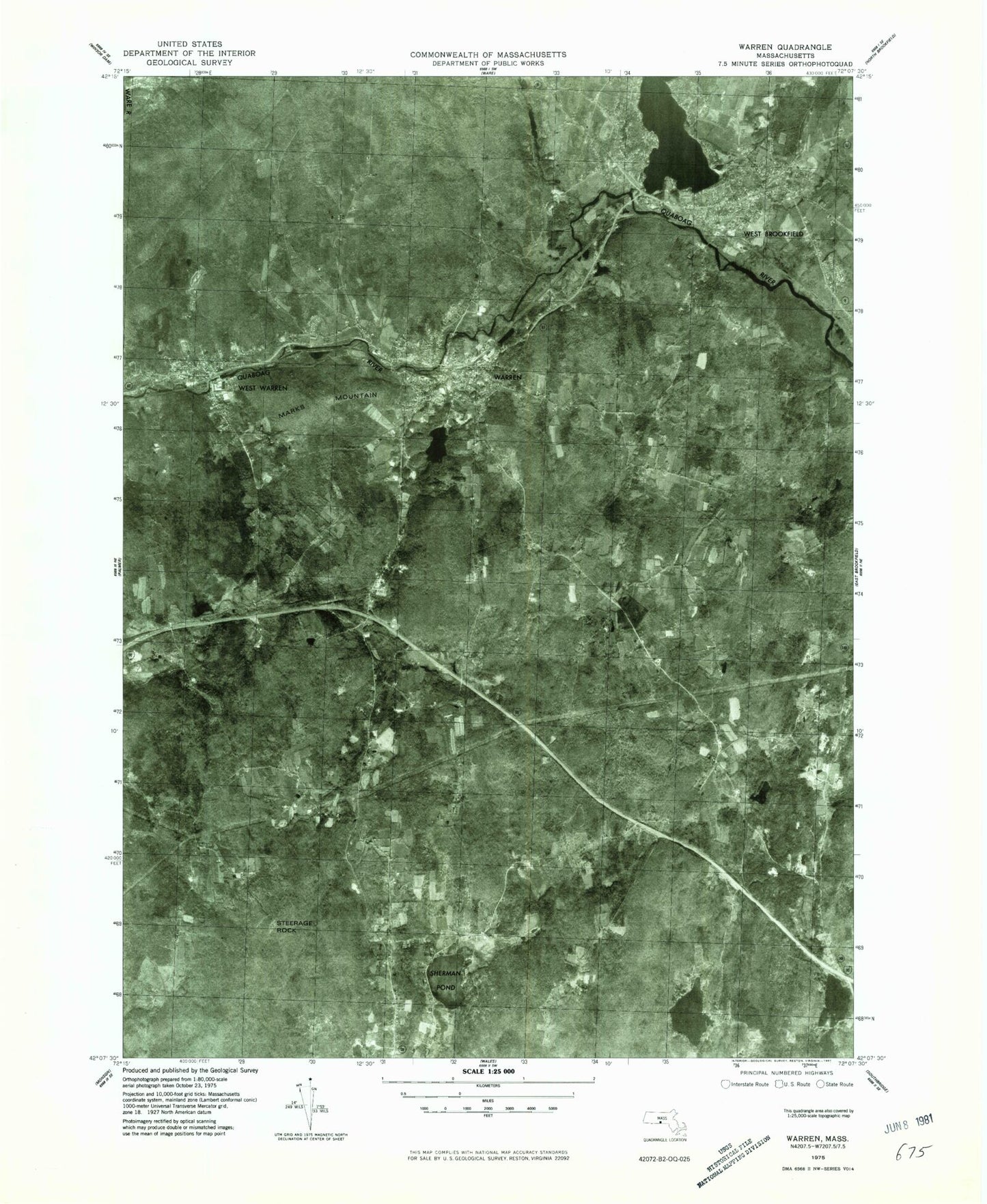
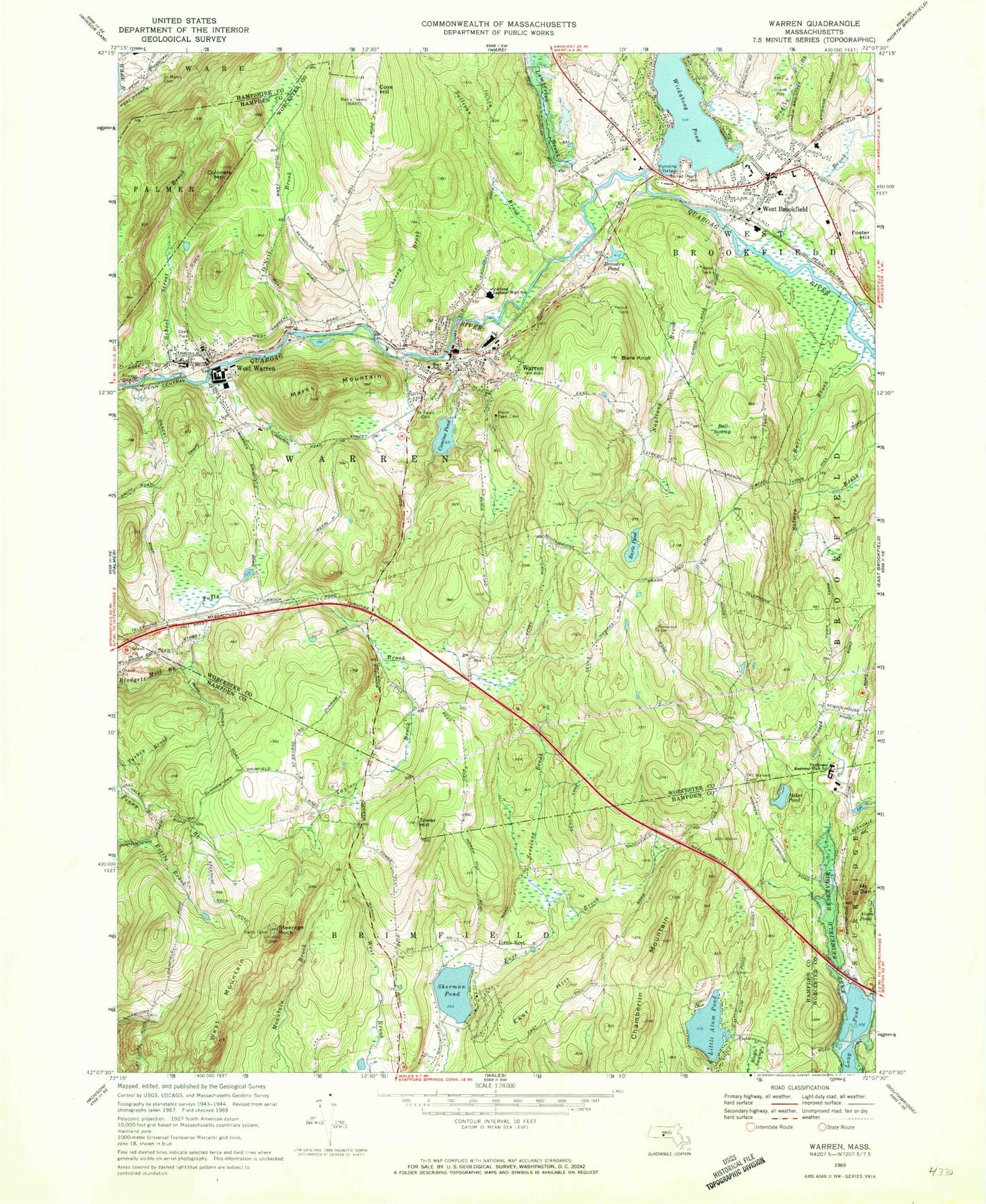
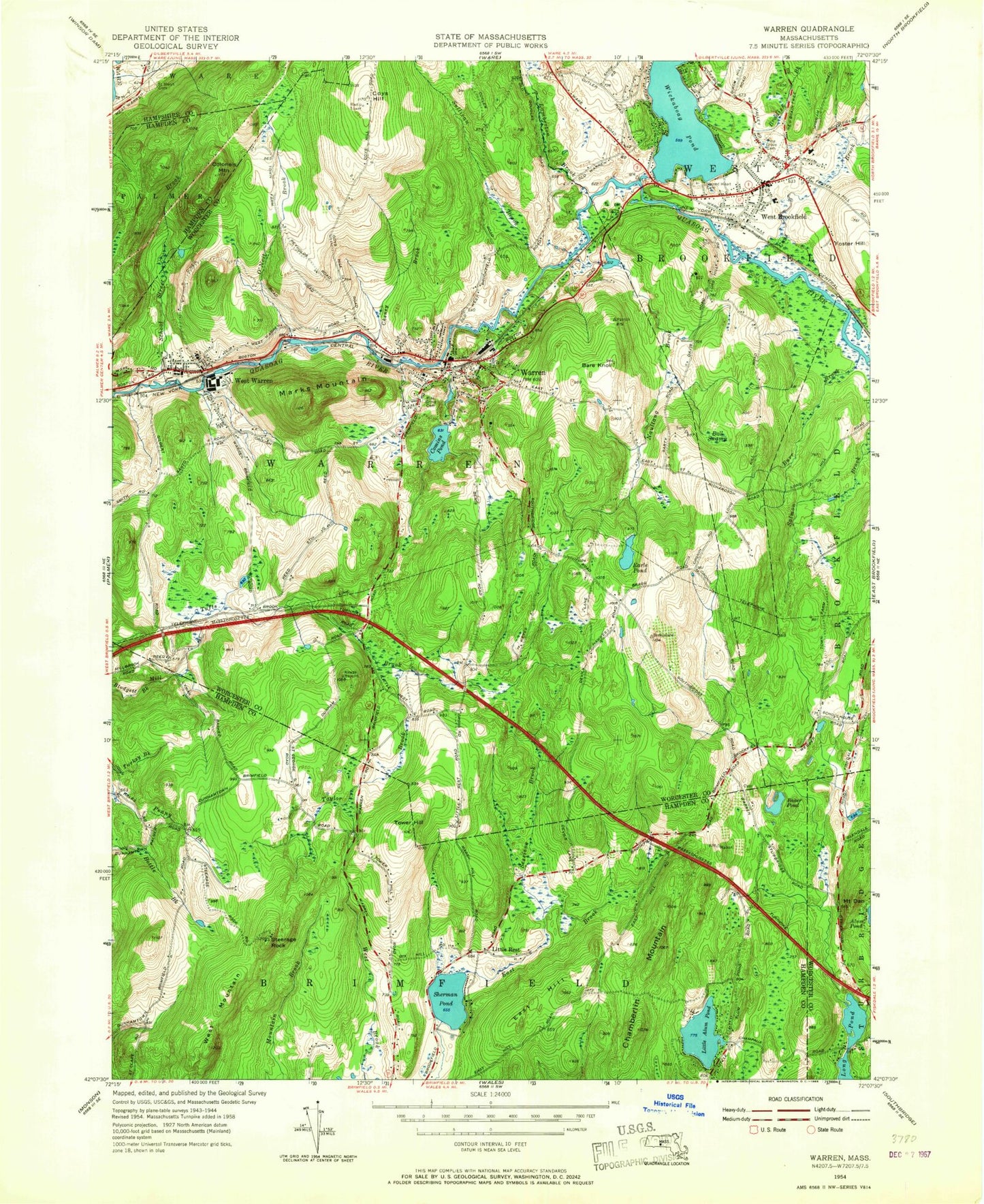
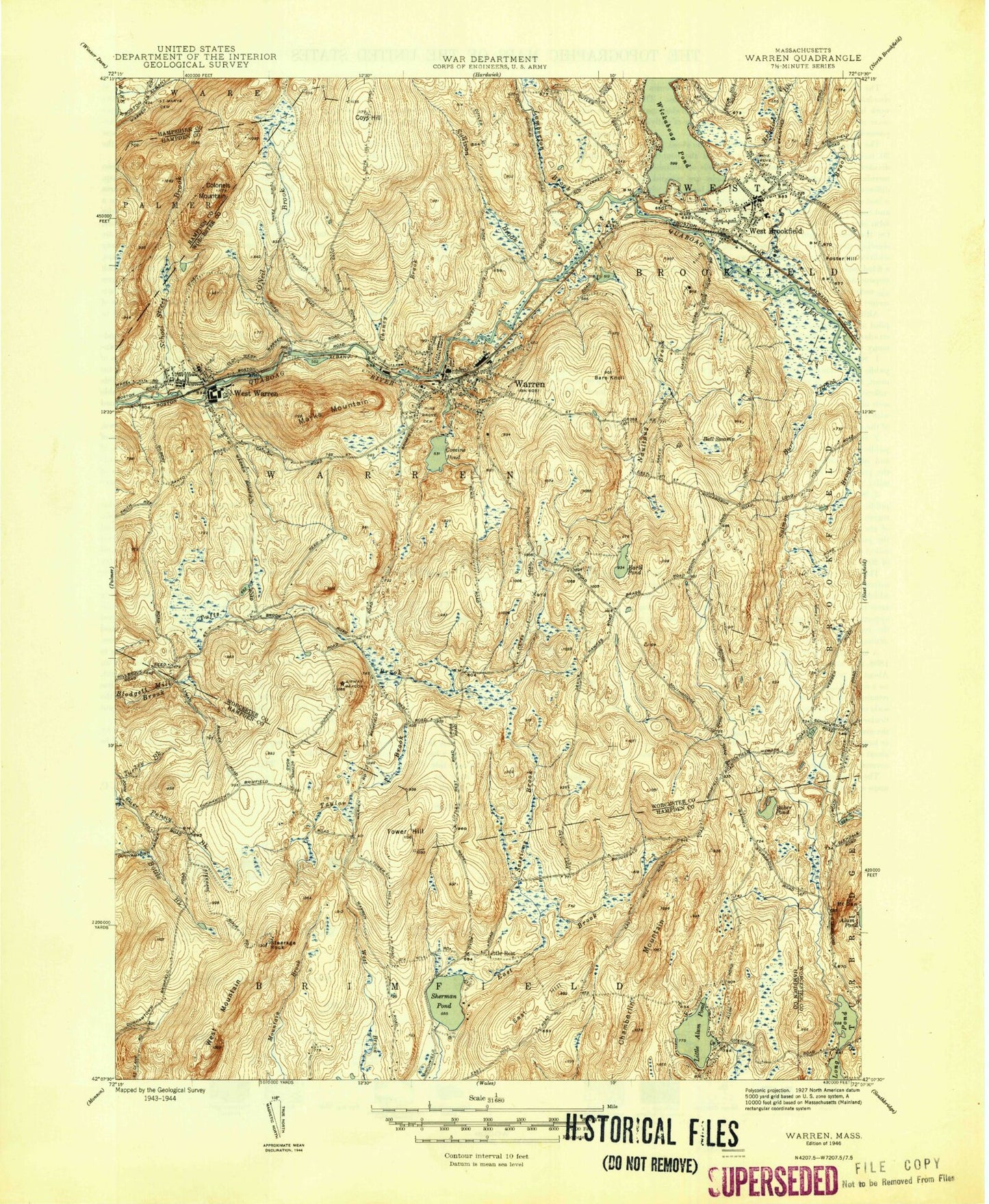
Historical USGS topographic quad map of Warren in the state of Massachusetts. Typical map scale is 1:24,000, but may vary for certain years, if available. Print size: 24" x 27"
This quadrangle is in the following counties: Hampden, Hampshire, Worcester.
The map contains contour lines, roads, rivers, towns, and lakes. Printed on high-quality waterproof paper with UV fade-resistant inks, and shipped rolled.
Contains the following named places: Saint Mary's Cemetery, East School, Quaboag Regional Middle High School, Dean Park, Saint Paul's Cemetery, Pine Grove Cemetery, Tantasqua Regional High School, South Warren Cemetery, W D Cheney Dam, Comins Pond Dam, Quoboag River Reservoir, West Warren Mill Pond Dam, Beaudry Pond Dam, Lamberton Brook Dam, Lamberton Brook Reservoir, Mill Brook, Baker Pond, Ball Swamp, Bare Knoll, Bradish Brook, Burr Brook, Chamberlin Mountain, Cheney Brook, Comins Pond, Colonels Mountain, Coys Brook, Coys Hill, Mount Dan, Earle Pond, East Hill, Lamberton Brook, Little Alum Pond, Little Rest, Marks Mountain, Naultaug Brook, O'Neil Brook, School Street Brook, Sessions Brook, Sherman Pond, Steerage Rock, Sullivan Brook, Taylor Brook, Tower Hill, Tufts Brook, Warren, West Brookfield, West Mountain, West Warren, Wickaboag Pond, Beaudry Pond, Marks Garrison, Morgans Pond, Long Hill, Town of Warren, Pasport Airport, Town of Brimfield, WARE-AM (Ware), WYDN-TV (Worcester), Brookfield Mobile Home Park, First Congregational Church, Sacred Heart of Jesus Church, Tantasqua Regional Vocational High School, Warren Post Office, West Brookfield Center Historic District, West Brookfield Elementary School, West Brookfield Post Office, West Brookfield Town Hall, West Warren Post Office, Tantasqua Regional Junior High School, Warren Census Designated Place, West Brookfield Census Designated Place, Lamoureux Greenhouses, Breezeland Orchards, Warren Fire Department Station 2, West Brookfield Fire Department, Warren Fire Department Station 1, Warren Fire Department Ambulance, West Brookfield Rescue Squad, West Brookfield Police Department, Warren Police Department, Pine Grove Cemetery, Sacred Heart Cemetery, Old Indian Cemetery, West Warren Census Designated Place, Saint Mary's Cemetery, East School, Quaboag Regional Middle High School, Dean Park, Saint Paul's Cemetery, Pine Grove Cemetery, Tantasqua Regional High School, South Warren Cemetery, W D Cheney Dam, Comins Pond Dam, Quoboag River Reservoir, West Warren Mill Pond Dam, Beaudry Pond Dam, Lamberton Brook Dam, Lamberton Brook Reservoir, Mill Brook, Baker Pond, Ball Swamp, Bare Knoll, Bradish Brook, Burr Brook, Chamberlin Mountain, Cheney Brook, Comins Pond, Colonels Mountain, Coys Brook, Coys Hill, Mount Dan, Earle Pond, East Hill, Lamberton Brook, Little Alum Pond, Little Rest, Marks Mountain, Naultaug Brook, O'Neil Brook, School Street Brook, Sessions Brook, Sherman Pond, Steerage Rock, Sullivan Brook, Taylor Brook, Tower Hill, Tufts Brook, Warren, West Brookfield, West Mountain, West Warren, Wickaboag Pond, Beaudry Pond, Marks Garrison, Morgans Pond, Long Hill, Town of Warren, Pasport Airport, Town of Brimfield, WARE-AM (Ware), WYDN-TV (Worcester), Brookfield Mobile Home Park, First Congregational Church, Sacred Heart of Jesus Church, Tantasqua Regional Vocational High School, Warren Post Office, West Brookfield Center Historic District, West Brookfield Elementary School, West Brookfield Post Office, West Brookfield Town Hall, West Warren Post Office, Tantasqua Regional Junior High School, Warren Census Designated Place, West Brookfield Census Designated Place, Lamoureux Greenhouses, Breezeland Orchards, Warren Fire Department Station 2, West Brookfield Fire Department, Warren Fire Department Station 1, Warren Fire Department Ambulance, West Brookfield Rescue Squad, West Brookfield Police Department, Warren Police Department, Pine Grove Cemetery, Sacred Heart Cemetery, Old Indian Cemetery, West Warren Census Designated Place, Saint Mary's Cemetery, East School, Quaboag Regional Middle High School, Dean Park, Saint Paul's Cemetery, Pine Grove Cemetery, Tantasqua Regional High School, South Warren Cemetery, W D Cheney Dam, Comins Pond Dam, Quoboag River Reservoir, West Warren Mill Pond Dam, Beaudry Pond Dam, Lamberton Brook Dam, Lamberton Brook Reservoir, Mill Brook, Baker Pond, Ball Swamp, Bare Knoll, Bradish Brook, Burr Brook, Chamberlin Mountain, Cheney Brook, Comins Pond, Colonels Mountain, Coys Brook, Coys Hill, Mount Dan, Earle Pond, East Hill, Lamberton Brook, Little Alum Pond, Little Rest, Marks Mountain, Naultaug Brook, O'Neil Brook, School Street Brook, Sessions Brook, Sherman Pond, Steerage Rock, Sullivan Brook, Taylor Brook, Tower Hill, Tufts Brook, Warren, West Brookfield, West Mountain, West Warren, Wickaboag Pond, Beaudry Pond, Marks Garrison, Morgans Pond, Long Hill, Town of Warren, Pasport Airport, Town of Brimfield, WARE-AM (Ware), WYDN-TV (Worcester), Brookfield Mobile Home Park, First Congregational Church, Sacred Heart of Jesus Church, Tantasqua Regional Vocational High School, Warren Post Office, West Brookfield Center Historic District, West Brookfield Elementary School, West Brookfield Post Office, West Brookfield Town Hall, West Warren Post Office