MyTopo
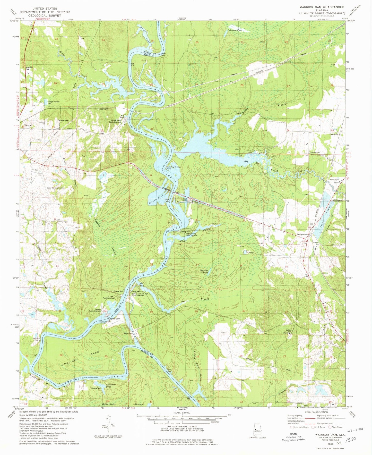
Classic USGS Warrior Dam Alabama 7.5'x7.5' Topo Map
Couldn't load pickup availability
Historical USGS topographic quad map of Warrior Dam in the state of Alabama. Map scale may vary for some years, but is generally around 1:24,000. Print size is approximately 24" x 27"
This quadrangle is in the following counties: Greene, Hale.
The map contains contour lines, roads, rivers, towns, and lakes. Printed on high-quality waterproof paper with UV fade-resistant inks, and shipped rolled.
Contains the following named places: Bethlehem Cemetery, Bethlehem Church, Bethlehem School, Big Brush Creek, Big Creek Shoals, Big Log Shoals, Browns Bluff, Browns Bluff Landing, Centre Point, Choctaw Bar, Choctaw Bend, Choctaw Bluff, Choctaw Bluff Landing, Coleman Pond, Crenshaw Pond, Cridleys Ferry, Cypress Swamp, Damsite Public Use Area, Darrah, Dollarhide Swamp, Dry Creek, Duck Bar, Eutaw Landing, Eutaw Municipal Airport, Evansville, Finches Ferry, Finches Ferry Bar, Finches Ferry Landing, Finches Ferry Public Use Area, Finches Point, Flatwood Church, Flatwood School, Friendship Church, Gosa, Grimm Chapel Baptist Church, Grinnel Pond, Halls Shoals, Holiness Church, Howard Brown Dam, Howard Brown Lake, Jackson Chapel, Jackson Chapel Cemetery, Jennings Ferry, Jennings Ferry Landing, Jennings Ferry Point, Jennings Ferry Public Use Area, Jenny Watson Creek, Jenny Watts Point, Jordan Branch, Lawson Lakes, Lewis Lawson Dam Number 1, Lewis Lawson Dam Number 2, Lock Number Seven, Lock Seven, Lock Seven Public Use Area, Lumbus Bar, Manette Pond, McClure, Meltons Bluff, Milkhouse Bar, Minter Creek, New Christian Cemetery, Oscar Underwood Bridge, Pafallaya, Pickens Bar, Pole Bridge Branch, Presley Ford Branch, Rosenwald School, Sample Cemetery, Samples Bluff, Slack Creek, Standing Cypress Point, Stave Bluff, Stave Bluff Landing, Steeles Camp, Stephens Bluff, Stephens Bluff Landing, Stephens Creek, Three Mile Landing, Underwood Bridge, Walton Cemetery, Warrior Lake, Warrior Lock and Dam, Warrior Lock and Dam Public Use Area, Wedgeworth, White Creek, Whites Creek, ZIP Code: 35441