MyTopo
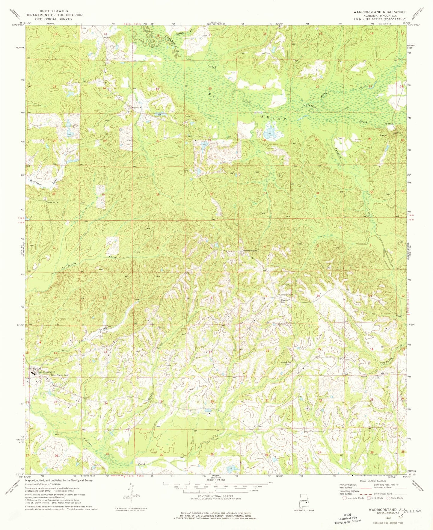
Classic USGS Warriorstand Alabama 7.5'x7.5' Topo Map
Couldn't load pickup availability
Historical USGS topographic quad map of Warriorstand in the state of Alabama. Map scale may vary for some years, but is generally around 1:24,000. Print size is approximately 24" x 27"
This quadrangle is in the following counties: Macon.
The map contains contour lines, roads, rivers, towns, and lakes. Printed on high-quality waterproof paper with UV fade-resistant inks, and shipped rolled.
Contains the following named places: Antioch Cemetery, Antioch Church, Big Swamp, Chapple Cemetery, Coopers Chapel, Crossroads, Dixie Creek, H A Vaughan Junior Dam, Hernando, Kelly Creek, Magnolia Cemetery, Magnolia Church, Magnolia School, New Hog Wallow Lake, Sanford Johnson Dam, Sanford Johnson Lake, Shady Hill Church, South Macon High School, Spring Branch, Swanson School, Sweet Pilgrim Cemetery, Sweet Pilgrim Church, Tanyard Creek, Tuskegee Institute Farm, Warrior Stand Cemetery, Warriorstand, Warriorstand School, Warriorstand Volunteer Fire Department, Warriorstand-Creek Stand Division