MyTopo
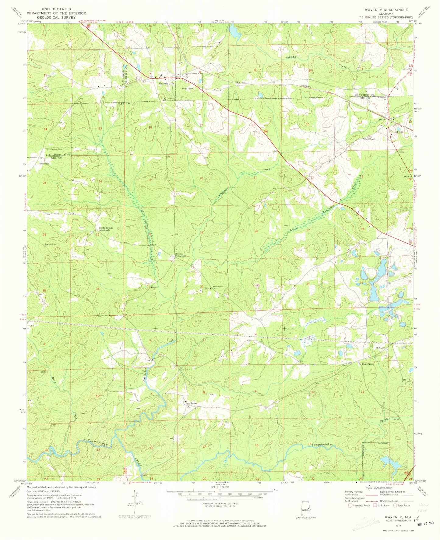
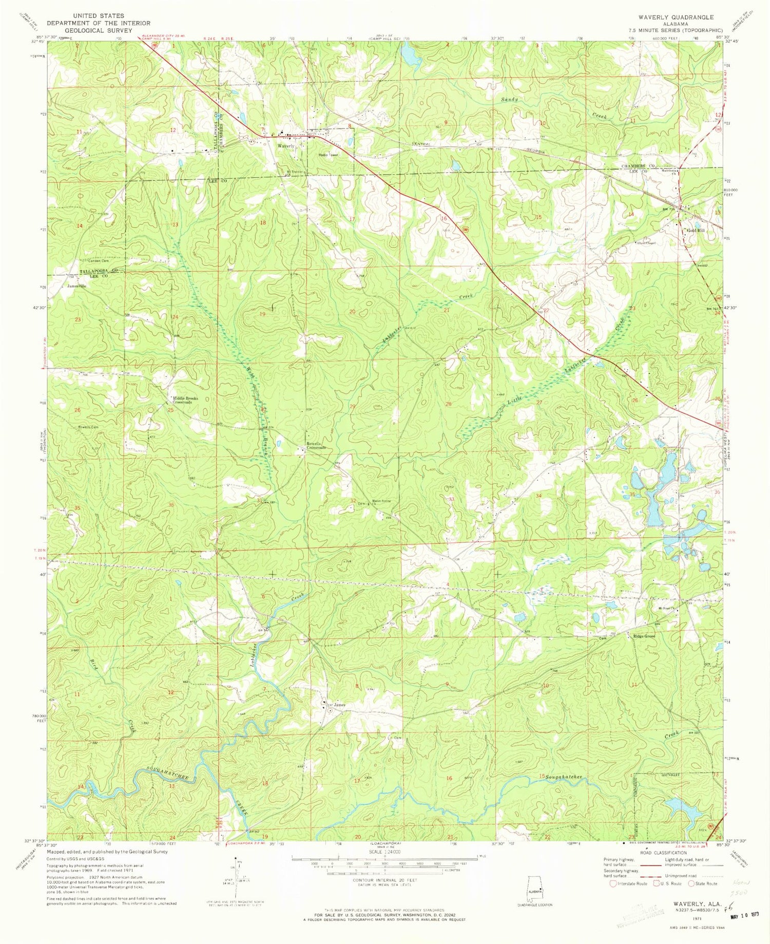
Classic USGS Waverly Alabama 7.5'x7.5' Topo Map
Couldn't load pickup availability
Historical USGS topographic quad map of Waverly in the state of Alabama. Typical map scale is 1:24,000, but may vary for certain years, if available. Print size: 24" x 27"
This quadrangle is in the following counties: Chambers, Lee, Tallapoosa.
The map contains contour lines, roads, rivers, towns, and lakes. Printed on high-quality waterproof paper with UV fade-resistant inks, and shipped rolled.
Contains the following named places: Bird Creek, Canaan Cemetery, Gold Hill, Mount Traveler Church, Rowells Cemetery, Webb Branch, Ogletree Outing Club Dam, Ogletree Outing Club Lake, Auburn Farm Pond S-14 Dam, Pond Number S-14, Auburn Farm Pond Number S-8 Dam, Pond Number S-8, Pond Number S-6, Auburn Farm Pond Number S-6 Dam, Auburn Farm Pond Number S-3 Dam, Pond Number S-3, Auburn Farm Pond Number 1 Dam, Pond Number S-1, Stephens Mill Pond, Canaan Primitive Baptist Church (historical), Alabama Agricultural Experiment Station, Clements Pond, Daniel - Caldwell Cemetery, Friendship Church (historical), Gold Hill Cemetery, Gold Hill School (historical), Gold Hill Methodist Church, Hayne Church (historical), Macon Springs School (historical), Macons Mill, Mount Sinai Cemetery, Ridge School (historical), Ridge Grove Cemetery, Waverly Cemetery, Maddox Family Cemetery, Waverly Public School, Little Loblockee Creek, Loblockee Creek, Macon Spring Church, Waverly, Mount Sinai Church, James, Jamesville, Middle Brooks Crossroads, Ridge Grove, Rowells Crossroads, Fisheries Research Unit Auburn University, Allens Chapel, Macedonia Church, Loachapoka-Roxana Division, Waverly Post Office, Town of Waverly, Swingle Creek, Farmville Volunteer Fire Department Station 2