MyTopo
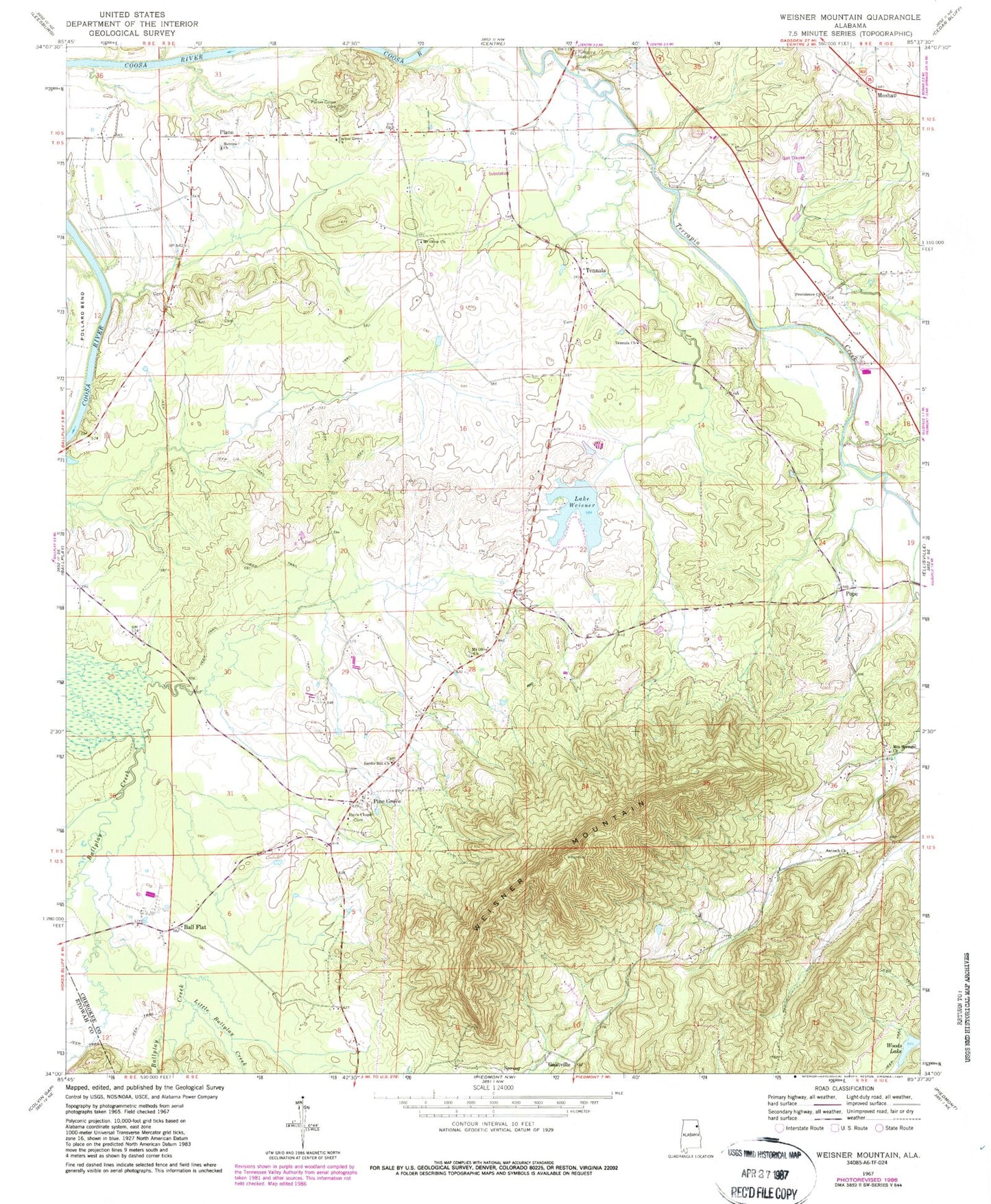
Classic USGS Weisner Mountain Alabama 7.5'x7.5' Topo Map
Couldn't load pickup availability
Historical USGS topographic quad map of Weisner Mountain in the state of Alabama. Map scale may vary for some years, but is generally around 1:24,000. Print size is approximately 24" x 27"
This quadrangle is in the following counties: Cherokee, Etowah.
The map contains contour lines, roads, rivers, towns, and lakes. Printed on high-quality waterproof paper with UV fade-resistant inks, and shipped rolled.
Contains the following named places: Antioch Church of Christ, Ball Flat, Centre Division, Cherokee Country Club, Davis Chapel Cemetery, Davis Chapel Methodist Church, Lake Weisner, Lighthouse Church, Little Ballplay Creek, Melrose Baptist Church, Morrison Cemetery, Morrison Creek, Mount Davis Community Center, Mount Olive Cemetery, Mount Olive Church, Mount Weisner Volunteer Fire Department, Mountain Spring, Mountain Springs Cemetery, Mountain Springs Methodist Church, Parker Grove Cemetery, Parkers Grove Methodist Church, Pine Grove, Plano, Pope, Providence Baptist Church, Providence Baptist Church Cemetery, Ricks, Sardis Hill Cemetery, Sardis Hill Missionary Baptist Church, Tabernacle of Life Church, Tennala, Tennala Baptist Church, Weaver Cemetery, Weisner Dam, Weisner Mountain, Woods Lake