
MyTopo
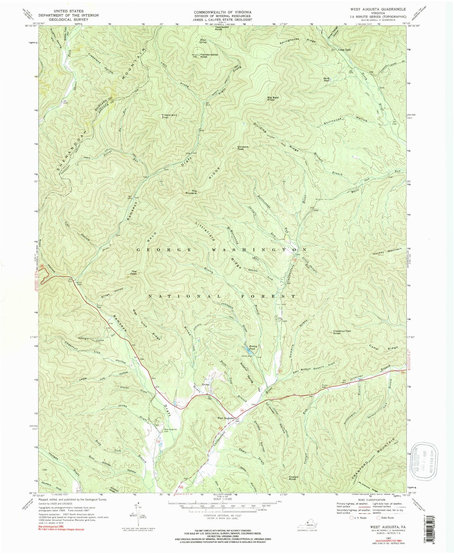
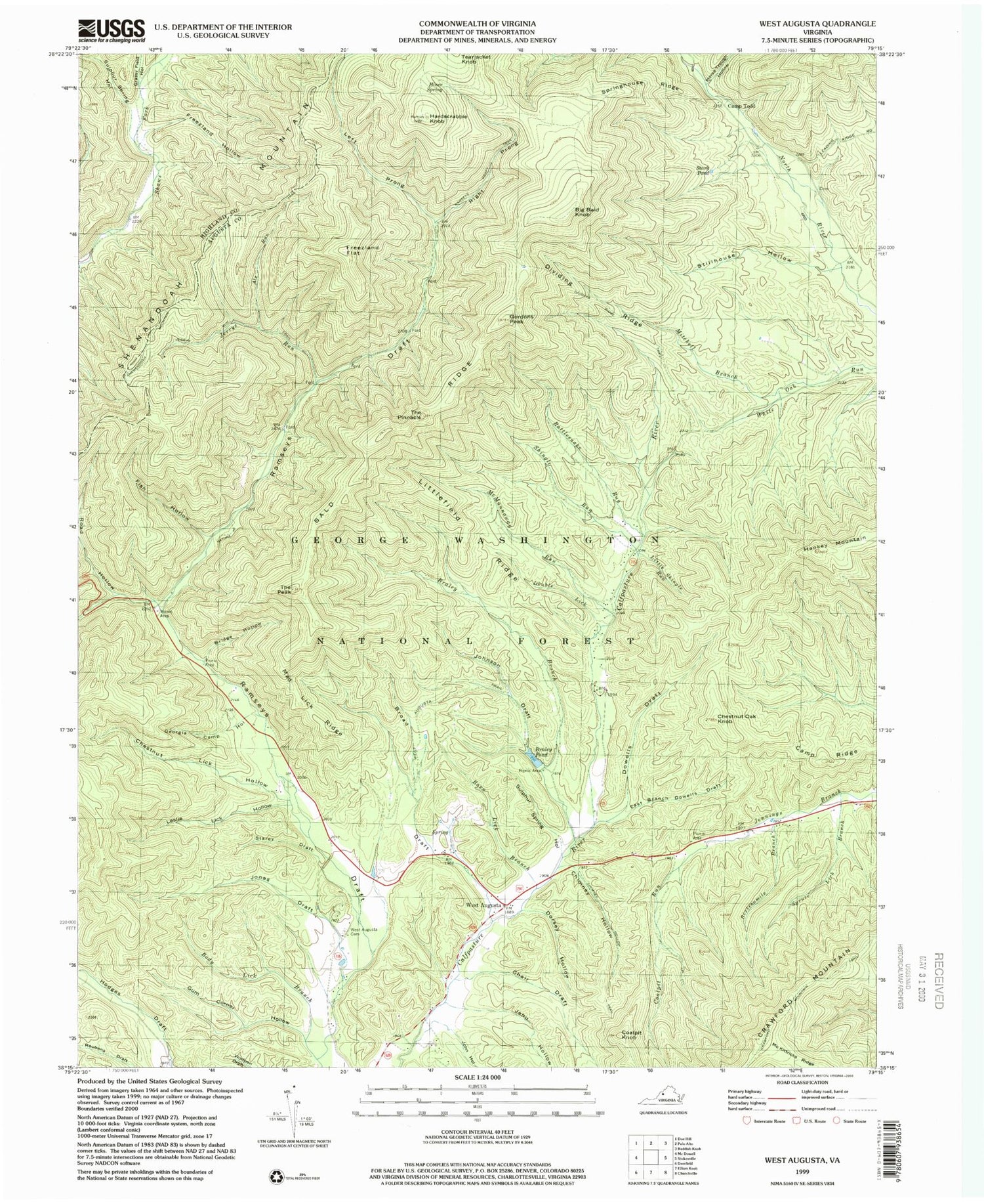
USGS Classic West Augusta Virginia 7.5'x7.5' Topo Map
Couldn't load pickup availability
Historical USGS topographic quad map of West Augusta in the state of Virginia. Scale: 1:24000. Print size: 24" x 27"
This quadrangle is in the following counties: Augusta, Highland.
The map contains contour lines, roads, rivers, towns, lakes, and grids including latitude / longitude and UTM / MGRS. Printed on high-quality waterproof paper with UV fade-resistant inks.
Contains the following named places: Als Run, Bald Ridge, Barn Lick Branch, Body Lick Branch, Braley Branch, Bridge Hollow, Broad Draft, Camp Ridge, Camp Todd, Chair Draft, Chestnut Lick Hollow, Chestnut Oak Knob, Chimney Hollow, Chimney Hollow Trail, Coalpit Knob, Coalpit Run, Crawford Mountain Trail, Dividing Ridge, Dividing Ridge Trail, Dorsey Hollow, Double Lick, East Branch Dowells Draft, Fish Hollow, Freezland Flat, Freezland Hollow, Georgia Camp Hollow, Gordons Peak, Grassy Field Hollow, Gum Corner Hollow, Hardscrabble Knob, Hiner Spring, Horse Trough Hollow, Jehu Hollow, Jerrys Run, Jerrys Run Trail, John Hollow, Johnson Draft, Jonas Draft, Left Prong Ramseys Draft, Leslie Lick Hollow, Little Shingle Run, Littlefield Ridge, Mad Lick Ridge, McKittricks Ridge, McMannaway Run, Mitchell Branch, Ramseys Draft Trail, Rattlesnake Run, Right Prong Ramseys Draft, Road Hollow, Shingle Run, Sixteenmile Branch, Springhouse Ridge, Spruce Lick Branch, Stamping Ground Hollow, Starey Draft, Stark Pond, Stillhouse Hollow, Sulphur Spring Hollow, Sulphur Spring Hollow, The Peak, The Pinnacle, West Augusta Cemetery, West Augusta Trail, Ramseys Draft Wilderness, Braley Pond Camp Site, Mountain House Camp Site, Bald Ridge Trail, Braley Dam, Big Bald Knob, West Augusta, Braley Pond, Dowells Draft, Sexton Shelter, West Augusta Post Office


