MyTopo
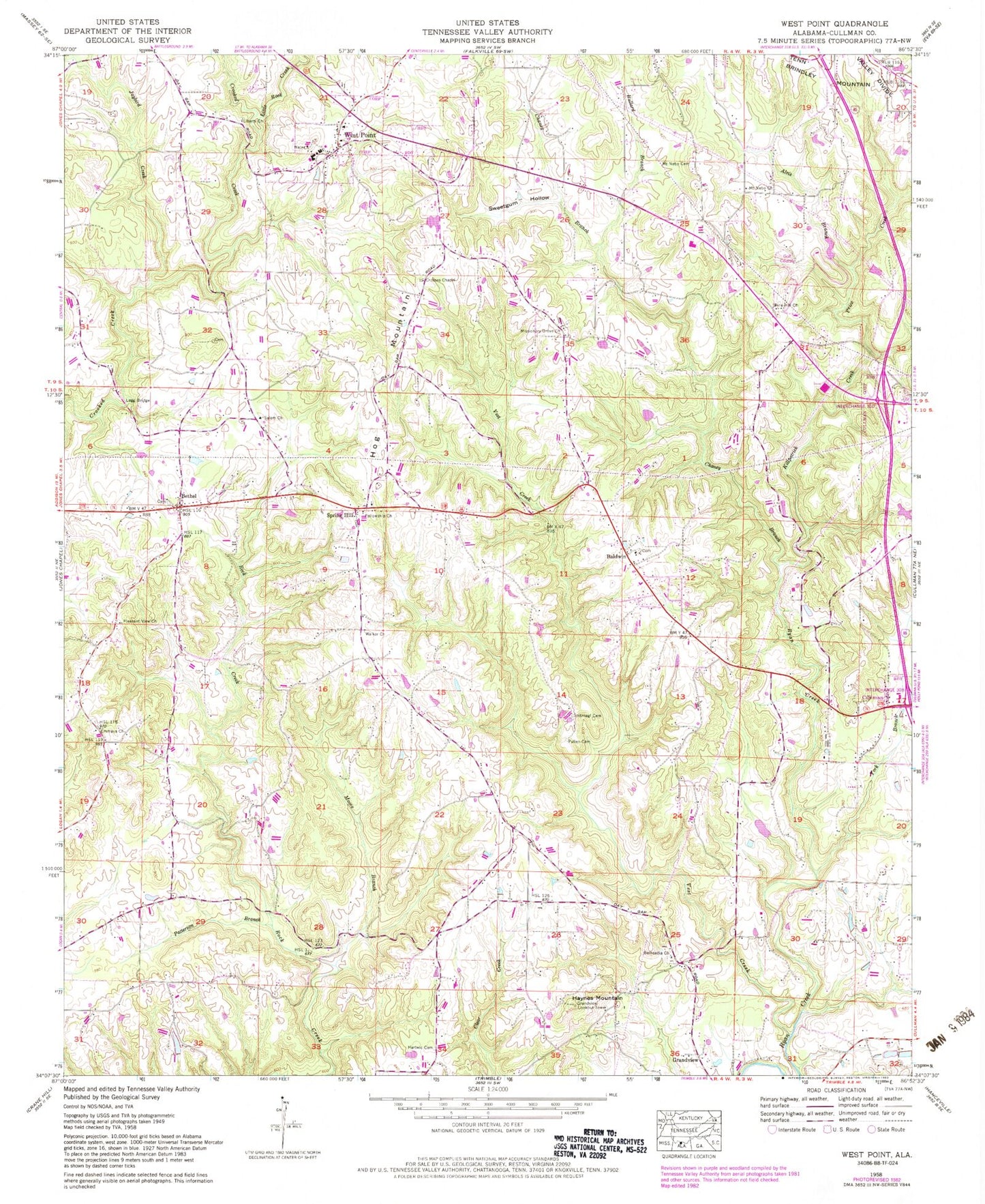
Classic USGS West Point Alabama 7.5'x7.5' Topo Map
Couldn't load pickup availability
Historical USGS topographic quad map of West Point in the state of Alabama. Map scale may vary for some years, but is generally around 1:24,000. Print size is approximately 24" x 27"
This quadrangle is in the following counties: Cullman.
The map contains contour lines, roads, rivers, towns, and lakes. Printed on high-quality waterproof paper with UV fade-resistant inks, and shipped rolled.
Contains the following named places: Alvis Branch, Ames School, Baldwin, Baldwin Chapel Cemetery, Baldwin Chapel Cumberland Presbyterian Church, Baldwin Church of Christ, Baldwin Heights Baptist Church, Baldwin Heights Cemetery, Baldwin School, Bethel, Bethel Church of Christ, Bethel Community Center, Bethsadia Baptist Church, Bethsadia Cemetery, Bethsadia Volunteer Fire Department Station 1, Bethsadia Volunteer Fire Department Station 2, Bethsadia Volunteer Fire Department Station 3, Brown Pond Dam, Browns Pond, Bullard Branch, Burrow Lake, Chaney Branch, Crosses Chapel Cemetery, Crosses Chapel United Methodist Church, Ege Farm Dam, Ege Farm Pond, Emeus Baptist Church, Emeus Cemetery, Emeus Methodist Church, Faith Cumberland Presbyterian Church, Fellowship Baptist Church, Fellowship Cemetery, Fellowship Primitive Baptist Church, Grandview, Grandview Lookout Tower, Hartwic Cemetery, Haynes Mountain, Hog Mountain, Honig School, Jaybird Creek, Killpatrick Creek, Legg Bridge, Liberty Congregational Methodist Church, Little Rock Creek, Logan Division, Logan Fire Department Station 2, Missionary Grove Baptist Church, Missionary Grove Baptist Church Cemetery, Moore Branch, Mount Nebo Baptist Church, Mount Nebo Cemetery, Ottis Burrow Dam, Patterson Branch, Pilgrim Rest Church Cemetery, Pilgrim Rest Independent Baptist Church, Pine Hill, Pine Hill Methodist Church, Pleasant View Congregational Methodist Church, Price Creek, Pullen Cemetery, Salem Missionary Baptist Church, Southern Pines, Spitznagl Cemetery, Spring Hill, Spring Hill Baptist Church, Steele Orchard, Sweetgum Hollow, Terri Pines Country Club, Town of West Point, Vest Creek, Walker United Methodist Church, West Point, West Point High School, West Point Volunteer Fire Department, Whites Dam, Whites Pond, York Branch, ZIP Code: 35057