MyTopo
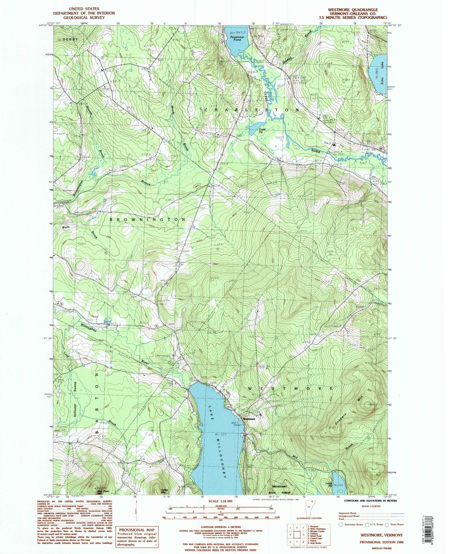
Classic USGS Westmore Vermont 7.5'x7.5' Topo Map
Couldn't load pickup availability
Historical USGS topographic quad map of Westmore in the state of Vermont. Typical map scale is 1:24,000, but may vary for certain years, if available. Print size: 24" x 27"
This quadrangle is in the following counties: Orleans.
The map contains contour lines, roads, rivers, towns, and lakes. Printed on high-quality waterproof paper with UV fade-resistant inks, and shipped rolled.
Contains the following named places: Long Pond, Bassett Brook, Blyhill Cemetery, Charleston Elementary School, East Brownington School, East Cemetery, Fisk School, Goodwin Mountain, Hinton School, Lake View School, Lakeview Cemetery, Lord Brook, May Pond Mountain, Mill Brook, Moody Brook, Nutting Brook, Pensioner Pond, Pierce Hill, Powers School, Songadeewin Camp, Stillwater Swamp, Stumpf Brook, Toad Pond, Valley Mountain, Westmore, Lake Willoughby, Town of Brownington, Town of Charleston, Town of Westmore, West Charleston Dam, Lubber Lake, East Brownington, East Brownington Cemetery, Lakeview Cemetery, Will-O-Wood Campground, Westmore Fire and Rescue